


Update On Our Thanksgiving Storm.

Cold & Snow Cover Increasing.
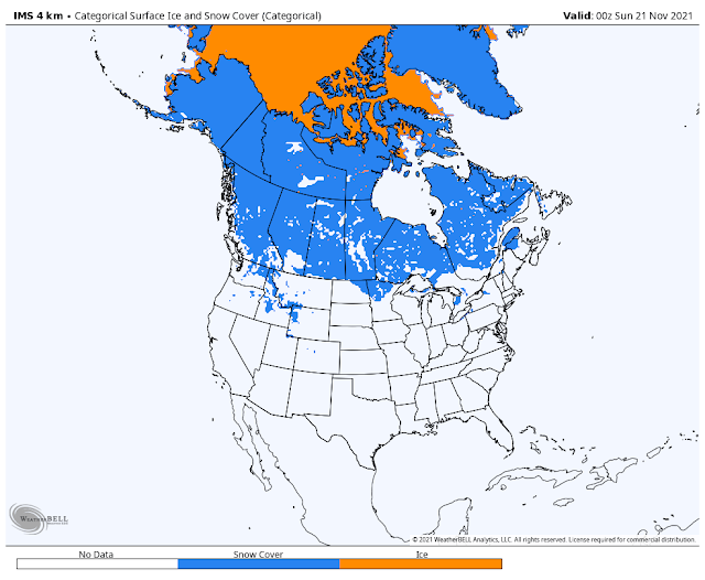
Snow cover to our north in Canada and Alaska continues to increase. This will be important as we approach the beginning of the meteorological winter (December 1st) and beyond. Temperatures in western Alaska have already dipped down to the -45F range. As the cold and snow cover continues to build in this region the polar jet stream will occasionally dive southward into the U.S. this winter dragging winter storms and arctic outbreaks into the nation. Not all La Nina winters are the same. My thinking is that we will see some hefty arctic outbreaks this winter along with some decent winter storms here in SE NM and W TX.
Update On Our Thanksgiving Storm.

A weak closed mid-upper low is forecast by the models to develop well west of San Diego today. Then strengthen as it is pulled eastward and southeastward towards the northern Baja and southern California area by Tuesday. It then is forecast to phase with a long-wave trough of low pressure to its north stretching from central California northward into the northwestern territories of Canada. By Thanksgiving morning the bottom half of this long-wave trough of low pressure breaks off and develops into a cutoff low or a closed low near the central Baja Region.
Once again just how far south this cutoff or closed low ends up will determine who gets wet neck of the woods. Too far south and we are left high and dry...which happens sometimes. The latest run of the computer models are doing better but I still expect to see some more changes in their forecasts so nothing is written in stone yet concerning our local forecasts.
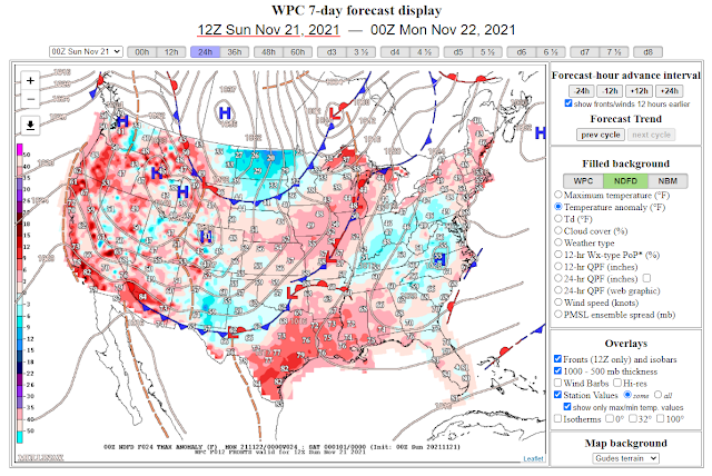
A cold front pushed southward through New Mexico and West Texas overnight. Cooler air will filter in behind it today. Today's high temperatures are forecast to be some 5-degrees below normal locally for the date.
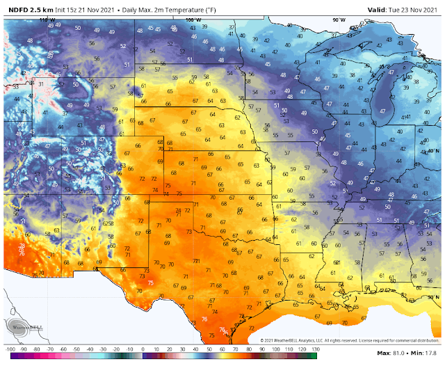
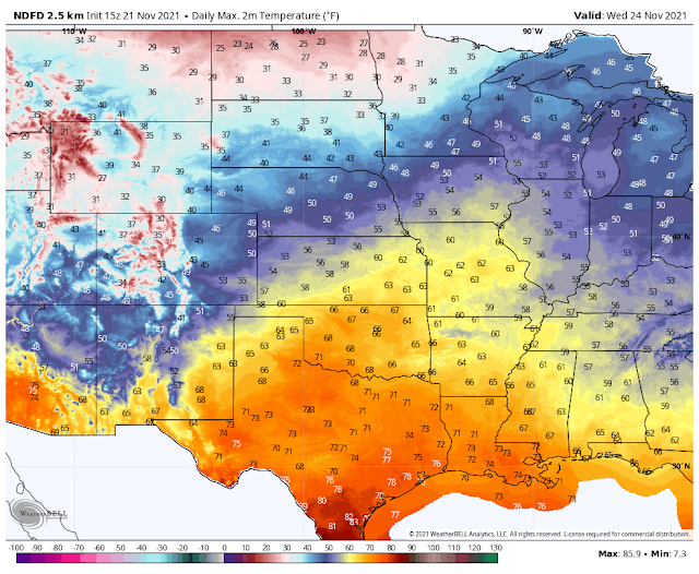
Thanksgiving Week Forecast.
Today.
Monday.
Tuesday.
Wednesday.
Thanksgiving Day.
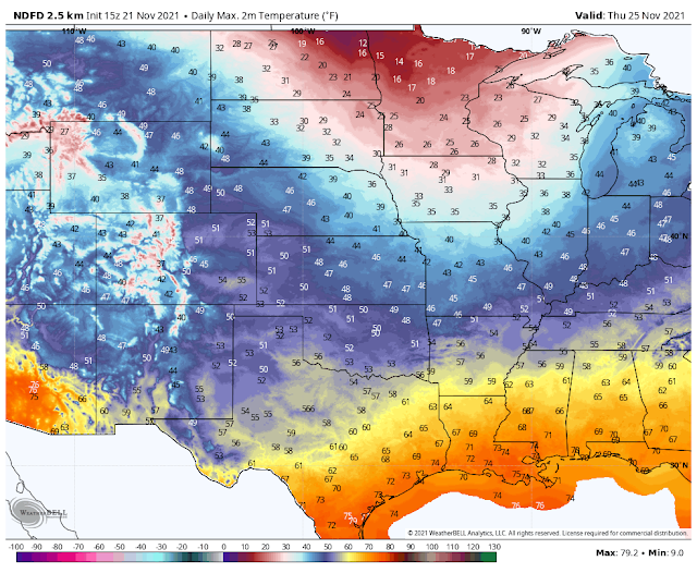
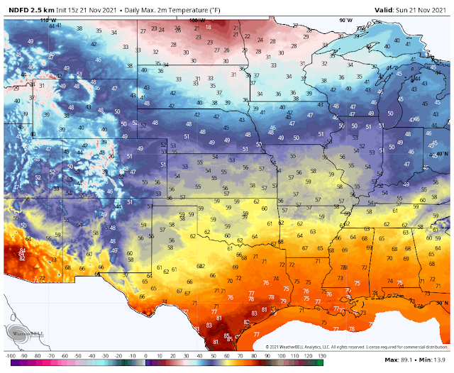
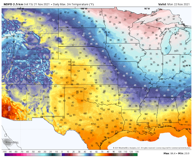
A rather mild start to the holiday week is expected. Highs today will be seasonably cool with readings in the 55º to 60º range. Monday's highs will rise up into the mid 60's. Tuesday and Wednesday will see the upper 60's to low 70's. Current forecasts are calling for the low to mid 50's Thanksgiving Day locally.
The mountains will be cooler this week with the 40's in the Cloudcroft area and the 50's to near 60º in the Ruidoso area. Highs on Thanksgiving will be in the 30's and 40's.
The mountains will be cooler this week with the 40's in the Cloudcroft area and the 50's to near 60º in the Ruidoso area. Highs on Thanksgiving will be in the 30's and 40's.
Valid Through 5 PM MST Thanksgiving Day.
Valid Through 5 PM MST Thanksgiving Day.
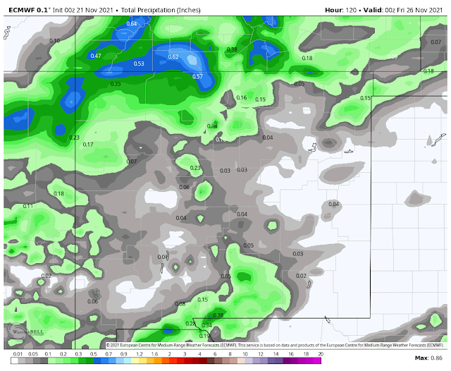
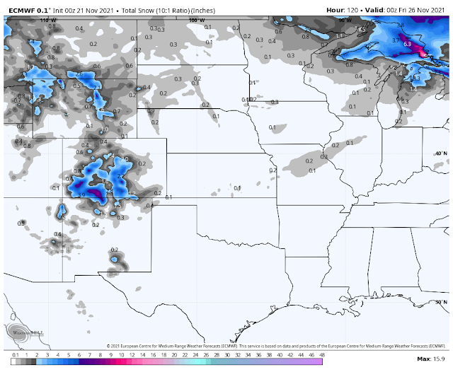
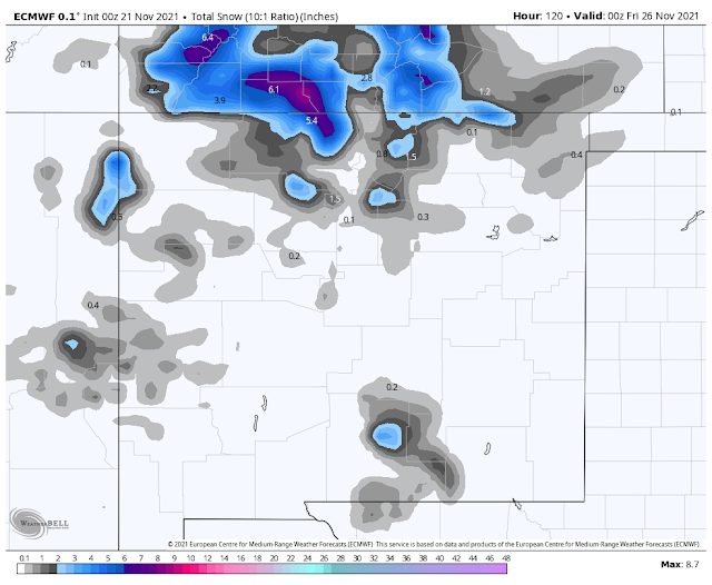
ECMWF Snowfall Forecasts.
Valid Through 5 PM MST Thanksgiving Day.
Valid Through 5 PM MST Thanksgiving Day.
ECMWF Precipitation Type Forecast.
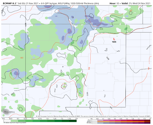
Valid At 2 PM MST Wednesday.
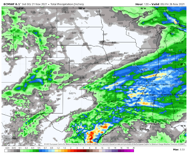
Depending upon the timing and track of our storm precipitation should start breaking out over western New Mexico Tuesday, and then spread eastward into Thanksgiving. This is subject to change.
Current model forecasts call for snow levels to start out high at around 8'000' to 9,000' feet across western and northern New Mexico on Wednesday. Lowering to around 6,000' or so by Wednesday evening.
Light rain showers will be possible across Southeastern New Mexico and parts of West Texas Wednesday into Thanksgiving. A rain/snow mix may occur across northern Lea County Thanksgiving night and also across the Guadalupe Mountains. Snow levels in the Sacramento Mountains will drop down to around 6,000' Wednesday night and rise up to around 7,000' on Thanksgiving. More updates later.
The Truth Is Stranger Than Fiction!


Comments
Post a Comment
Your comments, questions, and feedback on this post/web page are welcome.