

Round Two Tonight Into Saturday - Lowland Rain Showers & High Mountain Snow.

November 26, 2021.
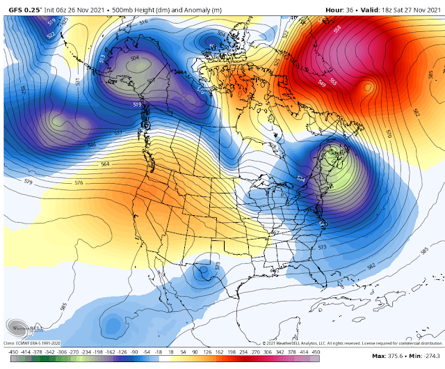
Second Phase Of Our Storm Tonight Into Saturday.
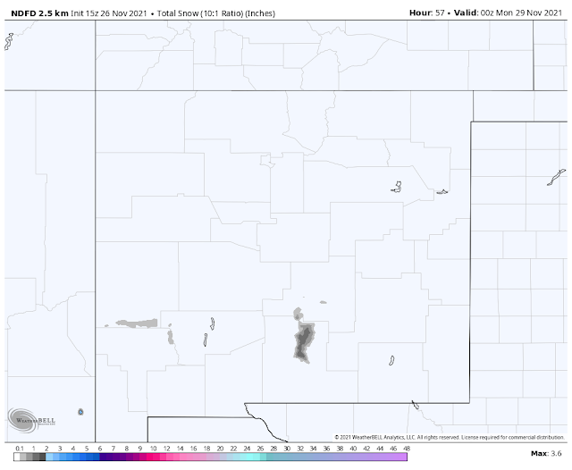
Valid At 11 AM MST Saturday.
Valid Today Through 5 PM MST Sunday.
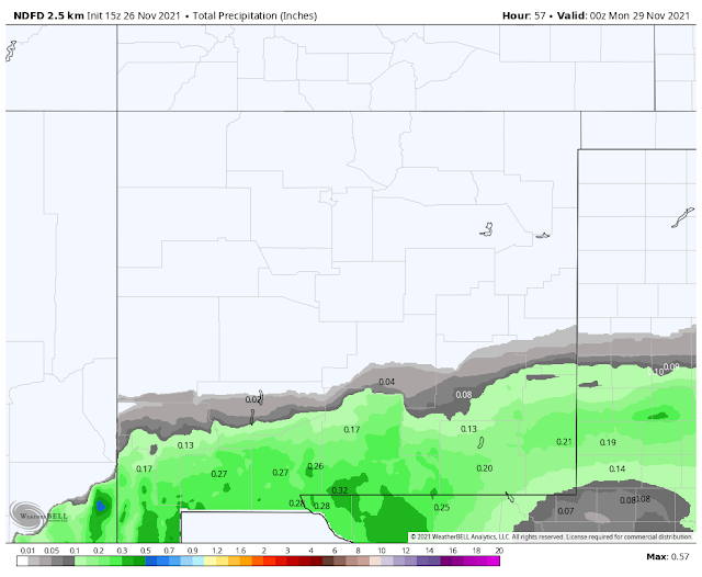
NWS NDFD Precipitation Forecast.
Valid Today Through 5 PM MST Sunday.
Lowland Rain Showers & High Mtn Snow.
Round two of our so-called winter storm comes tonight into Saturday. Cloudcroft and Ski Apache saw a couple inches of snow out of round one that ended yesterday morning. Clouds will increase this afternoon as the closed mid-level low centered over central Baja this morning moves northeastward towards the area.
This low is warm so to speak for this time of the year so snow levels are going to be high tonight into Saturday, generally at or around 8,000'. Another couple of inches of new snow appear likely in the Sunspot, Cloudcroft, and Ski Apache areas.
Lowland rain showers will develop tonight and spread northeastward over the Southeastern Plains and parts of West Texas. Some areas could pick up around a quarter of an inch of rain or so. Skies will clear Saturday afternoon as the storm weakens and departs the area.
High temps today into Sunday in the lowlands and valleys will be in the low 60's. The Ruidoso and Mayhill areas will see the 50's while the Cloudcroft area remains in the mid 40's. Highs climb another 10-degrees over these values for the area next week.
High temps today into Sunday in the lowlands and valleys will be in the low 60's. The Ruidoso and Mayhill areas will see the 50's while the Cloudcroft area remains in the mid 40's. Highs climb another 10-degrees over these values for the area next week.
Next week's weather returns to mild and warmer than normal conditions. No other storms are on the immediate forecast horizon. So it's back to boring but beautiful fall weather.


The Truth Is Stranger Than Fiction!


Comments
Post a Comment
Your comments, questions, and feedback on this post/web page are welcome.