

Our Thanksgiving Weather Forecast.
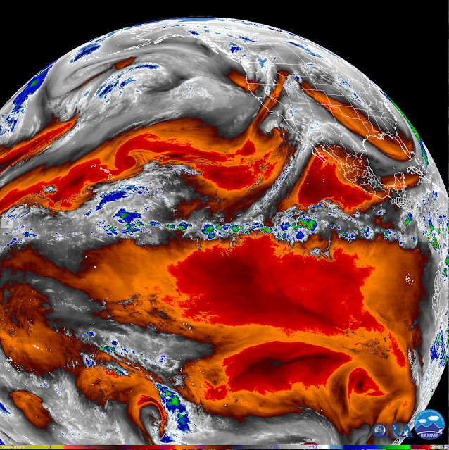

Our Storm Pulling Moisture In From The Eastern Pacific.
We can see that the subtropical jet stream is pulling mid and high-level moisture northeastward into the closed mid-level low circulation which was located southwest of San Diego early this morning. As this low moves eastward and phases with the long-wave trough of low pressure to its north, it will continue to pull this moisture northeastward into the Desert Southwest and our local area. Mid and high-level clouds will continue to stream across the area today into Wednesday night, thickening and lowering today into Wednesday.

European (ECMWF) 500 Millibar (18,000') Forecast.

By sunset, Wednesday a large elongated mid-upper level long-wave trough of low pressure will be entering western New Mexico. The bottom portion of this trough of low pressure is forecast to break off forming a closed low that will drift to the southwest on Thanksgiving and will be centered over the central Baja Peninisula by sunset. The forecast models basically stall this closed low over that area through the upcoming holiday weekend as it slowly weakens. So given this, it means that we will not get the storm we were hoping for but we will see the weaker version of it.
Not The Winter Storm We Need Or Wanted.

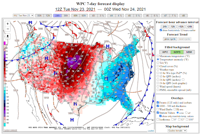
A Pacific cold front will move into New Mexico Wednesday afternoon and a backdoor front will slide southwestward through the state Wednesday night. This will bring colder temperatures to the area for Thanksgiving. Forecast highs today locally (Southeastern Plains) will be in the low to mid 70's which will be 5 to 10-degrees above normal for the date. Highs on Wednesday will be near 70 to the mid 70's, again 5 to 10-degrees above normal.
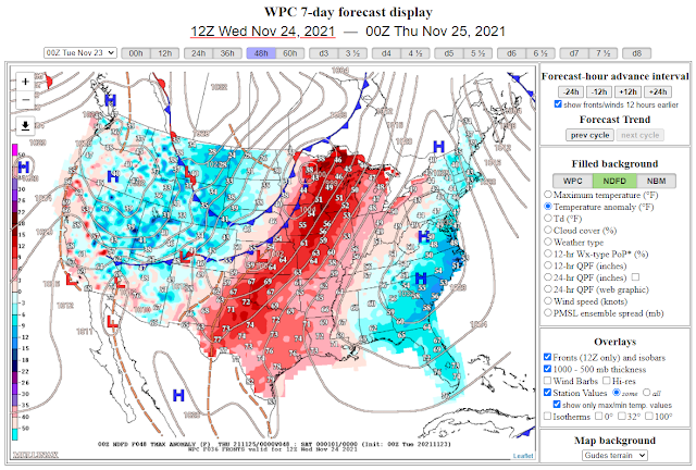
Thanksgiving Day will be chilly with highs in the low to mid 50's in the plains and the 30's to near 40 in the mountains. Friday will still be seasonably chilly with highs in the plains in the upper 50's to near 60. Thanksgiving will also be breezy which will add to the chill.
Today.
Wednesday.
Thanksgiving.

Today.


Wednesday.


Thanksgiving.


NWS NDFD Forecast Low Temperatures Friday Morning.


NWS NDFD Forecast High Temperatures.
Friday.


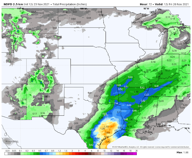
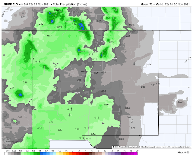


Current forecasts (early Tuesday morning) call for only light to maybe a few spots of moderate rainfall statewide today through Thanksgiving morning. Light rain showers have started moving into western New Mexico early this morning. These will increase in areal coverage today into Wednesday night. Western and northern New Mexico has the best chances of seeing meaningful rainfall totals.
Light rain showers will be possible across the Southeastern Plains Wednesday night.
Light rain showers will break out over the Sacramento, Capitan, and Guadalupe mountains starting tonight. Off and on light rain showers will occur at times into Thanksgiving morning below 6,000'. Snow levels on Wednesday will likely start out around 9,000' dropping down to around 6,000' Wednesday night. At this time (Tuesday morning) only light snowfall totals are forecast for the highest elevations of the Sacramento, Capitan, and Guadalupe mountains. It's possible that the higher peaks around Sunspot and Ski Apache could see an inch or two.
Sadly this storm isn't going to do much as far as snowfall is concerned to help the state's Ski Resorts out. The northern resorts will benefit the most.
Sadly this storm isn't going to do much as far as snowfall is concerned to help the state's Ski Resorts out. The northern resorts will benefit the most.
Although this storm will not be anything to write home about as far as winter weather goes at least it will make the holiday feel more fall and winter-like.
Thanksgiving Climatology In New Mexico.
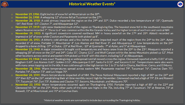


The Truth Is Stranger Than Fiction!


Comments
Post a Comment
Your comments, questions, and feedback on this post/web page are welcome.