


Hard To Beat Our Fall Weather This Year.
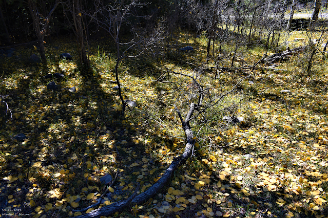
South Of Cloudcroft, New Mexico.

This morning's Canadian forecast model (GEM) depicts the jet stream forecast for early next Friday morning across North America. For most of this fall, the jet stream has barely entered New Mexico. This keeps the coldest air and the storm track north of the state. Thus our relatively uneventful and tranquil fall weather this year. There are some signs towards the end of the month and into December that this may change.
We are experiencing a moderate La Nina and this is forecast to continue into the winter and spring. This has so far kept New Mexico on the wanting side of the storm track. Until the Canadian snowpack deepens and the polar jet stream takes a more southerly track New Mexico isn't likely to experience any severe arctic outbreaks or major snowstorms.
Canadian (GEM) 500 MB (18,000') Forecast.
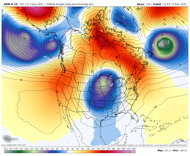
Valid At 5 AM MST Friday, November 12, 2021.
This mornings run of the computer forecast models indicates that a deep and cold mid-upper level storm will dive into the Northern and Central Plains late next week. The Canadian model is the strongest and coldest with its forecasts as depicted above. This should help drag colder air southward into the state late next week. But even so, this too will be short-lived as a warmup commences next weekend.
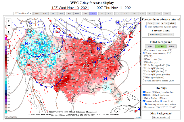
A Pacific cold front is forecast to sweep southeastward across the area on Wednesday. A reinforcing shot of colder air is forecast to occur next Friday. Most of Southeastern New Mexico has experienced its first freeze of the season but not all of it.
The Carlsbad Airport dropped down to 33º Friday morning for their lowest so far this fall. The Artesia Climate Co-Op Station recorded its first freeze on October 16th with a low of 32º. They dropped down to 30º on Oct 29th and 31º on Nov 4th. The Roswell Airport recorded its first freeze of the season on Friday morning with a low of 31º. The Hobbs Airport dropped to 32º Thursday morning.
All of the local area has yet to experience its first killing freeze and this may occur next Friday night into Saturday morning.
Overall this fall has been one of the nicest in years. That is if you like warm temps and no weather to speak of. Every once in a while New Mexico can produce some fantastic weather and this fall hasn't been disappointing.
Overall this fall has been one of the nicest in years. That is if you like warm temps and no weather to speak of. Every once in a while New Mexico can produce some fantastic weather and this fall hasn't been disappointing.


The Truth Is Stranger Than Fiction!


Comments
Post a Comment
Your comments, questions, and feedback on this post/web page are welcome.