

Thermometer Roller Coaster Ride Continues.
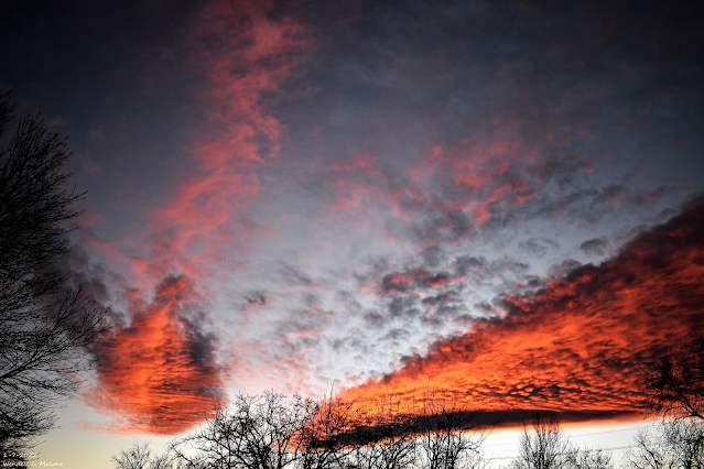
Carlsbad, NM Sunset.

GFS 500 MB (18,000') Forecast.

Valid At 5 PM MST Today.
GFS 500 MB (18,000') Forecast.

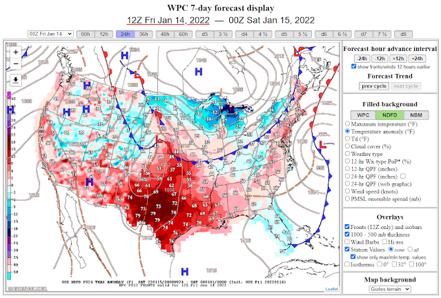
Two short wave troughs of low pressure (one located over the Great Basin and the second located over south-central Canada last night) will combine today to form a strong closed mid-upper level low over southeastern Oklahoma by sunset Saturday. This storm will drive a cold front southward into the region this afternoon into tonight.

Highs Today.
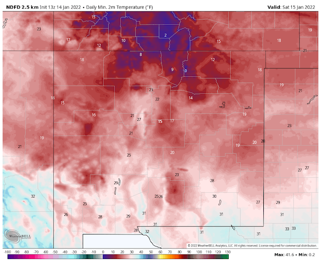
Lows Saturday Morning.


Apparent Temperature Forecast.
Saturday Morning.
Those gusty northerly winds combined with temps at or below freezing will produce apparent/wind chill temperatures in the teens and single digits Saturday morning so bundle up.
High Temps Saturday.
Low Temps Sunday Morning.
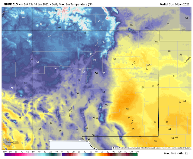
High Temps Sunday.
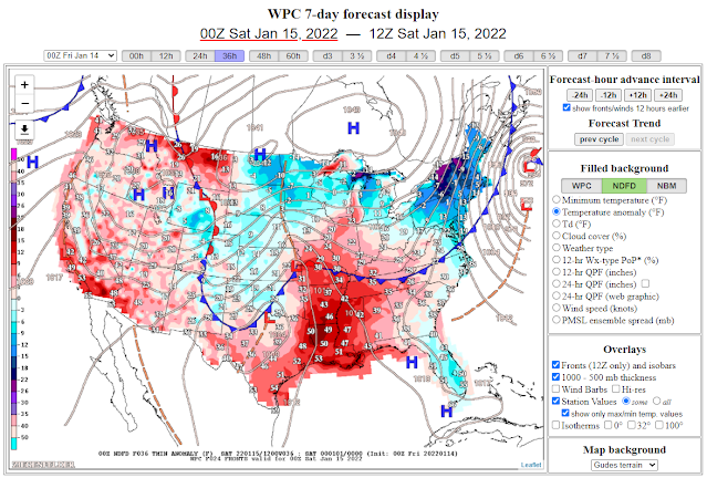
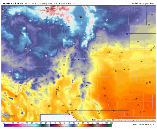
A southward moving cold front will work its way down the Eastern Plains of New Mexico and nearby West Texas this afternoon. Ahead of the front, our high temperatures across the Southeastern Plains will climb up into the low to mid 70's. These readings will be some 15º to 20º above normal for the date. Highs on Saturday behind the front in the colder airmass are forecast to be in the 40's to near 50º which will be some 5º to 10º below normal for the date.
Low temperatures Sunday morning are forecast to drop down into the low 20's for the Southeastern Plains. A few teens are possible. Lows in the Sacramento mountains are forecast to drop down into the teens to near 20º.
Forecast high temperatures for the Southeastern Plains on Sunday jump back up into the 60's.
Forecast high temperatures for the Southeastern Plains on Sunday jump back up into the 60's.
Saturday will be seasonably chilly with highs across the local area in the mid-upper 40's. The 30's and 40's will occur in the mountains. Certainly nothing earthshattering for this time of the year.
Looking back in the history books we find that on January 12, 1963, Roswell recorded a high temp of only 5º with a low of -22º the next morning. Ruidoso also dropped down to -22º.
January 1962 was even colder locally when Artesia registered a low of -20º to -24º on the 11th and Roswell -24º on the 11th. Elk dropped down to -24º on the 10th and Cloudcroft -21º on the 11th.
The Carlsbad Airport and Lake Avalon both dropped down to -18º on the 11th. Making this the coldest temperature recorded in Carlsbad (1900-2021). Past conservations with locals claim that places like Otis and Loving were even colder.
So as I have been telling just about everyone we are a very long way away from having a "cold winter" this year.
Windy This Evening Into Saturday Morning.
Red Flag Warnings are in effect today for Southeastern New Mexico and parts of West Texas where west to northwest winds at 15 - 25 mph with gusts near 35 mph will aggravate the fire danger.
Gusty northerly winds will accompany the frontal passage late this afternoon into Saturday morning. These gusts will range in the 35 - 50 mph range. A Wind Advisory is in effect for Lea County, Culberson County, and parts of the Permian Basin from 5 PM MST this afternoon through 8 AM MST Saturday morning. Its possible that Eddy County could be added to this advisory later today.
Gusty northerly winds will accompany the frontal passage late this afternoon into Saturday morning. These gusts will range in the 35 - 50 mph range. A Wind Advisory is in effect for Lea County, Culberson County, and parts of the Permian Basin from 5 PM MST this afternoon through 8 AM MST Saturday morning. Its possible that Eddy County could be added to this advisory later today.
A High Wind Warning is in effect for noontime today into Saturday morning for the Guadalupe mountains. West winds sustained at 30 - 40 mph with gusts near 60 mph are expected.
Localized areas of blowing dust will be possible tonight into Saturday morning. Watch for sudden drops in the visibility with little to no advanced warning in our normally dust-prone areas.
Model forecasts continue to struggle with a potential winter storm during the middle to end of next week. So the waters remain muddy on that issue with little hope (at least right now) for any significant relief to the worsening drought.
The Truth Is Stranger Than Fiction!


Comments
Post a Comment
Your comments, questions, and feedback on this post/web page are welcome.