


Most Of SE NM Missed Out By This Last Storm.
(May 12th - May 15th).


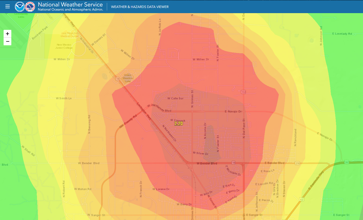
NWS 24-Hour Rainfall Totals.
Looks like Hobbs got all of our rain. Radar estimates show 2" to 3".
Here is the radar estimated rainfall for the city of Hobbs this afternoon (Monday, May 13th, 2019). The red shades indicate 1" to 2.50" fell. A personal weather station (PWS) in northwest Hobbs measured 2.20". Notice that this station was northwest of where radar estimated the heaviest rains to have fallen.
You hear me talk a lot about "localized heavy rainfall that may lead to localized flash flooding." This is the prefect example of this. The city got dumped on in a short time and surrounding areas outside of the city just a few miles away ended up with nothing.
— Bld Bth (@BLD_BTH) May 13, 2019
Hail and heavy rain earlier in Hobbs. Radar rainfall estimates of up to 2" along the Lovington Hwy near the Zia Park Casino & New Mexico Junior College.— Jorge Torres (@JorgeTWeather) May 13, 2019
📹: Olivia Chandler @KOB4 #nmwx pic.twitter.com/rIoMy7QwbO
Incredible video coming in from Hobbs of water rescues due to flash flooding! 🌧— Jorge Torres (@JorgeTWeather) May 14, 2019
📹: Jim Roll @KOB4 #nmwx pic.twitter.com/xcGA6Yx8Tv
The Truth Is Stranger Than Fiction - And Sometimes It Hurts!


Comments
Post a Comment
Your comments, questions, and feedback on this post/web page are welcome.