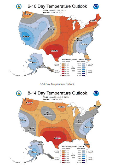
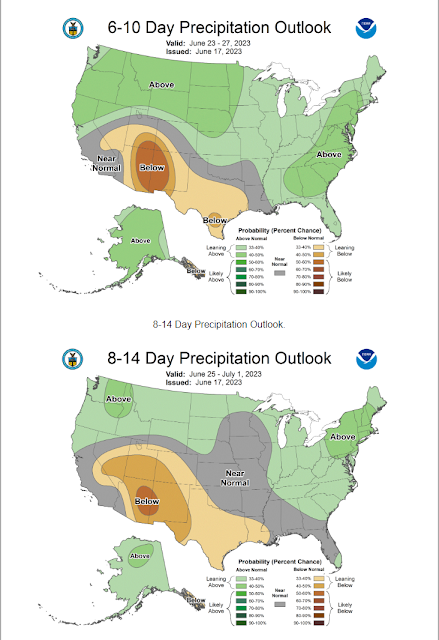
Continued Very Hot Into Next Week!
(6-10 & 8-14 Day Forecasts).
Blog updated at 1:51 PM MDT - With Today's Outlooks.
(6-10 & 8-14 Day Forecasts).
Today.
Sunday.
Monday.
GFS Model.
Continued Very Hot Into Next Week!
Hot, dry, and breez to windy weather today...or better put blast furnace weather. Southwest to west winds will gust up to around 40 mph this afternoon and evening across the southeastern plains. Gusts between 40 - 50 mph are forecast for the Sacramento, Capitan, and Guadalupe mountains. Single digit relative humidity values with high temps ranging from 100º to 105º across the southeastern plains today. The low to mid 80's are forecast for the Ruidoso area and the low to mid 70's for the Cloudcroft area.
Our forecast high temps ramp up this coming work week with no immediate hope of relief. Across the southeastern plains our daily high temps will climb up into the 105º - 108º range Monday, Tuesday, and Wednesday. And likely beyond if not higher by the end of next week.
There currently are no signs in the long range forecasts to offer any meaningful hope for our annual start of the monsoon. Thus no real chances for rain in the near future.
There Are None So Blind As Those Who "Will - Not" To See...107.


Horribly hot!
ReplyDelete