Turn Up The Heat!
A Developing Thunderstorm North Of Melrose, New Mexico.
Looking Northeast From Hope, New Mexico -120 Miles Away.
Turn Up The Heat!
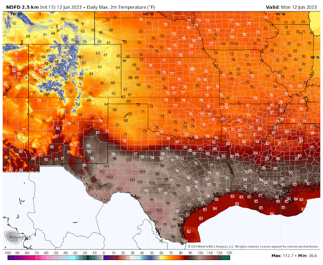
Today.
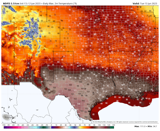
Tuesday.
Wednesday.
Thursday.
Friday.
Saturday.
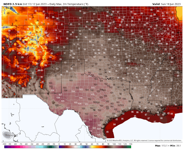
Sunday.
Carlsbad.
(Cavern City Air Terminal - KCNM).
Overall looking at the big picture (next two weeks) our weather looks to be hot and dry. Our daily high temps start trending up the end of this week and continue above the century mark for at least the following week here across the southeastern plains. Keep in mind that there we be adjustments to these high temperature forecasts in the coming days ahead...hopefully not too far upwards. 111ºF is bad enough for Carlsbad in two weeks, if that pans out.
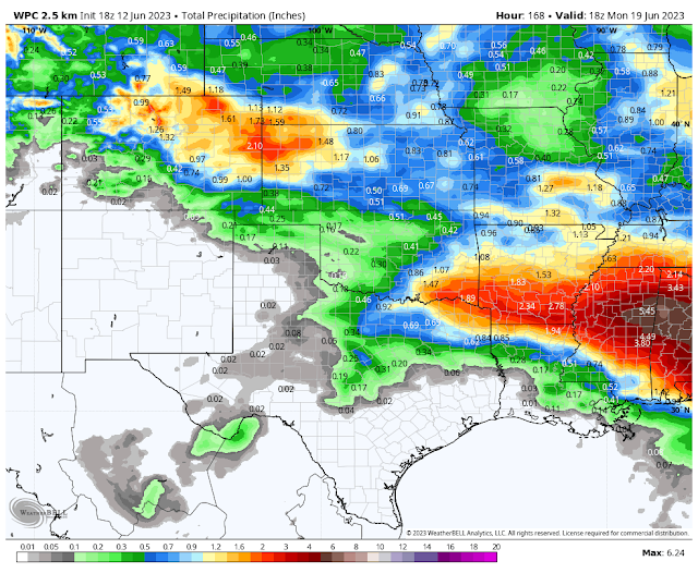
Meaningful or for that matter any rainfall does not appear likely except for the far corner of the northeastern plains. Officially our annual monsoon season starts June 15th and runs through September 30th. And typically before we experience our return of more moist southerly winds and associated daily rounds of thunderstorms especially over the states mountains we bake in the furnace for a couple of weeks. Some years longer with little rainfall until later in the summer. Some years not as long with our rains coming earlier.
A long standing saying in New Mexico is: If it does not rain by the 4th of July then it's going to be a dry year. Or a dry summer would be more correct in my opinion. With this being an El Nino year having a hot start to the summer would be normal with a cool down at the end of summer with more widespread thunderstorms and rains going into the fall. Time will tell how this year turns out.
There Are None So Blind As Those Who "Will - Not" To See...107.





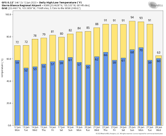




Your forecast from June 21 and on looks scorching, though I like that last day... 84/73 on June 28. Looks like the model you're using for you and Roswell is forecasting a pattern switch then - a polar front or maybe a switch to a monsoonal pattern? Or just a glitch in 14 days out?
ReplyDeleteSo far near average temperatures here, one of 2 springs and early summers in Las Cruces that way. 5/7 have been warmer to much warmer than normal, scaring my Colorado neighbors or convincing them +5 is their "new normal". Glad we / they got a break for once.
Thanks for the feedback David. I think it's just a glitch in the model forecast. Looks like the northern Mexican "Death Ridge" of high pressure digs in to stay for the long term. Much of the local area (lowlands and desert valleys) will stay at or above 100º through the end of the month. Not that I have a lot of confidence in its long range forecast but the noon run of the GFS model peaks out with Carlsbad at 113º on the 29th.
ReplyDeleteAhh, that makes sense. It looks like quite a high pressure! Also grateful we seem to stay below 103, far to your west. (Las Cruces)
DeleteJune, my least favorite month! Once we get passed the 21st I get happier.
ReplyDelete