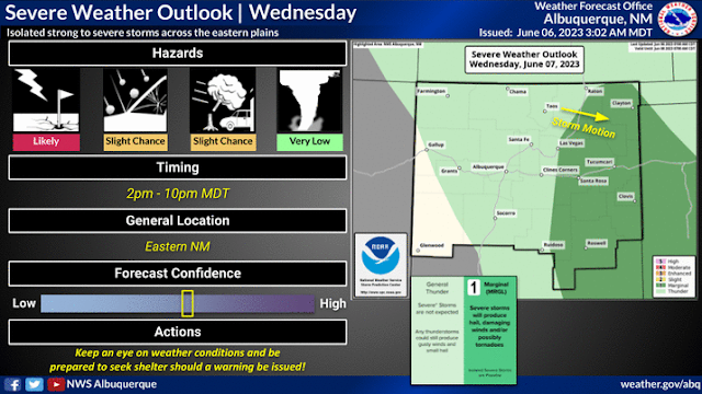
Wet Start To June - More T-Storms Today & Wednesday.
Cumulonimbus (CBMAM)
US hwy 82 West Of Artesia, NM.
Wet Start To June - More T-Storms Today & Wednesday.
June has started off on a wet note across the eastern plains and in a few spots in the southeastern plains of New Mexico. A few locations in the Sacramento mountains have picked up some decent rainfall the past several days also.
More is on the way today into Wednesday night then the tap gets shut off for a while. No this is not the beginning of our summer monsoon. Hopefully that kicks off over the next couple of weeks.
All three of the long range forecast models (US GFS, ECMWF, and the Canadian GEM) are calling for triple digit high temps next week across the southeastern plains. Rain...nope not so much.
(May 31st - June 6th, 2023).
(June 1st - June 5th, 2023).
(June 1st - June 5th, 2023).
There Are None So Blind As Those Who "Will - Not" To See...107.


Comments
Post a Comment
Your comments, questions, and feedback on this post/web page are welcome.