Rain Is Back In Our Forecast Thanks To Remnant Moisture From TS Harold.
Capitan Mountain.
Looking Southwest From St Rd 246.
Infrared.
At 6:58 AM MDT.
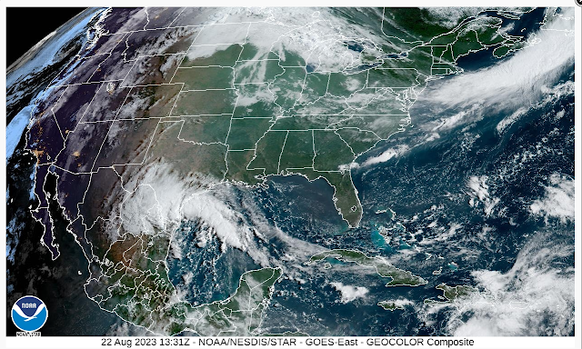
GeoColor Composite.
At 6:13 AM MDT.
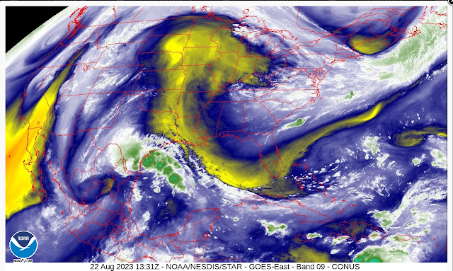
Water Vapor.
At 6:13 AM MDT.
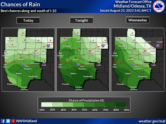
Valid Today Through Friday.
At 6 AM MDT Tropical Storm Harold was located 70 miles east-southeast of Port Mansfield, Texas. Harold is moving to the west-northwest at 18 mph. His maximum sustained winds are 45 mph with a central pressure of 1004 millibars or 29.65 inches of mercury.
Harold is forecast to move inland this morning and then track to the west-northwest today into Wednesday. By Wednesday afternoon his remnant circulation is forecast to be near the Texas Big Bend.
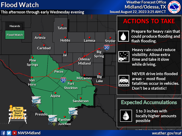
Low-level moisture from Harold will increase over the area today as the remnants of Harold approach. This means an increase in clouds as our chances for rain goes up. A Flood Watch remains in effect for a large chunk of West Texas through Wednesday evening. As of 8:30 AM MDT this Tuesday morning this watch does not include southeastern New Mexico.
As the remnant moisture from Harold moves into the area later today into Thursday scattered rain showers and thunderstorms will develop and spread northwestward. Locally heavy rainfall will occur across parts of the local area. A more widespread heavy rainfall event is forecast south of us into the Texas Big Bend country.
Current model forecasts call for local rainfall totals of an inch or less across Eddy, Chaves, and Lea Counties today into Friday. Localized rainfall totals may approach an inch or more in the Sacramento, Capitan, and Guadalupe mountains.
However when dealing with remnant moisture from former Hurricanes and Tropical Storms I have noticed through the years that the models often under forecast rainfall totals from these systems. Much will depend upon the track of the remnants of Harold as far as who gets the most rain. A slight shift further northward would mean more widespread and heavier rains for southeastern New Mexico and nearby areas. A shift further south would mean less. The further south and west you go the better your chances of getting wet are.
Hot hazy and somewhat humid conditions will continue today with our high temps across the southeastern plains dropping down to only around 90 on Wednesday.
Scattered thunderstorms dotted the landscape yesterday afternoon and evening. A brief thunderstorm dumped .61" of rainfall at the Ridgecrest Personal Weather Station (PWS) on the east side of Carlsbad. That station also recorded a thunderstorm wind gust of 63 mph as the storm collapsed over Carlsbad. On the northwest side of town I only measured .02".The CoCoRaHS Station 4.3 miles WSW of Capitan measured .37".
A PWS in Timberon measured .28".
There Are None So Blind As Those Who "Will - Not" To See...107.


Comments
Post a Comment
Your comments, questions, and feedback on this post/web page are welcome.