Posts

Showing posts from July, 2017

My Blog Archive List (July 2010 - August 2025).

Show more

Cannon AFB (KFDX) Radar Outage

Updated 10/01/2025 11am The Cannon Air Force Base (KFDX) WSR-88D will remain inoperable for an extended period due to a hardware failure at the site. Parts have been ordered. There is currently no estimate on when the radar will return to service. KFDX radar is the only radar coverage for portions of eastern New Mexico. However, you may find KPUX, KAMA, KLBB, and KMAF radars useful. If you have questions or concerns, please contact Cannon AFB Public Affairs at 575-784-4131.

Viewing My Web Page

If you are viewing my web page on your cell phone, then be sure and click on the three white bars located in the top left-hand corner of the page (only visible on your phone). This is the menu bar, and it opens up additional links and graphics. Such as forecast maps, severe weather outlooks, current conditions, radar and satellite links, and more.

Heavy To Very Heavy Rainfall Possible Monday Into Wednesday.

Image
Reported High Temperatures Saturday. The Carlsbad Airport ASOS reported a high temperature yesterday of 101ºF. Thunderstorms quickly formed on radar early last evening stretching from south to north along the Pecos Valley from just south of Lakewood to south of Carlsbad near the NM/TX State line. At 9:18 PM MDT the Carlsbad Airport ASOS clocked a thunderstorm wind gust of 68 mph with .17" of rainfall from the storm. The public in Otis, southeast of Carlsbad reported just a little over an inch of rain, and .50" in Sunnyview in southeastern Carlsbad. We picked up .04" here on the northwest end of town.  NWS NDFD Forecast High Temperatures Today. NWS NDFD Forecast High Temperature Anomalies Today. One more day of triple degree heat before we start a cool down Monday. A slow moving cold front is forecast to drop southward the eastern plains on Monday and into Southeastern New Mexico and West Texas by Monday night. This cooler air mass aided by...

Continued Hot Today Into The Weekend - A Break Next Week.

Image
NWS NDFD Forecast High Temperatures Today. NWS NDFD Forecast High Temperatures Anomalies Today. Parts of Southeastern New Mexico and West Texas will top out today at or just above 100ºF. On average these readings will be about 5-degrees above normal for the date. Saturday and Sunday will see similar high temperatures.  NWS NDFD Forecast High Temperatures Wednesday. NWS NDFD Forecast High Temperatures Anomalies Wednesday. A weak cold front is forecast to approach the area Monday as the center of the upper level high pressure shifts northwest into the Central Rockies next week. This will allow a decent fetch of low level upslope flow the east and southeast into the state and turn the flow aloft to the northwest and north. Meaning that these weak cold fronts will have a better chance to enter the area and the steering winds aloft will drive thunderstorms off of the mountains and southeastward out onto the plains.  By early next week we s...

Summertime Thunderstorms & Rainfall Totals.

Image
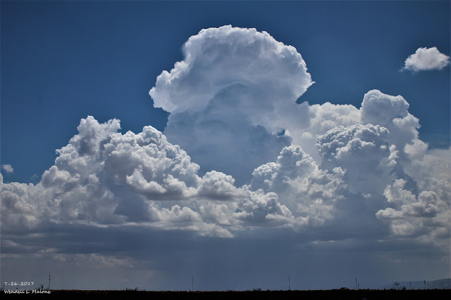
Looking Southwest From Just North Of Whites City - South Of Carlsbad, NM. Looking West At Guadalupe Peak Just South Of The NM/TX State Line. Looking West At The Hidalgo Gas Plant 18 Miles West Of Orla, TX.  Summer Thunderstorms Bring Life To The Desert Southwest. Year-To-Date Rainfall Totals. (January 1st - July 25th, 2017).    July 2017 Rainfall Totals. (July 1st - July 25th). Boiling upwards creating great white towers during the 90 to 100-degree heat and humidity of the valley floors, aided by the upslope effect of the mountains, these majestic storms bring not only relief  from the heat of the summer, but life to the desert in the summertime. For most of us the majority of our annual precipitation falls from these thunderstorms from May through September. This has been a good year for rainfall over most areas. The Truth Is Stranger Than Fiction!

Very Heavy Rains Last Night In The Mesilla Valley South Of Las Cruces.

Image
NWS MesoWest Radar Estimated 24-Hour Rainfall Totals.  NWS HRAP 24-Hour Rainfall Totals. (As Of 6 AM MDT This Morning). Courtesy Of NWS El Paso On FaceBook. CoCoRaHS Reported 24-Hour Rainfall Totals. (Ending At 8 AM MDT This Morning). Just one thunderstorm unloading upon a small area can dump a lot of rain in a short period of time during the summertime in the Desert Southwest, New Mexico included. Thus the story last evening in the Mesilla Valley south of Las Cruces in Doña Ana County. CoCoRaHS Station Mesquite 3.1 Miles Northwest (NM-DA-312) reported a 24 hour total of 3.45" . Just like California "It Never Rains In New Mexico - But Man When It Does, it Pours." The Truth Is Stranger Than Fiction!

Current US Hazardous Weather Watch/Warning Map

New Mexico

Eddy County

Guadalupe Mtns Eddy & Culberson County

Chaves County Plains & Mtn's

Lea County

Lincoln County

Otero County

Pagosa Springs, Colorado Flooding Oct 12, 2025

Arizona Flooding - Oct 12, 2025

🔴 Live 24/7 National Weather Radar & Alerts, Weather Intensity Score & YallBot!

Ruidoso Live Webcam

Ski Apache Webcam Live Link

Ski Apache Webcam Live Link
Click On The Image To Open It Up

Cloudcroft Live Webcam

Roswell Live EarthCam

New Mexico Weather Tweets

Average Daily High/Low Temperatures & Rainfall/Snowfall

My Rainfall Totals. 2.1 NNW Downtown Carlsbad, NM.

My Favorite Blog List.

Substack

Disclaimer

This blog and its contents are for informational purposes only! Always have multiple sources of information available to rely upon during severe weather. Do not rely solely on the Internet. Be weather-aware, plan ahead, have a backup plan, and be ready to act before severe weather strikes your location.