Posts

Showing posts from July, 2025

Numerous To Widespread Slow Moving T-Storms Will Produce Excessive Rainfall & Flash Flooding!

Image
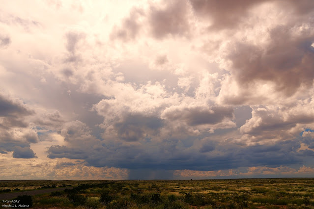
July 28, 2025. Afternoon Monsoonal T-Storm. 15 Miles Southwest Of Artesia, NM.  Early Morning Double Rainbow In Ruidoso This Morning. Blog Updated At 3:27 PM MDT. Ruidoso Under The Gun Again! A monsoonal surge of moisture stretches across most of New Mexico this morning. This, combined with an inverted mid-level trough of low pressure stretching northward into southern New Mexico from northern Mexico, and a Mesoscale Convective Vortex (MCV)  located over southwestern New Mexico, helped to produce moderate to heavy rain over southern New Mexico overnight into this morning. A band of showers and thunderstorms are ongoing as of 9:30 AM MDT this Tuesday morning, stretching northward from southern New Mexico to the Colorado state line. A Facebook friend in Dell City, Texas, west of Guadalupe Pass, reported 4.50" overnight.  Another round of numerous to widespread thunderstorms is forecast across much of the state today into tonight. Like last night, some of these may last into...

Moonsonal Surge Brings Scattered To Numerous T-Storms & Flash Flooding Threats!

Image
June 6, 2025. Double Rainbow. NM/TX State Line - Northeast Of Tatum, NM.  Back To Hit & Miss T-Storms In SE NM This Week. A Flood Watch is in effect for today into this evening for portions of north-central and northeastern New Mexico.  A Flood Watch is in effect for today into late tonight for portions of central New Mexico, including the northern Sacramento Mountains. A Flood Watch  is in effect for today into late tonight for portions fo southwest and south-central New Mexico.  Strong thunderstorms rolled into El Paso yesterday afternoon and dumped 1" to 2" of rain in the southern part of the city, according to radar estimates. Localized flash flooding shut down I-10 for a while and backed up traffic. Not far away, the El Paso International Airport ASOS only recorded .28" of rainfall.  Monsoonal moisture will surge northward from northern Mexico into southwestern New Mexico and then northeastward across the state today into this week. Most locations out...

Drying Out Some & Hot But Monsoonal T-Storms Return Again Next Week.

Image
April 6, 2025. Looking Southwest From St Hwy 246. Sunset & Capitan Peaks - Capitan Mountains Of NM. Blog Updated At 5:31 PM MDT Friday, July 25, 2025.  We are deep into the "Dog Days of Summer." Outside of our summer monsoonal thunderstorms, this means that at the lower elevations, we are hot and our weather is fairly tranquil. Most of the time, anyway, outside of an occasional thunderstorm downpour.  Hot with highs in the upper 90's to near 100 is our weather story across the southeastern plains today through Sunday. With only a slight chance (10% to 20%) of a few hit-and-miss thunderstorms today.  A few isolated to widely scattered thunderstorms are forecast across the Sacramento mountains today and Saturday. By Sunday and Monday into the middle of next week, these slow-moving storms will be more numerous with an increase in locally heavy rainfall and flash flooding. Once again, the burn scars across the state, including the Ruidoso and Hermits Peak/Calf burn scar a...

My Chase Of A Tornadic Supercell Southwest Of Lubbock - 6-6-2025.

Image
My YouTube Link Of My Chase Video: On Friday, June 6th, 2025, I head east from Artesia, NM, to Lovington on US Hwy 82. My first photo below was taken just west of Lovington. I turn north out of Lovington and head towards Tatum on St Rd 206. Then I go north on St Rd 125 until I hit the NM/TX state line southwest of Bledsoe, Texas. From there, I work my way southeast along a series of Farm to Market roads and end up west of Sundown in Hockley County. I had been coming up from behind (to the south) of a developing supercell thunderstorm that first formed north of Tatum, then moved east into Cochran County. It quickly became a right mover once it entered Hockley County. I first encountered its developing wall cloud west of Sundown. I don’t know how many storm chasers were on this storm, but it had to be in the dozens. I begin to watch a strong rotation in the wall cloud a couple of miles to the west of Sundown on Farm to Market Rd 301. This rapidly rotating wall cloud produced a couple of ...

Monsoon Surge & Uptick In T-Storms This Week.

Image
June 6. 2025. Tornado Between Needmore & Meadow, Texas.  Typical Monsoon Pattern This Week. A very typical monsoonal summer pattern has established itself over New Mexico. An uptick in scattered rain showers and t-storms will begin today and increase next week. By the end of next week, a slow drying trend will commence as we heat up going into the last week of July.  Be glad we don't have the Deep South, Midwest, and southeastern states' weather. Heat Advisories and Extreme Heat Warnings cover a huge stretch of real estate where heat index temperatures are forecast in the 105 to 115+ range for multiple days in a row today into early next week.  Flood Watches are in effect on Monday for the Sacramento Mountains (Lincoln and Otero Counties). Scattered thunderstorms will be most numerous across the Guadalupe, Sacramento, and Capitan Mountains, and other mountains of the state by midday today into next week. Hit-and-miss t-storms will dot the lower elevations, with the f...

Uptick In T-Storms & Flash Flood Risks Today! - 1941 Wettest Year In NM.

Image
June 10, 2025... Ragged Base Of A Severe T-Storm. Junction Of US Hwy 285 & Lake Rd - Lakewood, NM.  More Typical Monsoon-Like Weather. New Mexico's weather is expected to become more monsoon-like over the coming week. The most favored areas for scattered to numerous rain showers and t-storms today will be across the northeastern plains, and the recent burn scar areas in the northern Sangre de Cristo, Sacramento, and Gila Mountains. This specifically includes the Hermits Peak/Calf Canyon, Ruidoso area, and the Trout fire burn scars.  A Flood Watch remains in effect for today for northeastern New Mexico, the Hermits Peak/Calf Canyon, and the Ruidoso burn scars. Heavy rainfall over these locations (or any other areas in the state) in a short period of time will cause rapid flash flooding, especially in normally dry arroyos, small streams and creeks, low-lying areas, and the burn scars. Keep your situational awareness of the weather high and be prepared to seek higher ground ...

Increasing Chances For T-Storms/Heavy Rainfall/Flash Flooding!

Image
June 29, 2025. West Of Hope, NM. Blog Update at 12:23 PM MDT, Friday, July 11, 2025.  Blog Updated at 1:12 PM MDT, Friday, July 11, 2025. Parts of northeastern New Mexico have been upgraded to a Slight Risk for severe thunderstorms this afternoon and evening. Parts of southeastern New Mexico have been upgraded for a Slight Chance of severe thunderstorms on Saturday.  Good News & Bad News! A Flood Watch is now in effect for Eddy, Lea, and Culberson Counties as well as much of West Texas from Saturday afternoon through early Sunday morning!  A Flood Watch is in effect for today through late tonight for parts of New Mexico, including Lincoln County! Both good news and bad news or on the horizon, as we once again enter a pattern change with our weather here in New Mexico. The good news is that we will cool down, and scattered thunderstorms and rain showers become increasingly more likely today into next week.  The bad news is that over the next week, the threat...

Ruidoso Live Webcam

Cloudcroft Live Webcam

Roswell Live EarthCam

Current US Hazardous Weather Watch/Warning Map

New Mexico

Chaves County Plains & Mtn's

Eddy County

Culberson County

Lea County

Lincoln County

Otero County

Average Daily High/Low Temperatures & Rainfall/Snowfall