Our Next Winter Storm Is Getting Stronger & Slowing Down.
Valid At 5 AM MST New Years Morning.
European (ECMWF) Snowfall Forecasts.
But many questions are still unanswered tonight. Two of the more important questions are how much snow falls, and where? Sorry, I don't have a good answer for this just yet.
A Pacific cold front is forecast to sweep across the area Tuesday afternoon and evening. Ahead of it, a dry line is forecast to develop across Southeastern New Mexico and West Texas Tuesday. Along and ahead of this dry line scattered thunderstorms are forecast to break out. And a few of these may possibly become marginally severe Tuesday night into Wednesday morning. With the best chance of this happening in West Texas.
Low clouds, fog, and patches of light rain or light drizzle are forecast to overspread parts of the local area tonight. Any rain or drizzle that falls will be light. A few thunderstorms will be possible across Lea County Tuesday night.
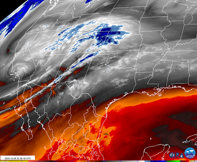
In the mid and upper levels of the atmosphere, a strong and cold closed low is forecast to develop and move southeastward out of southern California Tuesday into New Year's Day. The European model seems to think that the storm will split in two and affect our weather in two phases.
Snow will be possible Tuesday into Wednesday across the higher elevations of the Sacramento Mountains. One thing that the models are latching onto is the possibility of some heavy to very heavy snow bands setting up in the area...but exactly where? Don't know yet. So depending upon the eventual storm track we may or may not get some decent snowfall locally by New Year's.
Much uncertainty remains on the storm track, strength, and duration of this next incoming winter storm that will affect our local weather from Tuesday into New Years Day. For now, the models are trending towards a stronger, deeper, and slower storm with a track a little more favorable for the local area to receive some much-needed rain and snow.
I'll post another update on this developing winter storm Tuesday.
The Truth Is Stranger Than Fiction!


Comments
Post a Comment
Your comments, questions, and feedback on this post/web page are welcome.