Day 8 - Another Look At Our Christmas Outlook.
Valid At 5 AM MST Christmas Morning.
European Model (ECMWF) Snowfall Forecast.
Valid At 5 AM MST Christmas Morning.
U.S. Model (GFS) 500 MB (18,000') Forecast.
Valid At 5 AM MST Christmas Morning.
U.S. Model (GFS) Snowfall Forecast.
Valid At 5 AM MST Christmas Morning.
Canadian Model (GEM) 500 MB (18,000') Forecast.
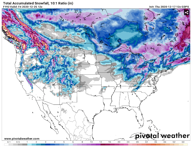
Canadian Model (GEM) Snowfall Forecast.
Valid At 5 AM MST Christmas Morning.
White Christmas Or No?
Eight days away from Christmas and the best answer to my question is still...who knows? Model mayhem continues with all three long-range computer forecast models still out in La la land with their forecasts. They are latching onto the idea of a winter storm dropping into the Desert Southwest around Christmas. For now, all three seem to think this storm will be rather moisture-starved so that's why the snowfall maps are coming up rather bare at this time in New Mexico. My confidence level in these forecasts still remains very low. More later.
The Truth Is Stranger Than Fiction!


Comments
Post a Comment
Your comments, questions, and feedback on this post/web page are welcome.