Posts

Showing posts from March, 2023

Why Are My Weather Posts Missing From Facebook.

Hello everyone. I just wanted to let you know that my Facebook page was shut down without any warning by Facebook this past Saturday, June 8th. All I was told was that I had violated their community standards. I don't know what triggered that; they didn't tell me. I was told this may be permanent or for six months.
My guess is that it may be because I posted several comments and articles from my Substack page about the riots in LA, and that must have triggered/angered someone, and they complained, thus Facebook shut me down. I don't know this as fact, though. I have appealed this decision, and I'm still waiting for their reply. I have read on X that this has happened to other Facebook users posting about the LA riots as well.
I always share my weather blog posts (that I post here) on my Facebook page and my X page. This included over twelve different New Mexico and West Texas Facebook Community sites. So there are thousands of you out there (based on my views and shares of those posts) who will no longer see those posts. My Facebook page may or may not be restored.
This is another good reason (as the National Weather Service often reminds us) to have multiple ways of receiving severe weather alerts when severe weather threatens your location. My weather web page is one of those ways, and I really appreciate all of you who have and still do use it. Thank you so much!!!
If my Facebook page is restored, I will continue to share my weather blog posts and some of the NWS Watches and Warnings...as I have been doing for years now.

Cold This Morning.

Image
RTMA Temperatures At 7 AM MDT This Morning. New Mexico NWS MesoWest Reported Low Temperatures. (This Tuesday Morning). Cold This Morning. Reported low temperatures across northern New Mexico this morning include -10º at the San Antonio Valles Caldera  automated weather station, -3º at the USCRN Station also located in the Valles Calera, and -2º at the Angel Fire Airport . Reported Local Low Temperatures. 13º at the Bell Canyon PWS northwest of Mayhill. 15º at the SD Ranch PWS southwest of Chippeway Park - south of Cloudcroft. 16º at the Walker Canyon Cabin PWS - NW of Mayhill. 16º at the Hay Canyon PWS west of Sacramento.  16º at the Apache Summit PWS - East of Mescalero.  17º at the Capitan PWS . 17º at the Mayhill PWS . 17º at the Cloudcroft NWS Climate Co-Op Station . 17º at the Ruidoso PWS . 18º at the Alto PWS .  18º at   the Mayhill Raws .  18º at the Sierra Blanca Regional Airport . 22º at the Clovis Municipal Airport . 25º ...

Storm Summary - Sunday, March 19, 2023.

Image
March 15, 2023. Lubbock, Texas. Altocumulus Standing Lenticular Clouds (ACSL). Blog Updated At 6:42 PM MDT Sunday, March 19, 2023. The Haves And The Have Nots. Our series of winter storms over the past week have left behind some very impressive rainfall and snowfall totals. Especially for March which is normally is our driest month of the year. Many areas of the state picked up a quarter to a half of an inch of rain while the southeastern plains received zip, zada, nada! Snowfall totals across the northern mountains have exceeded 18" to 24" in a few spots in the Sangre de Cristo mountains. Yet another winter storm will impact the state Monday through Wednesday with heavy northern mountain snows and moderate rains across portions of the state's valley locations. And then another colder storm Thursday with continued unsettled weather conditions into next weekend. Another high wind event looks likely across the Guadalupe, Sacramento, and Capitan mountains, and the southeast...

Winter Say's To Spring - Here Hold My Beer & Watch This!

Image
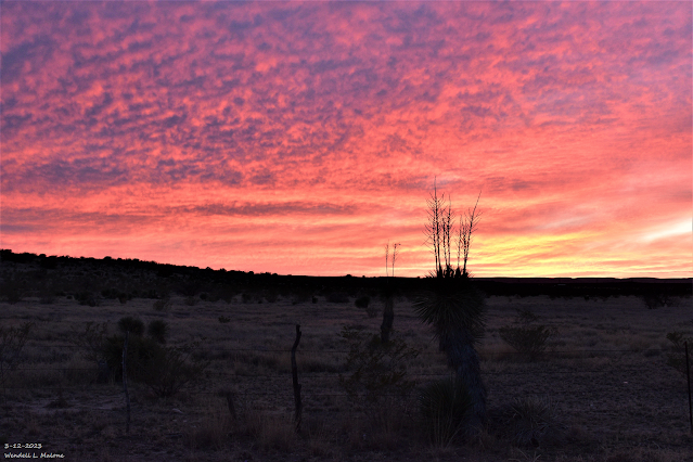
Yucca Sunset. March 12, 2023.  Carlsbad, New Mexico. Surface Map Forecast. Valid At 6 PM MDT Thursday Evening. NBM Total Precipitation Forecast. Valid Wednesday Through Next Monday. NWS NBM Total Snowfall Forecast. Valid Wednesday Through Next Monday. NWS Albuquerque Total Snowfall Forecast. Valid 6 AM MDT Wednesday Through 6 PM MDT Friday. NWS Midland Total Snowfall Forecast. Valid 6 PM MDT Thursday Through 6 PM MDT Saturday. NWS Midland Peak Wind Gust Forecasts. Winter Say's To Spring - Here Hold My Beer & Watch This! A parade of storms is forecast to impact the area Wednesday through the first of next week. A strong back door cold front will slide southward down the eastern plains and into Southeastern New Mexico Thursday afternoon bringing an end to our run of warm spring temps. A series upper level disturbances will cross the region during this time frame also. These will aide in producing rain and snow statewide.  For a change I have some good news to report. Al...

Windy Today - Next Winter Storm End Of Next Week?

Image
March 6, 2023. Looking South From Seven Rivers, NM.  Altocumulus Standing Lenticular Clouds (ACSL). Warm & Windy Today. Like a recurring bad dream our March winds are back. High Wind Warnings remain in effect until this evening for northeastern and eastern New Mexico. West winds sustained at 30-40 mph with gusts near 60 mph are forecast today.  Wind Advisories remain in effect for much of the rest of the state including Chaves and Lincoln Counties. West winds sustained at 25-35 mph with gusts near 50 mph are forecast today. Wind Advisories also remain in effect for Eddy, Lea, and Culberson Counties for west winds sustained at 25-35 mph with gusts near 55 mph.  Wind Advisories also remain in effect for most of the southern half of New Mexico including the Tularosa Basin and the southern Sacramento mountains. West winds sustained at 25-35 mph with gusts to 50-55 mph are forecast. Locally higher across the higher ridge tops of the Sacramento mountains.  ...

Our Afternoon High Temps Today Certainly Felt Like Spring.

Image
NWS MesoWest Reported High Temperatures. (Monday, March 6, 2023). There Are None So Blind As Those Who "Will - Not" To See...107.

Warm And Relatively Quiet Week Ahead.

Image
NWS NDFD Forecast High Temps. Today. Tuesday. Wednesday. Thursday. Friday. There Are None So Blind As Those Who "Will - Not" To See...107.

Our Weather Calms Down For Now.

Image
February 12, 2023  Looking West At Virga.  Near Carrizozo, New Mexico . Blinding Dust Storm In West Texas Causes Massive Pileup. A blinding dust storm with brown out conditions reportedly contributed to a massive pile up (18+ vehicles involved) in  Glassock County on Hwy 137  southeast of Midland  yesterday afternoon. Our Weather Calms Down For Now. Snowfall totals over the Sacramento mountains from this latest winter storm includes  4.5"  at the  Cloudcroft CoCoRaHS Station  located 2.3 miles south of town.  1.8"  at the CoCoRaHS Station located 1.8 miles southwest of town. And  2.2"  at the CoCoRaHS Station located 5.8 miles east-northeast of La Luz.  Scattered power outages occured in the Carlsbad and Loving areas Thursday afternoon with several reports of downed utility and power lines from the high winds. A Dust Storm Warning was issued for far southeastern Eddy County, Lea County, and much of the Permian Basin....

NWS Albuquerque Burn Scar Matrix

Current National Weather Service Watches/Warnings In Effect.

New Mexico

Chaves County Plains & Mtn's

Eddy County

Culberson County

Lea County

Lincoln County

Otero County

Current US Temps

Current US Wind Chill/Heat Index Temperatures

WPC 7-Day Precipitation Forecast

Roswell Live EarthCam

Ruidoso Live Webcam

Cloudcroft Live Webcam

NWS Midland 3-Day Precipitation Forecast

NWS Midland 3-Precipitation Chances

New Mexico 3-Day Precipitation Forecast

New Mexico Precipitation Chances

NWS El Paso 3-Day Precipitation Forecast

NWS El Paso Precipitation Chances

US 24-Hour Precipitation Forecast

US 3-Day Precipitation Forecast