The Rains Are Ending & As The Heat Returns.
Developing Supercell.
Looking North From Lovington, NM.
Say Goodbye To The Rain & Hello To The Heat.
Our recent stretch of wet and relatively cool weather was nice given the time of the year, but this is going away by the weekend.
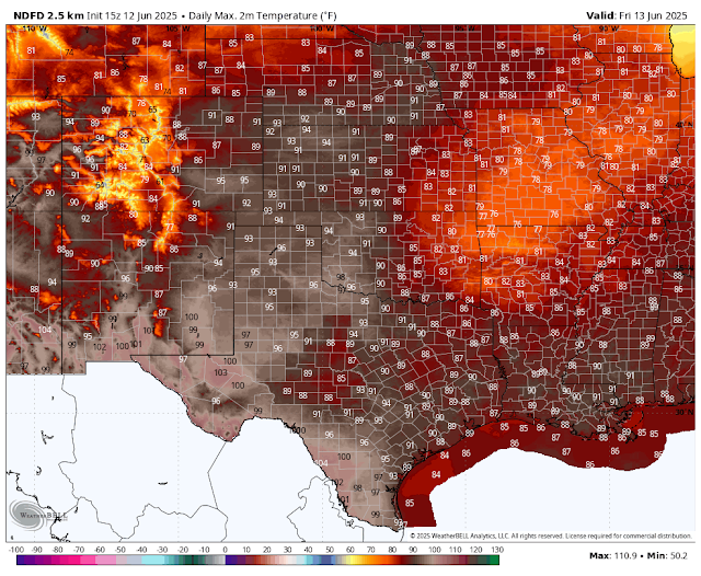
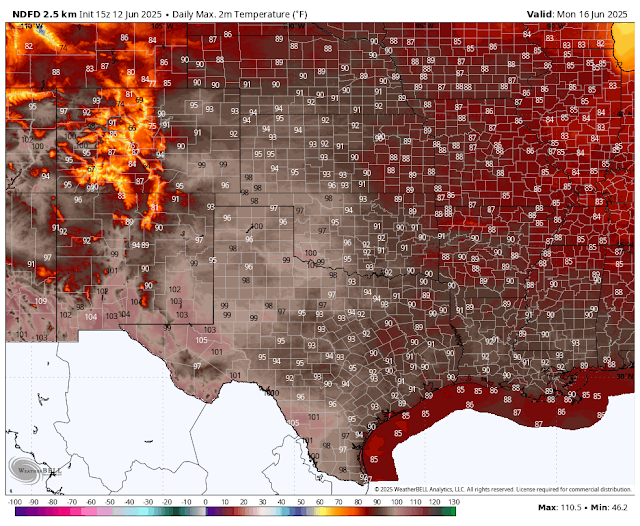
Overall, high temps across the state will average some 5 to 11 degrees above normal today into the first of next week. Highs across southern New Mexico and the southeastern plains will be in the 100 to 105 range Friday into next Tuesday.
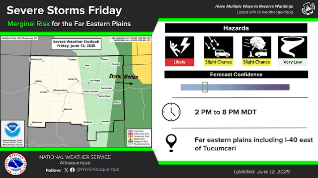
Hit and miss thunderstorms will break out over the eastern one-half of the state today and Friday. A few of these may become marginally severe and produce large hail, damaging thunderstorm winds, frequent lightning, and locally heavy rainfall.
From the central mountain chain westward, thunderstorm coverage will be more isolated and of the drier nature.
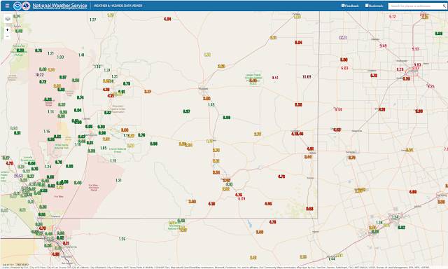
As we march deeper into our meteorological summer, the overall weather pattern will shift towards a monsoonal one. If lucky, we will see an above-average rainfall pattern this year. If not, the drought will only get worse.
Some improvements in our drought status have occurred with the recent rains. We still have a long way to go to end this drought, but progress is being made, albeit slowly, in some areas. Our annual summer monsoon typically begins around June 15th and ends by September 30th.
See the Albuquerque National Weather Service's 2025 Monsoon Outlook video on their YouTube Video and PDF file below for more info on this situation.
Our old summertime friend, the Sonoran heat ridge, is forecast to return and take control of our weather for the near future. The models disagree somewhat on their strength and exact location, but overall, the rains are leaving, and the heat is on.
NWS NDFD High Temperature Forecasts.
Today.
Friday.
Saturday.
Sunday.
Monday.
Tuesday.
Chaves County.
New Mexico Seasonal Drought Outlook.
384
FXUS64 KMAF 121132
AFDMAF

Area Forecast Discussion
National Weather Service Midland/Odessa TX
632 AM CDT Thu Jun 12 2025

...New AVIATION...

.KEY MESSAGES...
Updated at 625 AM CDT Thu Jun 12 2025

- Low thunderstorm chances (10-20%) persist in the higher terrain
  of west Texas and southeast New Mexico Thursday and Friday.

- A hot and dry weather pattern takes shape this weekend into the
  middle part of next week with temperatures reaching near to
  above 100 degrees over much of the area.
783
FXUS65 KABQ 121130 AAA
AFDABQ

Area Forecast Discussion...UPDATED
National Weather Service Albuquerque NM
530 AM MDT Thu Jun 12 2025

...New UPDATE, AVIATION...

.KEY MESSAGES...
Updated at 522 AM MDT Thu Jun 12 2025

- There is a minor risk of burn scar flash flooding this
  afternoon and early evening.

- Scattered showers and storms today may produce gusty outflow
  winds and brief heavy rain east of the central mountain chain.
  Gusty and dry storms are possible along and west of the central
  mountain chain today then over eastern New Mexico Friday.

- Moderate heat risk is expected in most low elevation areas
  Saturday through Monday as temperatures warm to the hottest
  levels so far this season. Major heat risk is possible for the
  southeast plains and the lower Rio Grande Valley.

&&

.UPDATE...
Issued at 522 AM MDT Thu Jun 12 2025

Rain chances were increased along the western fringes of the
moisture (Rio Grande Valley and adjacent mountains) for the
afternoon period in-line with recent hi-res guidance which shows
isolated gusty showers developing between 1PM and 3PM. Very little
rainfall is likely with his convection, but it may produce gusty
winds of 40mph+.

&&
532
FXUS64 KEPZ 121221
AFDEPZ

Area Forecast Discussion
National Weather Service El Paso TX/Santa Teresa NM
621 AM MDT Thu Jun 12 2025

...New FIRE WEATHER...

.KEY MESSAGES...

 -  Isolated to widely scattered thunderstorms through Thursday
    favoring area mountains with gusty outflows into the lowlands.

 -  Seasonable temperatures Wednesday, with heat building Friday
    through the weekend. Hottest temperatures Sunday and Monday.

&&
There Are None So Blind As Those Who "Will - Not" To See...107.












Comments
Post a Comment
Your comments, questions, and feedback on this post/web page are welcome.