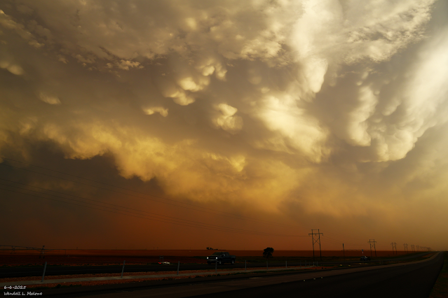
Say Hello To The Beginning Of Our Annual Summer Monsoon This Weekend.
Cumulonimbus Mammatus.
Between Lubbock & Brownfield, TX.
Record High Temps Tied & Broken Tuesday.
The Roswell Airport ASOS recorded a high temperature of 108, just shy of their record high for the date of 110 set in 2017.
The Artesia NWS Climate Co-Op Station tied its record high of 108, last set in 2008.
The Artesia Airport AWOS recorded a high of 108 on Tuesday, tying its record in 2017.
The Carlsbad Airport Airport ASOS recorded a high temp on Tuesday of 109, just shy of its record for the date of 110 in 1977. The Carlsbad NWS Climate Co-Op Station reached 110 in 1924 on June 17th.
Here at our home in NW Carlsbad, I topped out at 110 on my Davis Wireless Vantage Pro2 PWS.
First Apperance Of Our Summer Monsoon Late This Weekend.
Our annual summer monsoon is about to make its presence known across the region late this weekend into next week. A mid-upper level trough of low pressure is forecast to work its way southeastward into the Great Basin Friday into the weekend.
Meanwhile, a stout mid-upper level ridge of high pressure will continue moving eastward out of our area and eventually into the Ohio Valley by Sunday.
The flow aloft and the surface between these two controlling weather features will transport abundant low and mid-level subtropical moisture into the region Sunday into next week. Thus jump-starting our annual monsoon.
Scattered showers and thunderstorms will dot the landscape of the state Sunday into at least the middle of next week. Numerous showers and thunderstorms will eventually lay down some hefty rainfall totals by the middle of next week. Favored areas will be along the central mountains of the state and westward to the Arizona state line. Rainfall storm total of 2" to 4" appears possible in these areas for many of you.
The least favored areas for significant rainfall will be the Four Corners Region, and far southeastern New Mexico, and the Permian Basin of West Texas.
Given this will be a typical monsoon pattern, nocturnal thunderstorms may occur in some areas. Our daytime high temps will cool accordingly to more seasonal levels in most areas next week.
It is plausible that some locations could see more rain than the current model forecast indicates. Therefore, flash flooding may be a concern in the mountains and other areas Sunday into next week, especially over and near the recent burn scar areas.
Remnant tropical moisture from Hurricane Erick may feed into the monsoonal flow and get advected northward into the state, but it's too early to know for sure, and if so, what those impacts would be.
GFS Forecast Storm Total Rainfall Amounts.
(Sunday Through Next Wednesday).
ECMWF Forecast Storm Total Rainfall Amounts.
(Sunday Through Next Wednesday).
National Blend Of Models (NBM) Forecast Storm Total Rainfall Amounts.
(Sunday Through Next Wednesday).
There Are None So Blind As Those Who "Will - Not" To See...107.


Bring it!
ReplyDelete