Unusually Deep Mid-Upper Level Storm Headed Our Way.


Winds at ~ 0500 EDT lulled to about 50mph (http://www.mountwashington.org/weather/conditions.php) allowing the Night Observer (Ryan Knapp) to weight down and set up his camera long enough to “light write” a message with his headlamp – GO SOX!

Unusually Deep Mid-Upper Level Storm.


Valid @ 3 PM MDT Tuesday.


An unusually deep mid-upper level storm is slowly sinking southward over northern California early this morning. Unfortunately there still remains more questions about where this storm is headed than there are answers.

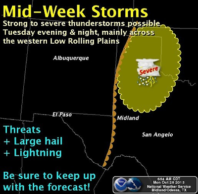
 A slower and more southward track of the storm would mean more rain and snow for New Mexico...and a possible influx of the remnant moisture from Hurricane Raymond. Along with the possibility of severe thunderstorms over eastern and southeastern New Mexico Tuesday and Wednesday.

 A more northerly track would mean less precipitation and more wind.

The Truth Is Stranger Than Fiction! 

 My Web Page Is Best Viewed With Google Chrome.

Comments

NWS Midland Radar

NWS Albuquerque Radar

NWS Lubbock Radar

Holloman AFB Radar

NWS El Paso Radar

South Plains Radar

Southern Rockies Radar

Regional Radar

Current Watches In Effect

SPC Mesoscale Discussions

Storm Prediction Center (SPC) Day 1 Severe Weather Outlook

Current NWS National Watches/Warnings In Effect

Current NWS National Watches/Warnings In Effect
Click On The Map For The Latest Updates

New Mexico

Eddy County Plains & Guadalupe Mtn's

Guadalupe Mtn's In Culberson County

Chaves County Plains & Mtn's

Lea County

Lincoln County

Otero County

Current US Temps

Current US Wind Chill/Heat Index Temperatures

NWS Forecast High Temps Today

NWS Forecast Low Temps Tonight

NWS Albuquerque Storm Total Rainfall Forecast

NWS Midland Storm Total Rainfall Forecast

NWS El Paso Storm Total Rainfall Forecast

Average Daily High/Low Temperatures

Average Daily High/Low Temperatures