Posts

Current Date & Time

My Current Weather Conditions

My CoCoRaHS Precipitation Data

My CoCoRaHS Precipitation Data

New Mexico & Texas Climate Data

Albuquerque International Ballon Festival Climatology

National Hurricane Center

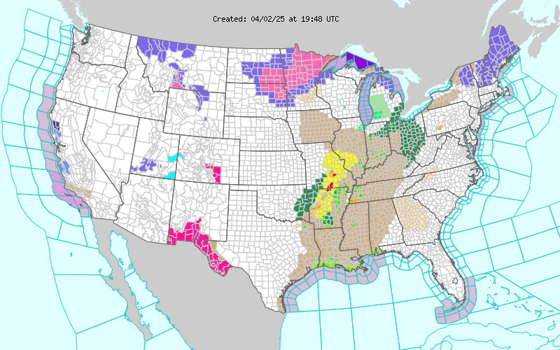
Current US Hazardous Weather Watch/Warning Map

New Mexico

Chaves County Plains & Mtn's

Eddy County

Guadalupe Mtns Eddy & Culberson County

Lea County

Lincoln County

Otero County

Texas

Arizona

Colorado

My Blog Archive List (July 2010 - August 2025).

Show more

Hurricane Polo's Rainfall #3 - Cooler With More Seasonable Fall Temps Ahead.

Image
September 25, 2026.  Atoka, South Of Artesia.  Selected Higher 72-Hour Rainfall Totals.  Santa Fe CoCoRaHS 5.2 S 4.55" Glenwood CoCoRaHS 8.8 NNW 4.38" Western Springs Near Elk (San Miguel Co) HADS 4.35" Caprock Raws East Of Artesia 4.28" Grady Raws N of Clovis 4.06" Santa Fe 4 ENE 3.46" T Or C CoCoRaHS 12 ESE 3.40" Espanola 4 S 3.38" 10K Sandia Mountains East of Albuquerque 3.34"  Rio Grande Below Leasburg Dam Near Radium Springs 1E HADS 3.34" Rio Rancho CoCoRaHS 3.3 ENE 3.32" Las Cruces 19.4 N 3.24" Santa Fe CoCoRaHS 10.7 S 3.10" Cosmic Raws Apache Summit Near Sunspot 2.96" Tatum CoCoRaHS 0.9 E 2.75" Cienegita Springs HADS W of Ruidoso 2.74" Alamogordo CoCoRaHS 8.8 N 2.65" Capitan CoCoRaHS 5.5 NE 2.59" Ski Apache CoCoRaHS 2.50" Near Old Ponderisa Pines Golf Course Cox Canyon SE of Cloudcroft 2.48"  Sierra Blanca Regional Airport AWOS 2.00" Maljamar PWS 2.83" Deming 11.7 N 2.67...

Widespread Heavy/Torrential Rains & Flash Flooding From Hurricane Polo's Remnant Tropical Moisture!

Image
September 25, 2026. Normally Dry Rio Felix Arroyo. Taken From The Bridge On US Hwy 285. Southern Chaves County - West Of Hagerman.  Blog Updated At 12:50 PM MDT Monday, Sept 28, 2026. Blog Updated At 8:00 PM MDT Monday, Sept, 28, 2026.  Another Dangerous Excessive Rainfall & Flash Flood Event Starting Today!  All Of New Mexico Is Under Flood Watches! Update: A few supercell thunderstorms will develop across southern New Mexico and the eastern half of New Mexico, as well as across parts of West Texas, Tuesday afternoon into early Wednesday morning. These thunderstorms will produce damaging severe wind gusts in excess of 60 mph and perhaps a few isolated tornadoes. As noted by the Albuquerque National Weather Service Office, trees in these areas will be more susceptible to being blown down due to the very wet soil conditions.    Today's quiet weather before round two of heavy to excessive rains and flash flooding will come to a fast end first across northwest ...

NWS Regional Radar

NWS Regional Radar

My Precipitation Totals - 2.1 NNW Downtown Carlsbad

My Precipitation Totals - 2.1 NNW Downtown Carlsbad

My Seasonal Snowfall Totals - 2.1 NNW Downtown Carlsbad

My Seasonal Snowfall Totals - 2.1 NNW Downtown Carlsbad
