Posts

Showing posts from October, 2026

Current Date & Time

Widespread Rain Today Into Friday Night - Flash Flooding Likely In Some Areas!

Image
October 25, 2026. Lincoln, New Mexico. Blog Updated At 12:10 PM MDT, Thursday, Oct 29, 2026. More T-Storms/Heavy Rain/Flash Flooding. If you love a cool, wet fall, then more of that is on the way today into Friday night. Once again this morning, low clouds and areas of fog, dense in some areas, blanket southeastern New Mexico and nearby West Texas. It's been 12-13 years since we've had a fall like this, and I love it.  Two more Pacific storms are lined up to impact our weather today into Friday night, and again the first of next week. A strong closed mid-upper-level low was centered northwest of Seattle this morning, with a long-wave trough of low pressure extending southward to south of the southern Baja Peninsula.  This closed low will deepen and eventually split in two by sunset Saturday. A shortwave trough of low pressure on the southern end of this low will deepen west of the Baja Sur Saturday, before swinging northeast into Arizona on Sunday.  The closed mid-upper-l...

Storm Summary - Monday, Oct 26, 2026...Next Storm Arrives Late This Week.

Image
October 17, 2026. South Of Cloudcroft, NM. Some Of The Heavier 7-Day Rainfall Totals. (Monday, Oct 19 - Monday, Oct 26, 2026). We haven't had a wet fall (September and October) like this year since 2013, 2014, and 2015. Over the weekend, southern Colorado and northern New Mexico just got drenched, which resulted in widespread life-threatening river flooding and flash flooding. Some communities along the San Juan River Basin in northwest New Mexico saw historic flooding.  Widespread rainfall totals in many of these areas over the past week have been in the 2" to 5" range. Many reporting stations have recorded 5" to 7", with several in the 8" to 10" range. When you get this much rain in such a period of time over the Rocky Mountains and high deserts, there is only one place for it to go: down, into the valleys, creeks, streams, rivers, and arroyos.  Widespread flash flooding and river flooding inundated some communities in northwestern New Mexico and sou...

Increasing Threat Of Severe T-Storms/Heavy Rainfall/Flash Flooding!

Image
October 17, 2026. Alamo Peak - South Of Cloudcroft, NM. Severe T-Storm & Flash Flood Threat Increasing Today Into Sunday. Northwestern and northern New Mexico have received very heavy rainfall over the past several days, with storm totals in the 1" to 4" range. You aren't out of the woods yet with scattered to numerous showers and thunderstorms forecast today into Saturday.  Flood Watches, Flood Warnings, and Flood Advisories continue in effect across parts of northwestern New Mexico this morning. Scattered to numerous thunderstorms, with some of them severe, are likely today into tonight across much of the state, with the central and southern areas having the greatest risk for severe thunderstorms. Large hail, damaging thunderstorm wind gusts in excess of 58 mph, frequent cloud-to-ground lightning, locally heavy rainfall, and flash flooding will be the primary threats. Isolated tornadoes are also possible with the strongest supercell thunderstorms.  Scattered to nume...

Tornado Watch In Effect For Western NM Today/Tonight - Stormy Today Into The Weekend!

Image
October 17, 2026. Alamo Peak - South Of Cloudcroft, NM. Today Into Friday. A Tornado Watch has been issued for Northern and Eastern Arizona and Western New Mexico from 11:10 AM MDT through 7:00 PM MDT tonight.  Another strong Pacific storm is going to keep New Mexicans busy today into the upcoming weekend, with more wet weather possible over the state next week. A potent closed mid-upper-level low was located west of Los Angeles this morning. This storm is forecast to move inland over southern California by sunset today, then wobble around southern California Friday and Saturday before opening up and weakening as it moves northeast to the Four Corners on Sunday. A Pacific cold front will swing eastward across New Mexico today into Friday before becoming stationary over the state on Saturday. It's not going to bring much cold air into the state.  Scattered to numerous showers and thunderstorms are forecast across the western half of New Mexico today into Friday. Some of these t...

Warming Up With Rain Returning & Saturday Morning's Lows.

Image
October 17, 2026. South Of Cloudcroft, NM. Blog Updated at 9: 54 AM MDT, Monday, Oct 19, 2026.  Reported Low Temperatures Saturday Morning. Eagle Nest NWS Climate Coop Station 0º Angel Fire Airport ASOS 8º Bell Canyon PWS NW of Mayhill 18º Scenic Canyon PWS - NW of Wimsatt 19º Myers Cabin PWS - Sacramento 20º Mountain Park NWS Climate Coop Station 20º Mayhill 3.4 NW NMCC 20º Alto PWS NBOX-13 21º Ruidoso WS_29 22º Elk NWS Climate Coop Station 25º Timberon PWS 25º Ruidoso NWS Climate Coop Station 21º Sierra Blanca Regional Airport AWOS 25º Cloudcroft NWS Climate Coop Station 26º Portales NWS Climate Coop Station 26º Smokey Bear Raws Ruidoso 26º Runyan Ranches NMCC 28º Hondo NMCC 29º Dunken Raws 30º Hagerman NMCC 30º High Rolls PWS 31º Dexter NMCC 31º Roswell XL AWS 5.2 N 31º Artesia NWS Climate Coop Station 31º Artesia Ag Science Center NMCC 31º Lovington NMCC 31º Queen Raws 31º Hobbs XL AWS 6.75 NW 32º Hope 4.9 W NMCC 33º Lakewood/Seven Rivers NMCC 33º Hobbs Lea County Regional Airp...

Talk About An About Face Change In Our Forecasts.

Image
September 27, 2026. Hondo, New Mexico - East Of Ruidoso. Another Hot One In SE NM Today. For the fourth day in a row, the Carlsbad Airport has reached or exceeded 90º for a high temp. As of 5 PM this afternoon, it had climbed up to 90º. Normal high/low temps for Oct 14th for Carlsbad are 78º/50º. Hopefully this is the last time we see 90º until next spring. A Pacific cold front is moving from west to east across the state late this afternoon, dropping temperatures behind it. While it was 90º in Carlsbad at 5 PM, it was 54º in Farmington, 55º in Gallup, 60º in Angel Fire, 67º in Santa Fe, 73º in Albuquerque, 58º in Raton Pass, and 54º in Clayton.  Cooler air will continue spreading across the state tonight into Thursday, and even more so on Friday and Saturday. Thursday will see highs drop another 5º to 10º over most of the state below today's highs. Friday and Saturday will see an additional 10º to 15º of cooling across the eastern half of the state, with the 50s and 60s commo...

Summer Today & Tuesday - Fall & Winter Starting Thursday!

Image
September 25, 2026. Bulldog Bowl - Artesia, New Mexico. Courtesy Of Artesia Bulldog Paw Prints. Excessive rainfall from remnant tropical moisture from Hurricane Polo drenched southeastern New Mexico September 22nd through the 26th. Storm totals in Artesia reported by the public that week were in the 6" to 8" range. As a result, Bulldog Bowl in Artesia got flooded, but as far as I know, there was no damage, and the water was drained off with no issues. Bulldog Paw Prints in Artesia captured this incredible photo.  Wild Swings In Our Weather Ahead! I told you in yesterday's blog post that there would likely be changes in our weather forecasts this week. They have already started. We will be going from summer today and tomorrow into fall and winter Thursday through Saturday.  Forecast models have settled down in this morning's 12Z (6 AM MDT) runs. All three long-range models (GFS, ECMWF, and the Canadian GDPS) have a potent mid-upper level closed low centered over easte...

Stormy Week With Big Changes Ahead.

Image
September 25, 2026. Normally Dry Rio Felix Arroyo. Looking West From The Bridge Over US Hwy 285. Local Record High Temperatures For: Roswell Monday 97 in 2024 Artesia Airport Monday 95 in 2024 Artesia Climate Monday 93 in 2024 Carlsbad Airport Monday 97 in 1979 Carlsbad Climate Monday 95 in 1979 Carlsbad has reached 91º for a high temp today, Artesia 88, Roswell 87, and Hobbs 86.  Monday will likely be the hottest day of the month for the southeastern plains, with forecast highs ranging from near 90 to the mid-90s. A few of us may get close to tying or breaking our daily record high temperatures on Monday. Some people think this is our Indian summer, but it's not. A true Indian summer event occurs after the first frost/freeze in fall, and we haven't seen that yet in New Mexico except across some of the higher mountain valleys of the state. A lot is going on in the atmosphere that will affect our weather over the state and local area this upcoming week. After seeing highs in sou...

Warming Back Up This Weekend - Next Week Turning Unsettled.

Image
October 7, 2026. Hobbs, New Mexico Sunset. A warming trend has commenced and will continue this weekend through Columbus Day before a Pacific cold front cools us down next Tuesday and Wednesday. A second cold front will likely drop our temps further by next Thursday and Friday.  Until then, the southeastern plains will get rather toasty Sunday and Monday, with highs forecast in the low to mid 90s. We may get close to the daily record highs. Record High Temperatures For: Roswell Sunday 96 in 2020 Roswell Monday 97 in 2024 Artesia Airport Sunday 93 in 2020 Artesia Airport Monday 95 in 2024 Artesia Climate Sunday 96 in 2020 Artesia Climate Monday 93 in 2024 Carlsbad Airport Sunday 96 in 1979 Carlsbad Airport Monday 97 in 1979 Carlsbad Climate Sunday 98 in 1903 Carlsbad Climate Monday 95 in 1979 Breezy southerly and southwesterly winds will pick up Sunday across the southeastern plains with gusts around 25 mph. Stronger gusts are forecast for the Guadalupe, Sacramento, and Capitan Moun...

My Blog Archive List (July 2010 - August 2025).

Show more

My Current Weather Conditions

MY CoCoRaHS Precipitation Data

NWS Albuquerque 2026 Winter Outlook (Updated Nov 3rd).

NWS Midland Web Page

NWS Midland Web Page
Click On The Map To Open It Up

SE New Mexico & West Texas Precipitation Forecasts

Eddy County

Guadalupe Mtns Eddy & Culberson County

Lea County

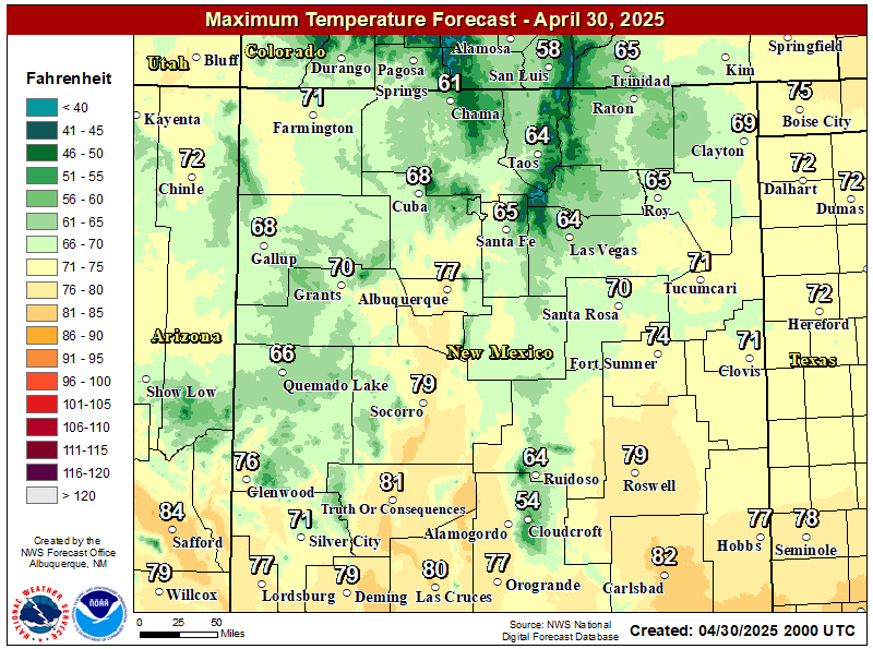
NWS Midland Forecast High Temperatures Today

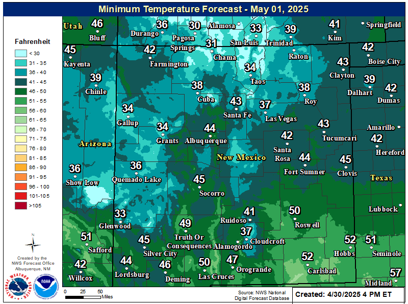
NWS Midland Forecast Low Temperatures Tonight

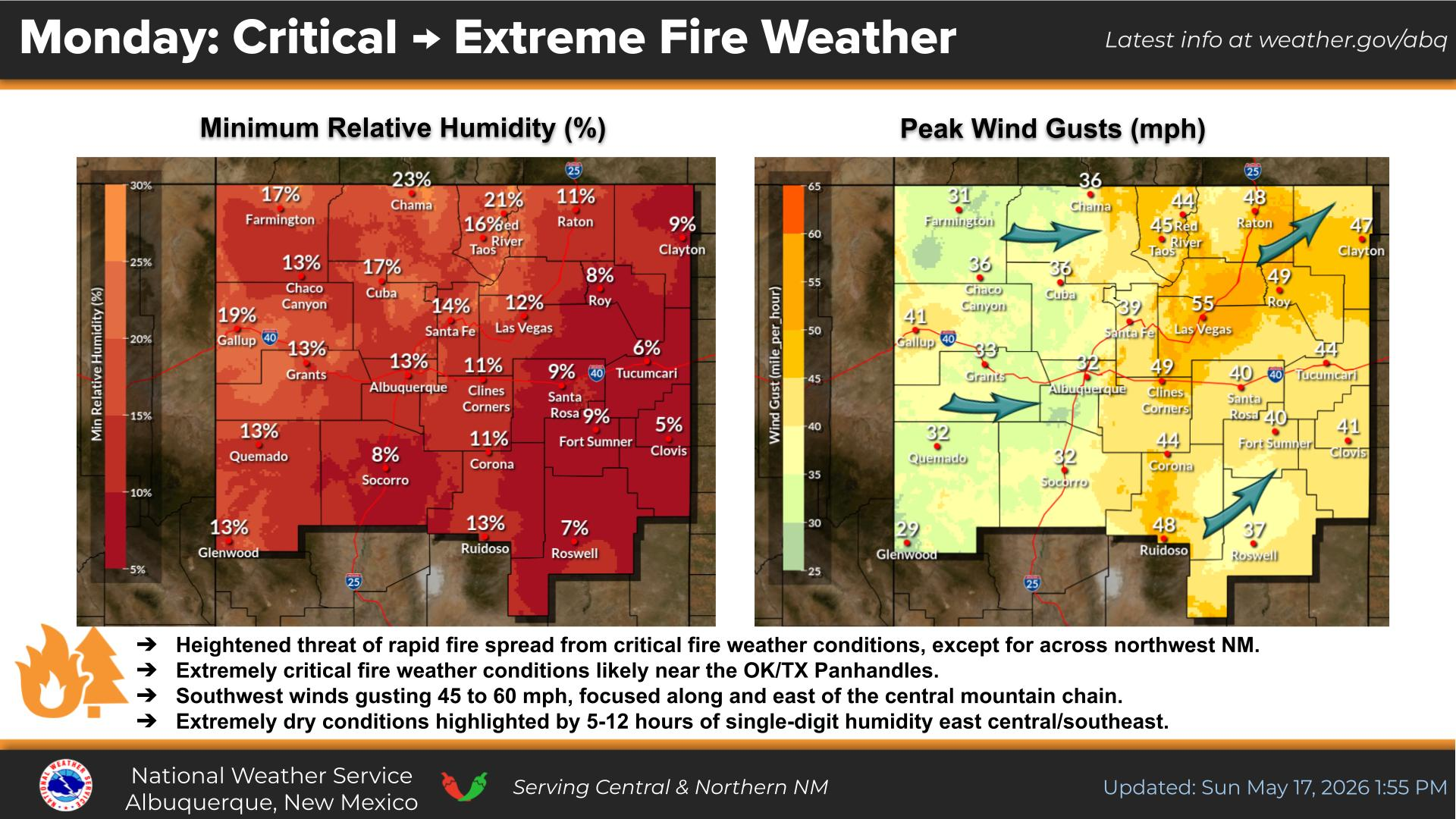
NWS Midland Peak Wind Gust Forecast

NWS Midland Graphic Forecast

NWS Midland Graphic Forecast
Below normal highs today with temperatures in the upper 40s to mid 50s. Clouds remain across most areas today with light drizzle possible.

NWS Albuquerque Web Page

NWS Albuquerque Web Page
Click On The Map To Open It Up

NWS Albuquerque New Mexico Precipitation Forecasts

New Mexico

Chaves County Plains & Mtn's

Lincoln County

NWS Albuquerque Hazardous Weather Outlook

NWS Albuquerque Hazardous Weather Outlook

NWS Albuquerque Forecast High Temperatures Today

NWS Albuquerque Forecast Low Temperatures Tonight

NWS Albuquerque Wind Chill Forecast

NWS Albuquerque Peak Wind Gust Forecast

NWS Albuquerque Graphic Forecast

NWS Albuquerque Graphic Forecast

NWS Albuquerque Graphic Forecast

NWS Albuquerque Forecast Grpahics

NWS El Paso Web Page

Southern New Mexico & Far West Texas Precipitation Forecasts

Texas

Otero County

NWS El Paso Hazardous Weather Outlook

NWS El Paso Hazardous Weather Outlook
Click On The Image To See The Rest Of The Outlooks

NWS El Paso Hazardous Weather Outlook

NWS El Paso Hazardous Weather Outlook
Click On The Image To See The Rest Of The Outlooks

NWS El Paso Forecast High Temperatures Today

NWS El Paso Forecast Low Temperatures Tonight

NWS El Paso Wind Chill Forecast

NWS El Paso Peak Wind Gust Forecast

NWS El Paso Graphic Forecast

NWS El Paso Graphic Forecast
A cold front will move across the region tonight and that will give us high temperatures on Monday a little below average. Our winds will be light. Most of us will see plenty of sun, but some lower clouds will sneak into Otero and Hudspeth Counties behind the cold front.

NWS Lubbock Web Page

NWS Lubbock Web Page
Click On The Map To Open It Up

NWS Lubbock South Plains Precipitation Forecasts

NWS Lubbock Hi Temperature Forecast Today

NWS Lubbock Low Temperature Forecast Tomight

NWS Lubbock Graphic Forecast

NWS Lubbock Graphic Forecast
Fog is likely across the region through late morning. While the fog will lift, clouds will remain through the rest of the day and through the night. This will keep highs near 50 and lows in the upper 30s to mid 40s.

NWS Lubbock Graphic Forecast

NWS Lubbock Graphic Forecast
After starting off foggy and cool, the week will eventually warm into the 60s. Shower and thunderstorm chances return Thursday.

My Rainfall Totals - 2.1 NNW Downtown Carlsbad

My Rainfall Totals - 2.1 NNW Downtown Carlsbad

My Seasonal Snowfall Totals - 2.1 NNW Downtown Carlsbad

My Seasonal Snowfall Totals - 2.1 NNW Downtown Carlsbad

Disclaimer

This blog and its contents are for informational purposes only! Always have multiple sources of information available to rely upon during severe weather. Do not rely solely on the Internet. Be weather-aware, plan ahead, have a backup plan, and be ready to act before severe weather strikes your location.