

Tornado Watch In Effect For Western NM Today/Tonight - Stormy Today Into The Weekend!

Alamo Peak - South Of Cloudcroft, NM.
Today Into Friday.
A Tornado Watch has been issued for Northern and Eastern Arizona and Western New Mexico from 11:10 AM MDT through 7:00 PM MDT tonight.
Another strong Pacific storm is going to keep New Mexicans busy today into the upcoming weekend, with more wet weather possible over the state next week.
A potent closed mid-upper-level low was located west of Los Angeles this morning. This storm is forecast to move inland over southern California by sunset today, then wobble around southern California Friday and Saturday before opening up and weakening as it moves northeast to the Four Corners on Sunday.
A Pacific cold front will swing eastward across New Mexico today into Friday before becoming stationary over the state on Saturday. It's not going to bring much cold air into the state.
Scattered to numerous showers and thunderstorms are forecast across the western half of New Mexico today into Friday. Some of these thunderstorms will be clipping along to the northeast at around 35 to 50 mph.
Heavy to excessive rainfall will occur with some of these storms today and tonight, then spreading east to central New Mexico on Friday. Widespread rainfall totals in these areas today into Friday will be in the .25" to 1.75" range. More isolated but heavy storm totals of 2" to 4" will be possible west of the continental divide, on top of the .25" to 1" that has already fallen.
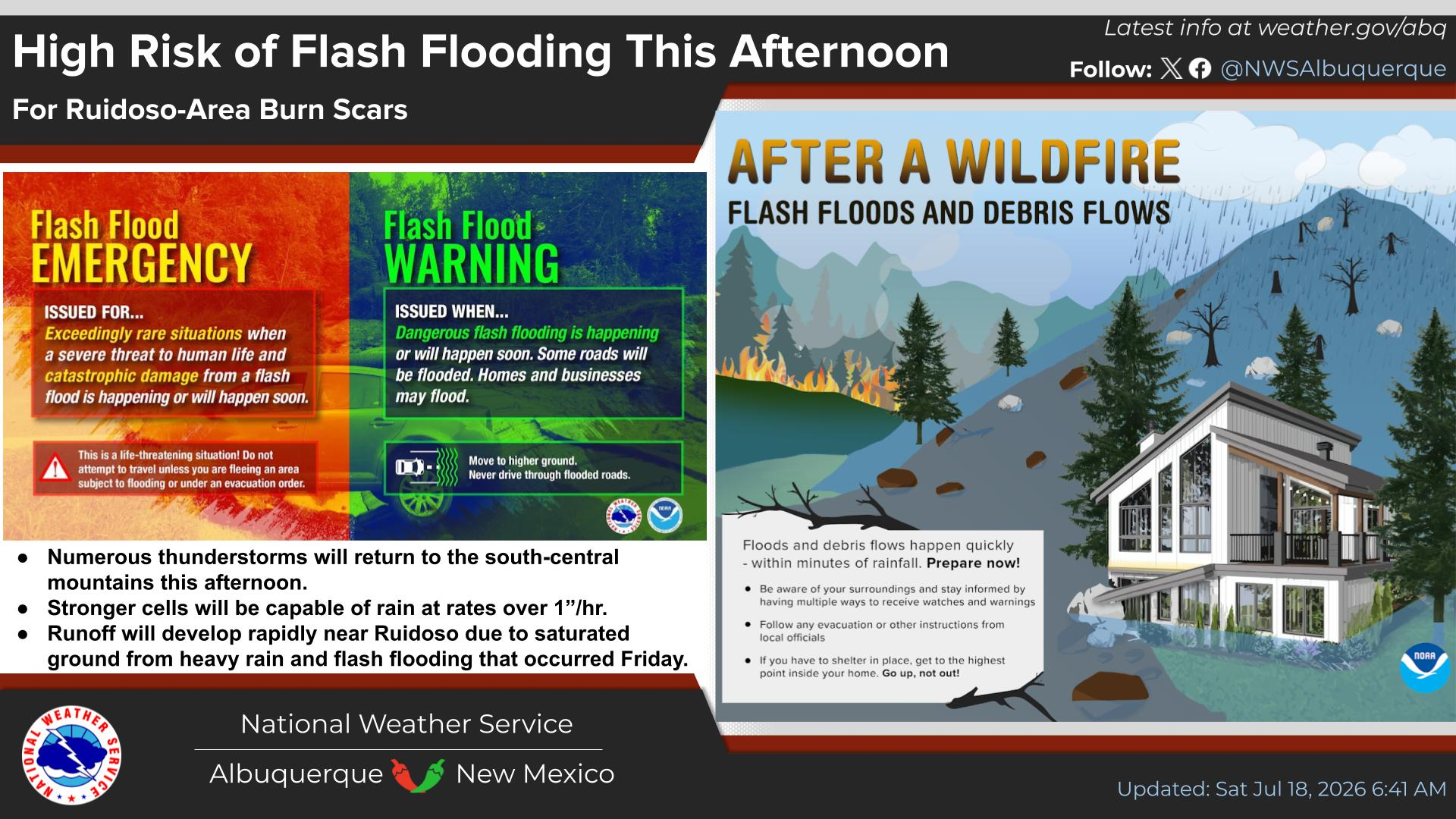
The threat for excessive rainfall and flash flooding in these areas is high; therefore, Flood Watches remain in effect through Friday afternoon for western New Mexico.
Severe thunderstorms will also be possible across the western half of New Mexico today and tonight, then spreading east to central New Mexico on Friday. Severe thunderstorms will be possible over southern and parts of southeastern New Mexico on Saturday.
Large hail, damaging thunderstorm wind gusts in excess of 58 mph, frequent cloud-to-ground lightning, heavy to excessive thunderstorm rains, and flash flooding will be the primary severe weather threats in the above-mentioned areas today into Saturday. A few isolated tornadoes may also occur.
Friday Into Monday.
Our chances for scattered to numerous showers and thunderstorms increase Friday afternoon into Sunday across southeastern New Mexico. Showers and thunderstorms will be on the increase across the Sacramento, Capitan, and Guadalupe Mountains tonight into the weekend.
Some of these thunderstorms are likely to be severe over central and southern New Mexico, including the Sacramento Mountains on Friday. Severe thunderstorms will be possible across the southeastern plains on Saturday.
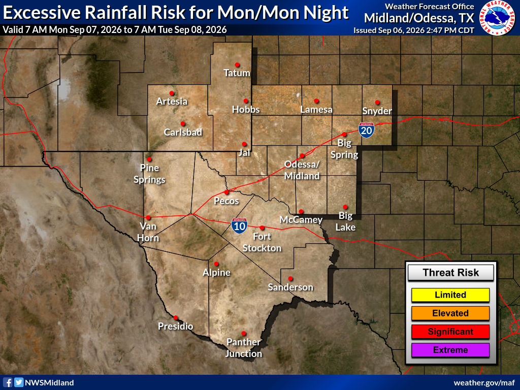
Scattered to numerous showers and thunderstorms will produce locally heavy rainfall Friday night through Sunday across the local area. Localized flash flooding may also occur with the stronger storms, and those that train over any given location. At this time, the highest threat for flash flooding looks to be over the Guadalupe, Sacramento, and Capitan Mountains. The southeastern plains will be on the eastern edge of this threat, and if the heavier rains shift eastward, then that threat will go up.
Current forecast models indicate storm total rainfall amounts from Friday through Sunday will be in the .50" to 1.50" range across the southeastern plains. And in the 1" to 3" range over the Guadalupe, Sacramento, and Capitan Mountains tonight through Sunday. Locally higher amounts are possible.
Snow may fall over the higher peaks of the northern mountains late this weekend, generally above 10,000'.
Tropical Storm Vance was located 505 miles south of Acapulco, Mexico at 8 AM MDT this morning. He has sustained winds of 60 mph and is moving to the northwest at 3 mph. Vance is forecast to rapidly strengthen today into the weekend and become a major hurricane by Saturday morning. Vance could enhance the rich tropical/subtropical moisture field to the southwest of the Desert Southwest next week as he weakens and dissipates. This may have an impact on our weather then.
Severe T-Storms In October.
Severe thunderstorms are not common in New Mexico in October, but they are not unheard of either. One of the strongest on record occurred in Socorro on October 4, 2004, from 1:06 to 1:22 PM MDT. Hail up to 3.0" in diameter caused $40 million dollars in property damage.
"Strong thunderstorms developed during the mid-morning along the continental divide west of Albuquerque, then swept eastward with brief hail again reaching the Albuquerque metro area. A trailing, southern storm that formed over west central Socorro County became intense as it reached the City of Socorro which was pounded by 5 to 10 minutes of baseball size hail with estimated terminal velocities of near 100 mph. This record hail storm produced widespread and intense damage to automobiles, broken windows and screens as well has destroying home and commercial roofs. Damage estimates included $15 million to the New Mexico Tech campus, where nearly every building was damaged, and the fleet of university vehicles was almost a total loss. Countywide insurance claims had reached $40 million. The storm passed east into rural and unpopulated areas of Socorro County, where it likely produced several small tornadoes."
I've listed a few of the more significant severe weather events that have impacted southeastern New Mexico recently. There have been other severe thunderstorm and flash flooding events locally in October over the past 130 years.
Most recently, training severe thunderstorms produced damaging winds and catastrophic/historical flash flooding in Roswell during the evening of October 19, 2024. Rainfall reports in the city were in the 6" to 11" range, with one unconfirmed report of 12", all within a few hours.
I chased a supercell thunderstorm northwest of Carlsbad on St Hwy 137 (Queen Hwy) that produced golf ball to tennis ball size hail, a rotating wall cloud, and local flash flooding on October 2, 2023.
A nasty Severe Thunderstorm rolled through the Artesia, Cottonwood, and Lake Arthur areas on the evening of Wednesday, October 21, 2015. Reports from the public indicated that hail was pea- to quarter-sized in Artesia, as large as Tennis Balls in the Cottonwood area near Mill and Bolton Roads. Ping-pong to golf ball-sized hail was reported in south Carlsbad. Wind damage was also noted in the Cottonwood area north of Artesia. 24-hour rainfall reports by the public in the Cottonwood and Lake Arthur areas ranged from 2 " to 6 " in the neighborhood.
On October 21, 2010, a tornado touched down northwest of Roswell, New Mexico. Multiple photos of the tornado were documented, including some by Chaves County Skywarn Coordinator Jim Tucker. See my blog posts #1 and #2 for the photos and info.
Area Forecast Discussion
National Weather Service Midland/Odessa TX
1234 PM CDT Thu Oct 22 2026

...New AVIATION...

.KEY MESSAGES...
Updated at 1225 PM CDT Thu Oct 22 2026

- Above normal temperatures and dry conditions continue through
  most of Friday.

- Rain chances increase from west to east late Friday through the
  weekend, with highest rain chances over our western areas Saturday
  and Sunday.

&&
Area Forecast Discussion...UPDATED
National Weather Service Albuquerque NM
1146 AM MDT Thu Oct 22 2026

...New AVIATION...

.KEY MESSAGES...
Issued at 1139 AM MDT Thu Oct 22 2026

- Flash flood risk continues in western New Mexico today,
  spreading eastward into central New Mexico tonight through
  Friday.

- Additional heavy rainfall looks increasingly likely over eastern
  New Mexico this weekend with a risk of flash flooding.

- There will be a risk of severe storms producing large hail and
  damaging winds over western New Mexico today, then over central
  areas Friday.

- Rainfall over northwest New Mexico this week will create rises
  on tributaries as well as main stem rivers such as the San Juan
  and Animas. No river flooding is currently forecast, but trends
  will be monitored closely over the next few days.

&&
Area Forecast Discussion
National Weather Service El Paso TX/Santa Teresa NM
1150 AM MDT Thu Oct 22 2026

...New DISCUSSION, AVIATION, FIRE WEATHER...

.KEY MESSAGES...
Updated at 1149 AM MDT Thu Oct 22 2026

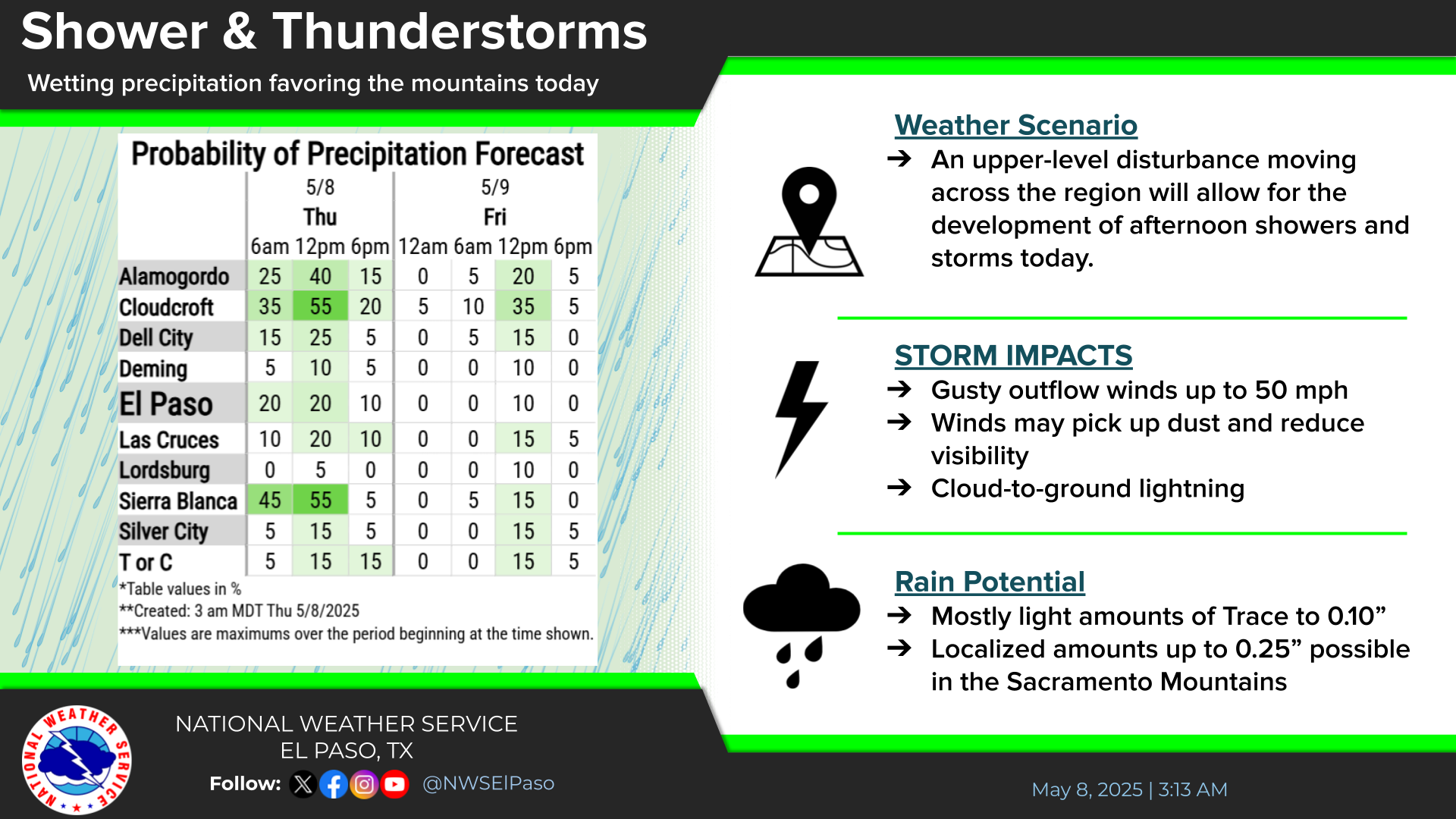
 - Widespread chances for showers and thunderstorms through
   Friday as moisture moves north into the region. Some stronger
   storms could result in flash flooding, damaging winds, and
   large hail.

 - The flood threat lingers for eastern areas this weekend before storm
   chances decrease early next week.

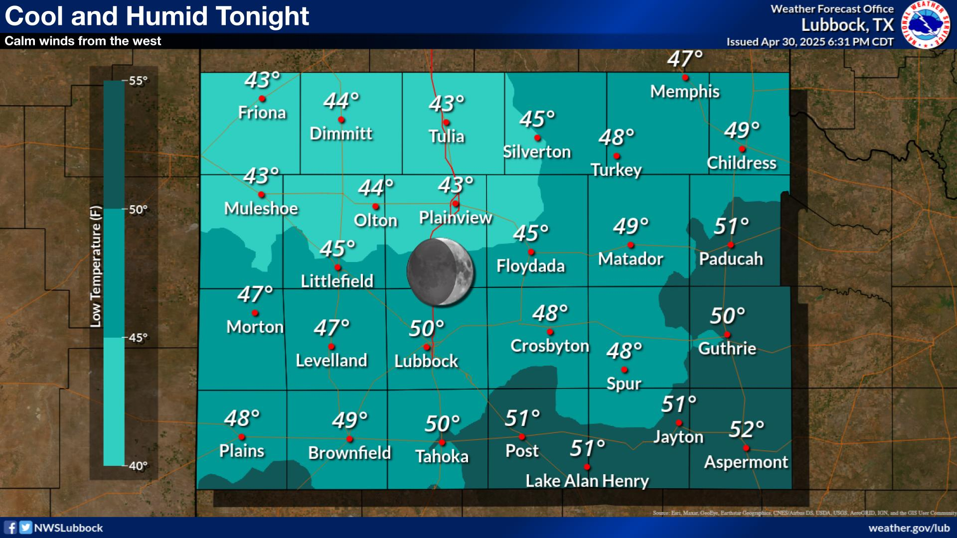
 - Temperatures will be cooling down to average by the weekend.

&&


Valid From 6 AM MDT Thursday Morning Through 6 AM MDT Monday, October 26,2026.


(Valid Today Through 6 AM MDT Sunday).


(Valid Today Through 6 AM MDT Sunday).


(Valid Today Through 6 AM MDT Sunday).


You Want The Truth; You Can’t Handle The Truth!

































Comments
Post a Comment
Your comments, questions, and feedback on this post/web page are welcome.