

Widespread Rain Today Into Friday Night - Flash Flooding Likely In Some Areas!

Lincoln, New Mexico.
Blog Updated At 12:10 PM MDT, Thursday, Oct 29, 2026.
More T-Storms/Heavy Rain/Flash Flooding.
If you love a cool, wet fall, then more of that is on the way today into Friday night. Once again this morning, low clouds and areas of fog, dense in some areas, blanket southeastern New Mexico and nearby West Texas. It's been 12-13 years since we've had a fall like this, and I love it.
Two more Pacific storms are lined up to impact our weather today into Friday night, and again the first of next week. A strong closed mid-upper-level low was centered northwest of Seattle this morning, with a long-wave trough of low pressure extending southward to south of the southern Baja Peninsula.
This closed low will deepen and eventually split in two by sunset Saturday. A shortwave trough of low pressure on the southern end of this low will deepen west of the Baja Spur Saturday, before swinging northeast into Arizona on Sunday.
The closed mid-upper-level low dives southeastward into the Four Corners area late this weekend before moving into northeastern New Mexico Monday afternoon. Monday night into Tuesday, it lifts northeast into Oklahoma.
A Pacific cold front is forecast to move eastward across the state Monday, bringing windy and cooler weather to the area.
Meanwhile, abundant mid-upper level subtropical remnant moisture is streaming northward and northeastward into the state and Texas from former Hurricane Vance. This, combined with the instability from the approaching West Coast storm, will produce widespread rains mainly across the eastern half of the state today into Friday night. The heaviest rains are forecast to fall over southeastern New Mexico.
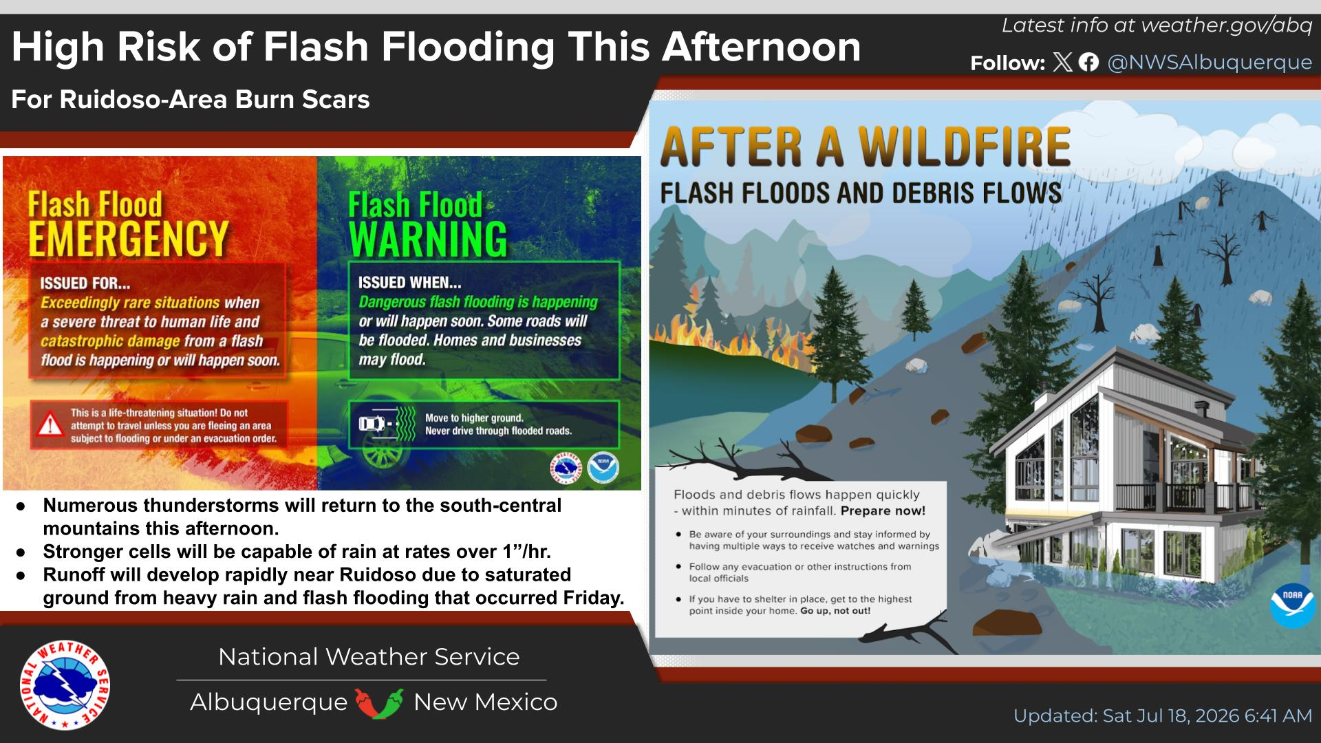
Scattered to numerous thunderstorms are forecast for the Guadalupe, Sacramento, and Capitan Mountains, as well as southern New Mexico, and the southeastern plains eastward into West Texas today through Friday. Some of these storms will be capable of producing heavy rainfall, especially if training of thunderstorms occurs. Otherwise, widespread light to moderate rainfall is forecast with pockets of heavy rain at times.
As of this morning, it appears that Lea County eastward into the South Plains and the Permian Basin of West Texas stands to get the heaviest rains. Flood Watches cover much of this real estate.
Link for the Flood Watch for the South Plains and Lubbock area.
Link for the Flood Watch for Eddy, Lea, and Culberson Counties and the Permian Basin.
Link for the Flood Watch for Lincoln County.
Link for the Flood Watch for Otero County.
A Flood Warning for south-central Socorro County remains in effect today also.
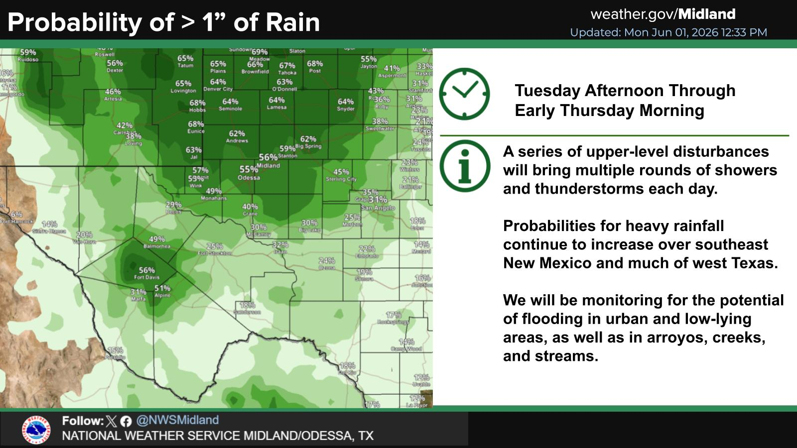
Storm total rainfall amounts for southeastern New Mexico today through Friday night are in the 1" to 3" range, with locally higher totals possible. Storm total rainfall amounts for Lincoln County are in the 1" to 1.50" range, with locally higher totals possible.
Interestingly enough, this morning's 6 AM MDT run of the experimental RRFS Para forecast model paints a bullseye storm rainfall amount of 5" to 7" over southern and southeastern Lea County by Friday.
There remains some uncertainty in computer model forecasts concerning storm total rainfall amounts. So any shift in the storm track may affect current forecasts. Some areas may end up getting more than forecast while others less.
Although our daytime high temperatures have been running slightly below to close to normal for late October, our overnight low temperatures are well above normal. Our nights have been warmer than normal because of all of the cloudiness and rain.
Normal High/Low Temps For Oct 29th.
Raton 62/28
Clayton 64/36
Tucumcari 69/38
Clovis 67/38
Portales 71/40
Roswell 73/43
Artesia 73/38
Carlsbad 73/43
Carlsbad Caverns 71/48
Tatum 71/38
Hobbs 71/45
Eunice/Jal 76/43
Elk 68/32
Pacicho 71/38
Capitan 67/34
Ruidoso 62/31
Cloudcroft 56/31
Mountain Park 62/38
Socorro 68/36
Truth or Consequences 73/45
Deming 74/41
Silver City 70/43
Las Cruces 75/43
Alamogordo 71/47
El Paso 75/49
Midland/Odessa 74/49
Chama 56/23
Taos 62/28
Eagle Nest 56/21
Red River 51/21
Los Alamos 58/34
Gallup 64/26
Grants 64/27
Farmington 63/33
Santa Fe 62/33
Las Vegas 62/32
Albuquerque 65/41
Rain should be ending on Halloween day, with skies clearing by nightfall. Temps at sunset will range from the upper 60s on the southeastern plains to the 40s and 50s in the Sacramento mountains.
Storm number two will begin affecting the state Sunday into next Tuesday, with western New Mexico, the Four Corners Area, and parts of northern New Mexico favored for the most widespread and impactful rains. Snow levels once again will remain high for this time of the year at above 10,000' across northern New Mexico. Depending upon the storm track, snow levels may lower over the northern mountains Sunday into Monday.
Showers and a few thunderstorms are forecast to return to the Sacramento and Capitan mountains Sunday into Monday after a break on Saturday. Rain is forecast to mix with or change over to all snow at Ski Apache on Monday. Cloudcroft may also see a mix of rain and snow on Monday.
Don't forget to change your clocks back one hour to Mountain Standard Time (MST) at 2 AM Sunday morning. Or when you go to bed Saturday night.
Area Forecast Discussion
National Weather Service Midland/Odessa TX
634 AM CDT Thu Oct 29 2026

...New AVIATION...

.KEY MESSAGES...
Updated at 630 AM CDT Thu Oct 29 2026

- Patchy (locally dense) fog possible early this morning mainly
  across portions of southeast New Mexico, the Permian Basin, and
  Pecos River Valley.

- Numerous showers/storms are in store today through Friday
  evening. Multiple rounds of heavy rainfall will lead to flash
  flooding, especially across low-lying and urban areas.

- Another system brings windy conditions and near-to-below normal
  temperatures to the area early next week.

&&
Area Forecast Discussion...UPDATED
National Weather Service Albuquerque NM
548 AM MDT Thu Oct 29 2026

...New AVIATION...

.KEY MESSAGES...
Issued at 540 AM MDT Thu Oct 29 2026

- Showers and thunderstorms will be capable of producing locally
  heavy rainfall over southern NM Thursday, shifting to southeast
  and eastern NM Thursday night into early Friday.

- River flooding lingers over parts of central and northern New
  Mexico through at least Friday.

- Confidence continues to increase that a Pacific storm system
  will bring impactful rainfall across western NM and the Four
  Corners region late this weekend into early next week. Snow is
  favored above 10,000 feet elevation.

&&
Area Forecast Discussion
National Weather Service El Paso TX/Santa Teresa NM
648 AM MDT Thu Oct 29 2026

...New AVIATION, FIRE WEATHER...

.KEY MESSAGES... Updated at 645 AM MDT Thu Oct 29 2026

 - Showers and thunderstorms will arrive in two batches today,
   starting with the afternoon, and then sweeping west to east
   overnight. Additional storms will work into SW New Mexico on
   Friday afternoon, weakening as they drift east Friday night.
   Localized flash flooding will be possible.

 - A quiet period looks to arrive in time for Halloween,
   Saturday.

 - A upper level system will bring more showers and thunderstorms
   to the area Sunday and into Monday.

 - Quieter and drier weather looks to prevail next week.

&&
(Valid Today Through 5 PM MST, Tuesday, November 3, 2026).


(Valid Today Through 5 PM MST Tuesday, November 3, 2026).

(Valid Today Through 2 PM MDT, Friday, October 30, 2026).

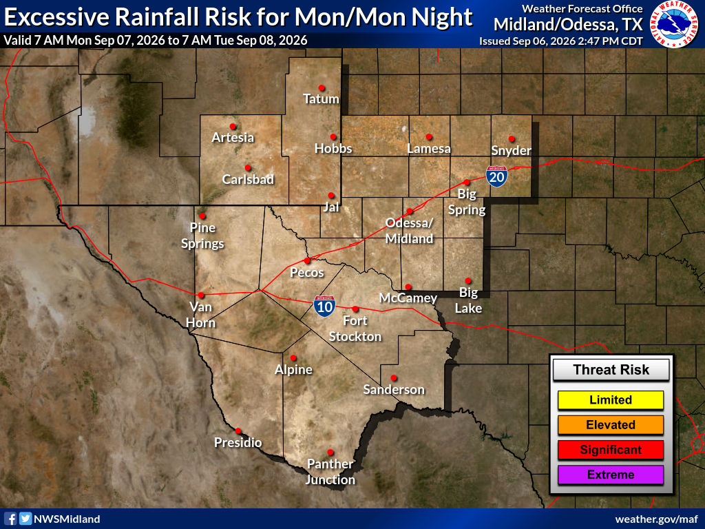
Excessive Rainfall Forecasts.


CoCoRaHS Rain Gauge.

Hey everyone, I thought you might be interested in this. I found this CoCoRaHS rain gauge on Amazon recently, and I purchased it. For years, I've used the original CoCoRaHS gauge for my reports, but now I'm using this one. I love this version because the outer cylinder is scaled in tenths of an inch and inches. Like the original gauge, the inner tube is still scaled in hundredths and tenths of an inch.
This makes it really easy to read during heavy rain events. You would still want to use the inner cylinder to measure your rainfall total for your spotter, heavy rain/flash flood/CoCoRaHS reports. But this gauge makes it super easy for a quick report without having to dump the inner tube before your normal report time.
This makes it really easy to read during heavy rain events. You would still want to use the inner cylinder to measure your rainfall total for your spotter, heavy rain/flash flood/CoCoRaHS reports. But this gauge makes it super easy for a quick report without having to dump the inner tube before your normal report time.
You Want The Truth; You Can’t Handle The Truth!

































Comments
Post a Comment
Your comments, questions, and feedback on this post/web page are welcome.