Looking Ahead To Early Next Week - First Taste Of Winter?
Cloudcroft, New Mexico.
(Valid At 6 PM MDT Sunday, Oct 16, 2022).
GFS 500 Millibar (18,000') Forecast.
(Valid At 6 PM MDT Sunday, Oct 16, 2022).
GFS Surface Forecast.
(Valid At 6 AM MDT Monday, Oct 17, 2022).
GFS High-Temperature Forecast Sunday.
GFS High-Temperature Forecast Monday.
GFS Temperature Forecast Anomaly.
(Valid At 6 PM MDT Monday).
GFS High-Temperature Forecast Tuesday.
GFS Temperature Anomaly Forecast.
(Valid At 6 PM MDT Tuesday).
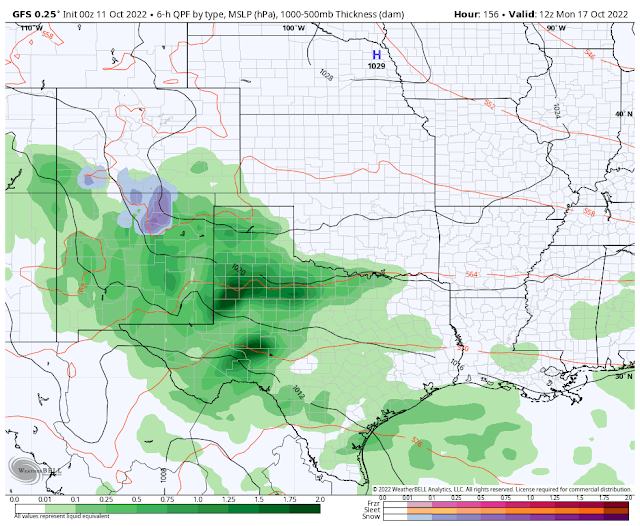
GFS Storm Total Precipitation Forecast.
(Valid At 6 PM MDT Monday).
National Blend Of Models (NBM) Total Precipitation Forecast.
(Valid At 6 PM MDT Wednesday, Oct 19, 2022).
GFS Storm Total Snowfall Forecast.
(Valid At 6 PM MDT Monday).
Split Flow Pattern In The Jet Stream.
After nearly a week of very wet and cool weather, it's time to dry out and warm up. This trend will continue through the rest of this week into the beginning of the weekend. Then more wet and cool weather Sunday into the first of next week looks possible.
A split flow pattern in the jet stream will develop this coming weekend. With the polar jet stream being shoved northward into the Yukon Territories or northwest Canada, and southeastward into the Great Lakes and the northeastern U.S.
A split flow pattern in the jet stream will develop this coming weekend. With the polar jet stream being shoved northward into the Yukon Territories or northwest Canada, and southeastward into the Great Lakes and the northeastern U.S.
Yet another closed mid-level low is forecast to move into the northern Baja Region on Saturday then eastward to southern Arizona by Sunday evening.
A strong cold front is forecast to dive southward into New Mexico Saturday afternoon into Sunday. This will bring a much cooler airmass to the state and area. Low-level easterly upslope flow behind the front, combined with lift, and instability associated with the mid-level low over Arizona will come together to give us another period of wet and much cooler weather early next week.
If current forecast model trends continue we may see another prolonged period of very wet weather. Locally heavy rainfall and flash flood threats appear to be a possibility.
Forecast models are also hinting that snow once again may fall over the northern mountains of the state beginning Sunday with snow levels dropping down to around 9,000'. The GFS model as of this writing (Tuesday morning) is the most bullish with this and is forecasting heavy snow. Should all of this pan out don't be surprised if Ski Apache and Sierra Blanca peak see some of the white stuff too? Will the Cloudcroft area see snow? Maybe but it's a little too early to tell for sure.
As always it's too early to go off into the weeds with the details but for now, the models generally agree that a change to much cooler and wetter conditions lies in store for us late this upcoming weekend continuing into the beginning of next week. More on all of this later this week.
There Are None So Blind As Those Who "Will - Not" To See...107.


Comments
Post a Comment
Your comments, questions, and feedback on this post/web page are welcome.