Strong Fall Storm This Weekend Into Early Next Week.
Cloudcroft, New Mexico.
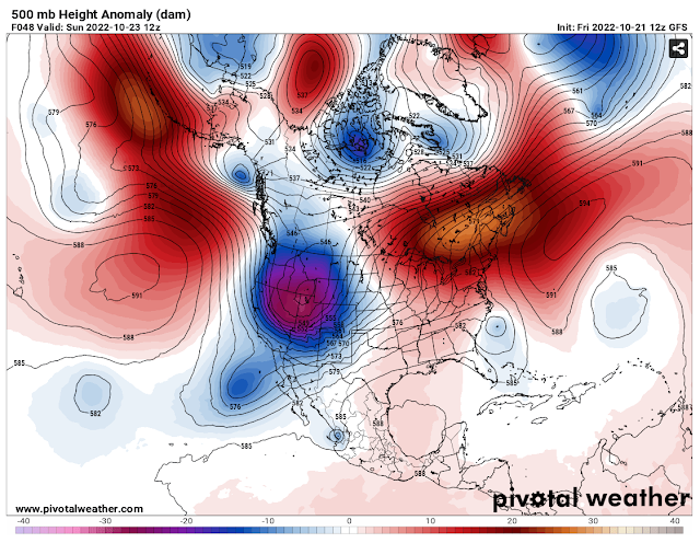
GFS 500 MB (18,000') Forecast.
(Valid At 6 AM MDT Sunday.)
GFS 200 MB (39,000') Jet Stream Forecast.
(Valid At Noon MDT Sunday).
(Valid Monday).
Major changes in the upper air pattern over the Western U.S. will be reflected by a strong fall storm that will affect New Mexico's weather Saturday into Tuesday. A deep mid-level storm will develop over the Pacific Northwest on Saturday. This deep and cold closed mid-level low will then swing east into the Great Basin by Sunday. Then drop southeast into Southeastern New Mexico Monday afternoon.The subtropical jet stream will phase or merge with the polar jet stream over New Mexico Saturday night into Sunday.
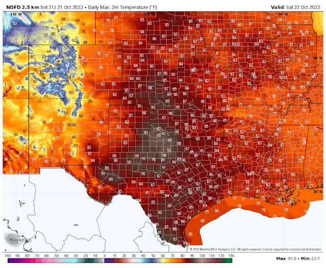
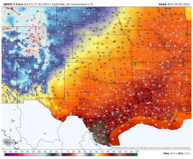
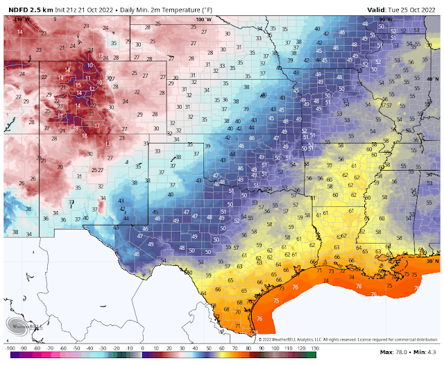
For the first time this fall season a strong Pacific cold front will sweep across New Mexico from northwest to southeast on Monday. Bringing much colder temperatures to the state Monday into Wednesday. In fact the seasons first frost/freeze is likely to occur in some of the lower valley locations of the state including central and southern New Mexico. I think that this may also occur over parts of eastern and southeastern New Mexico by next Tuesday/Wednesday.
Saturday.
Sunday.
Monday.
NWS NDFD Forecast Low Tempertures Tuesday Morning.
I have a feeling that the forecast models are too warm with their temperatures behind the cold frontal passage Monday into Wednesday. So I expect to see some possible adjustments in their forecasts downward over the next couple of days.
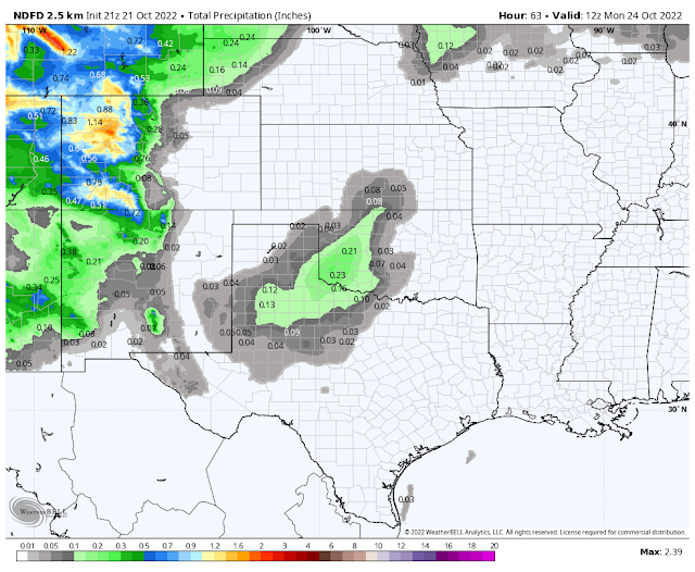
Storm Total Rainfall Amounts.
(Valid By 6 AM MDT Monday Morning).
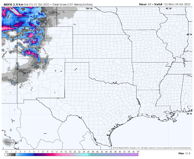
Storm Total Snowfall Amounts.
(Valid Sunday - Monday).
I also think that the forecast models are too dry with their precipitation forecasts with this storm. This will be more true if the closed mid-level storm sinks futher south than what they are forecasting.
Snow is forecast to fall over the western, northern, and central mountains of the state Sunday into Monday. The highest totals currently being forecast will occur over the northern mountains where some locations will see 4"-6". While the western mountains will see 1"-2". I expect these forecasts to possibly change so I'll keep you updated on those changes should they happen.
Snow is forecast to fall over the western, northern, and central mountains of the state Sunday into Monday. The highest totals currently being forecast will occur over the northern mountains where some locations will see 4"-6". While the western mountains will see 1"-2". I expect these forecasts to possibly change so I'll keep you updated on those changes should they happen.
Rain showers will change over to snow in the higher elecations of the Sacramento mountains Sunday night and continuing into Monday night. Snow levels at this time look like they will only drop down to around 7,500' to 8,000'.
Last but hardly least of all will be our first wind event of the fall. Strong southwesterly winds are forecast to develop statewide on Saturday and increase further on Sunday. Local gusts across southern and southeastern New Mexico will be in the 30 mph range on Saturday.
Sunday will see gusts in the 40 mph range. Across the Sacramento mountains gusts on Sunday will be in the 50-60 mph range. Ski Apache may see gusts to around 65 mph. Guadalupe Pass will see southwesterly wind gusts near 50 mph on Sunday.
With a jet stream speed max (between 34,000' to 39,000') over northeastern New Mexico on Sunday potentially damaging southwesterly winds at the surface are forecast to gust up into the 50-60 mph range. A Wind Advisory will be in effect for parts of northern New Mexico on Sunday.
Localized areas of blowing dust will be possible across the lower valleys of the state on Sunday especially in those areas where it has been drier recently.
There Are None So Blind As Those Who "Will - Not" To See...107.







Comments
Post a Comment
Your comments, questions, and feedback on this post/web page are welcome.