Past Week Has Been Very Wet & More Rain To Come.
Alamo Peak South Of Cloudcroft.
Heavy Rains Have Kicked Off October.
(As Of October 9, 2022).
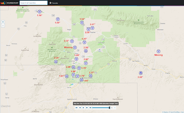
NM NWS MesoWest October Rainfall Totals.
(As Of 9 AM MDT Sunday, Oct 9, 2022).
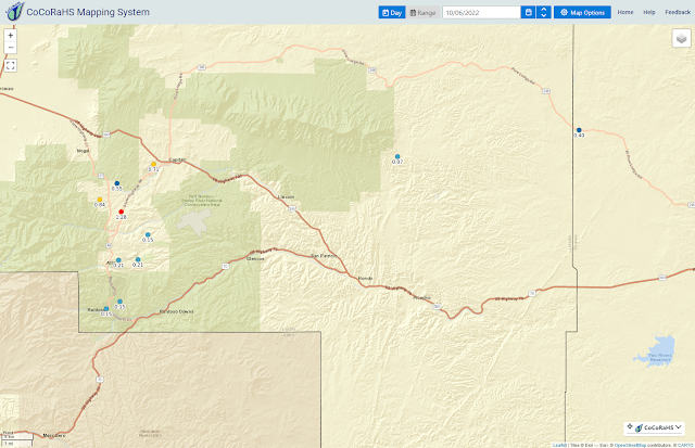
NM CoCoRaHS 24-Hour Rainfall Totals.
(As Of 9 AM MDT Sunday, Oct 9, 2022).
NM CoCoRaHS October Rainfall Totals.
(As Of 9 AM MDT Sunday, Oct 9, 2022).
(As Of 9 AM MDT Sunday, Oct 9, 2022).
October has started out very wet and cool and this trend is forecast to continue through Monday night. Widespread moderate to heavy rains with a few embedded thunderstorms are in our forecast today through Monday night. Areas of fog will also occur in many locations especially at night into the morning hours.
A Flood Watch is in effect for today through Monday night for Eddy, Lea, and Culberson Counties as well as parts of West Texas. Another 1" to 2" are in our local forecasts today into Monday night with a few spots possibly picking up more.
This is the time of the year that we need to start looking at the potential for our first freeze across the lower elevations of Southeastern New Mexico. Long-term averages show this occurs between the last week of October and the first week of November. Typically by Halloween, most of us have experienced our first freeze with a few exceptions.
Selected Highest Local 5-Day Rainfall Totals.
(As Of 9 AM MDT Sunday, Oct 9, 2022).
Personal Weather Station (PWS) near Alto 5.20"
Personal Weather Station (PWS) north of Mayhill 5.16"
Personal Weather Station (PWS) in Cloudcroft 4.53"
Personal Weather Station (PWS) in Riverside east of Artesia 4.03"
Cloudcroft CoCoRaHS Station 1.8 Miles SW 3.82"
Personal Weather Station (PWS) SW of Cloudcroft 3.64"
Personal Weather Station (PWS) SW of Cloudcroft 3.64"
Cloudcroft CoCoRaHS Station 0.4 Miles ESE 3.48"
Personal Weather Station (PWS) SW of Hondo 3.40"
Cloudcroft NWS Climate Co-Op Station 3.37"
Automated Weather Station (CRN) 8 SE Pinon 3.14"
Denver City, Tx NWS Climate Co-Op Station 3.12"
Capitan CoCoRaHS Station 1.3 Miles WSW 3.03"
Personal Weather Station (PWS) Central Roswell 2.99"
Personal Weather Station (PWS) W of Mayhill 2.98"
White Sands Missile Range Main Post 2.81"
Sierra Blanca Regional Airport AWOS NE of Ruidoso 2.71"
White Sands Missile Range Main Post 2.81"
Sierra Blanca Regional Airport AWOS NE of Ruidoso 2.71"
Artesia CoCoRaHS Station 3.5 Miles NNE 2.70"
Nogal CoCoRaHS 4.6 Miles SSE 2.64"
Personal Weather Station (PWS) West Blevins Rd In Atoka 2.40"
Roswell CoCoRaHS Station 3.4 Miles NNE 2.37"
Guadalupe Pass ASOS 2.31"
Atoka 4 Miles S of Artesia 2.00"
Atoka 4 Miles S of Artesia 2.00"
There Are None So Blind As Those Who "Will - Not" To See...107.


Comments
Post a Comment
Your comments, questions, and feedback on this post/web page are welcome.