Rain Falls On The Little Bear Fire - My First Photos. June 17, 2012.
Click On The Photos To Enlarge Them.


My wife and I headed up to Ruidoso yesterday morning to shoot some pictures and video of the burn scar area, and of any potential flash flooding that may occur. On the way up there I received a phone call from Joel Arnwine, the Eddy County Emergency Manager, who is helping coordinate the firefighting efforts, asking me if I would be willing to help them monitor the potential for flash flooding in the area.
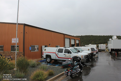
So Diane and I spent the afternoon at the Lincoln County Command Center in Alto. She ran errands for them and I monitored GRLevel3 2.0. I also got to visit with Kerry Jones, the Albuquerque National Weather Service Coordination Meteorologist, who was leading the monitoring efforts concerning the heavy rain and flash flood potential.
On our way up there we encountered a thunderstorm in Ruidoso Downs that produced some minor street flooding. It also produced some quarter size hail. Take a look at the last photo above, that's some of that hail that fell just before 1 PM MDT that was still on the ground when we came back home around 7:30 PM.
Thunderstorms broke out over the area, which was a tremendous help to fire fighting efforts, even though the threat for flash flooding chased some of the firefighters and local residents back out of their homes once again.
I shot a few photos in the Alto area but I did not have enough time to get any more. I plan on heading back up there soon to shoot some more photos, when they get the fire under control and open everything back up. As we were leaving Ruidoso, light rain was falling with a temp of 57F.
A personal weather station (Cedar Creek - KNMRUIDO10) in northwest Ruidoso reported 1.25" of rain.
A CoCoRaHS station located 3.9 NNW of Ruidoso reported .55". The Incident Raws #14 (COW Mtn) reported .75". The Incident Raws #15 (Skyline) reported .40", the Sierra Blanca Snotel Site reported .30", the Incident Raws #13 (Lift-6) reported .25",and the Sierra Blanca Regional Airport AWOS reported .25".
The Truth Is Stranger Than Fiction!
My Web Page Is Best Viewed With Google Chrome.


Comments
Post a Comment
Your comments, questions, and feedback on this post/web page are welcome.