Current Date & Time

Little Bear Fire Update - Ruidoso, New Mexico. June 27, 2012.

Click On The Photo To Enlarge It.

(Visit His Facebook Page To See More Photos.)

Project could have lessened fire damage.

(Click On The Link To Read The Full Article.)

Forest Service official: Environmental groups delayed thinning-
Quote- "Damage from the Little Bear Fire could have been reduced if a proposed Forest Service thinning project had not been delayed by an appeal from two environmental groups, a Forest Service official said Tuesday.
"Any type of treatment we could have done would have reduced the severity of the fire," said Chad Stewart, fire and timber officer for the Lincoln National Forest. While the fire as a whole could not have been stopped by thinning efforts, especially in the face of 40 mph wind gusts, damage to the Bonito watershed likely would have been greatly reduced, he said.
The thinning project, aimed at 11,600 acres surrounding Bonito Lake was delayed by an appeal from the two environmental groups in late 2011."
-----------------------------------------------------------------------------

#littlebearfire June 27, 10:45 am- Mop-up and rehab continue

(Click On The Link To Read More.)

Summary: Rehabilitation efforts, which include reseeding waterbars and dozerlines were initiated in the burn area today. The fire perimeter remained quiet today with low to moderate fire behavior in the Aspen and Bear Canyon areas. A portion of the fire received a small amount of rain yesterday that helped suppression resources with interior hotspots. Flooding is still a possibility along areas of Bonito Creek with thunderstorms and showers predicted for the next couple of days. When in an area that has been damaged, especially near drainages, if thunder cells build, rain is falling or imminent please immediately leave the area and seek higher ground for safety. A large amount of resources are being released for other assignments; aviation resources continue to support other fires in New Mexico.
All roads accessing private land within the Little Bear Fire area are now open. Some roads accessing the Lincoln National Forest remain closed. These include NM 532 (Ski Run Road) west from the softball complex near NM 48 junction and Forest Road 107 above Bonito Dam (a permit from the Forest Service is required to access this area.)
The Truth Is Stranger Than Fiction!

My Web Page Is Best Viewed With Google Chrome.

Comments

My Blog Archive List (July 2010 - August 2025).

Show more

My Current Weather Conditions

Eddy County

Guadalupe Mtns Eddy & Culberson County

Lea County

NWS Midland Web Page

NWS Midland Web Page
Click On The Map To Open It Up

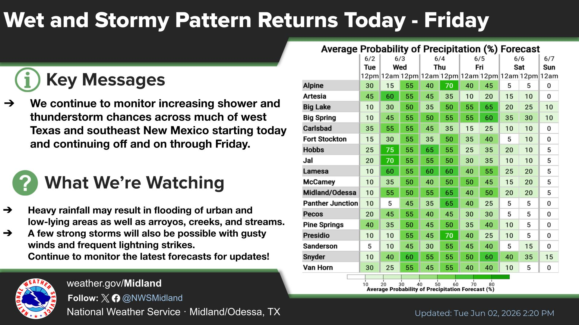
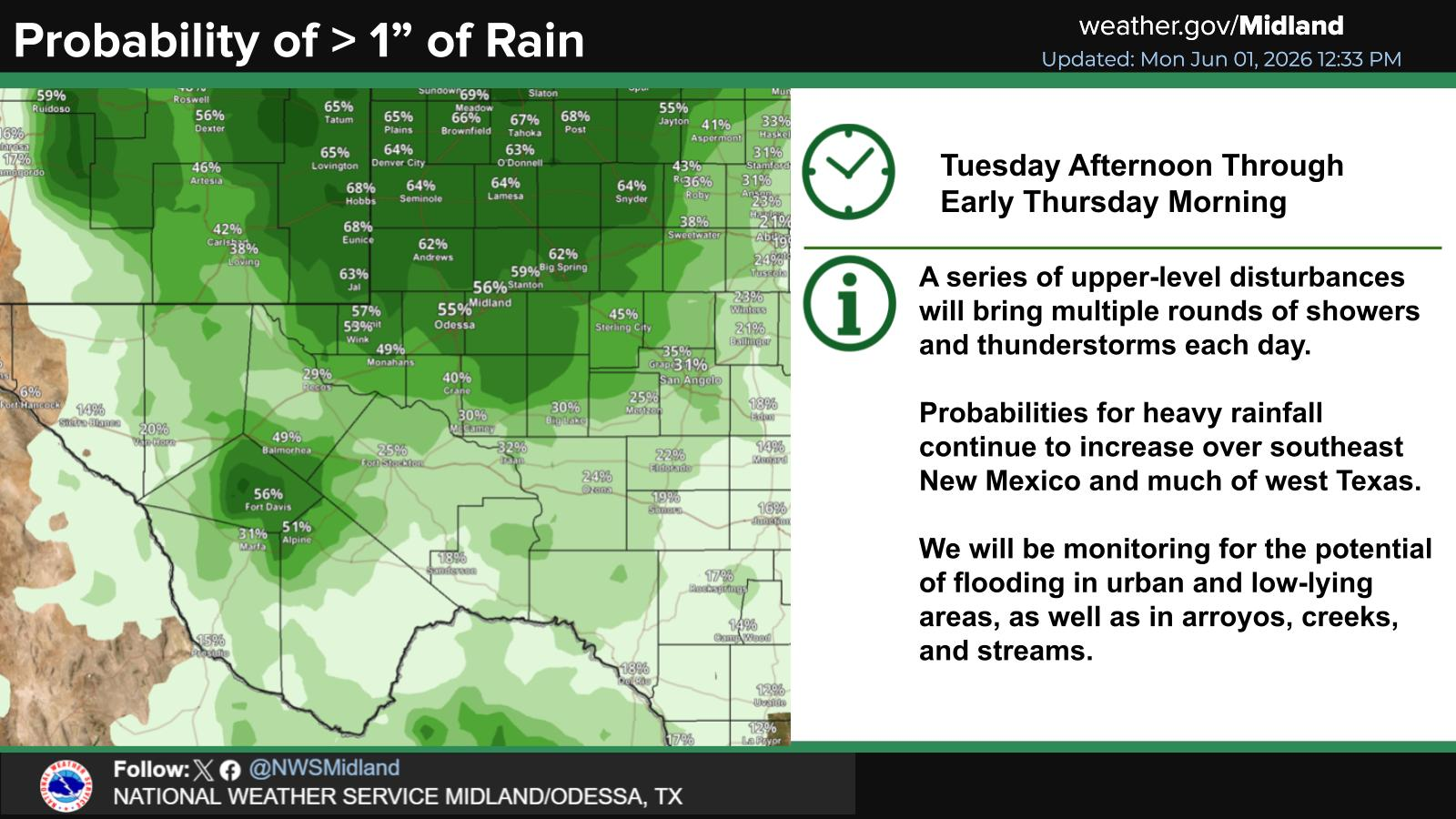
SE New Mexico & West Texas Precipitation Forecasts

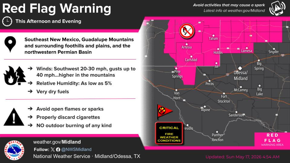
NWS Midland Hazardous Weather Outlook

NWS Midland Hazardous Weather Outlook
Click On The Image To See The Rest Of The Outlooks

NWS Midland Hazardous Weather Outlook

NWS Midland Hazardous Weather Outlook
Click On The Image To See The Rest Of The Outlooks

NWS Midland Hazardous Weather Outlook

NWS Midland Hazardous Weather Outlook

NWS Midland Forecast Graphic

NWS Midland Forecast Graphic

NWS Midland Graphic Forecast

NWS Midland Graphic Forecast

NWS Midland Graphic Forecast

NWS Midland Graphic Forecast

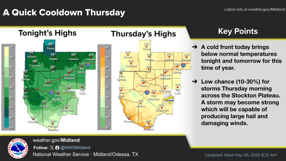
NWS Midland Forecast High Temperatures Today

NWS Midland Forecast Low Temperatures Tonight

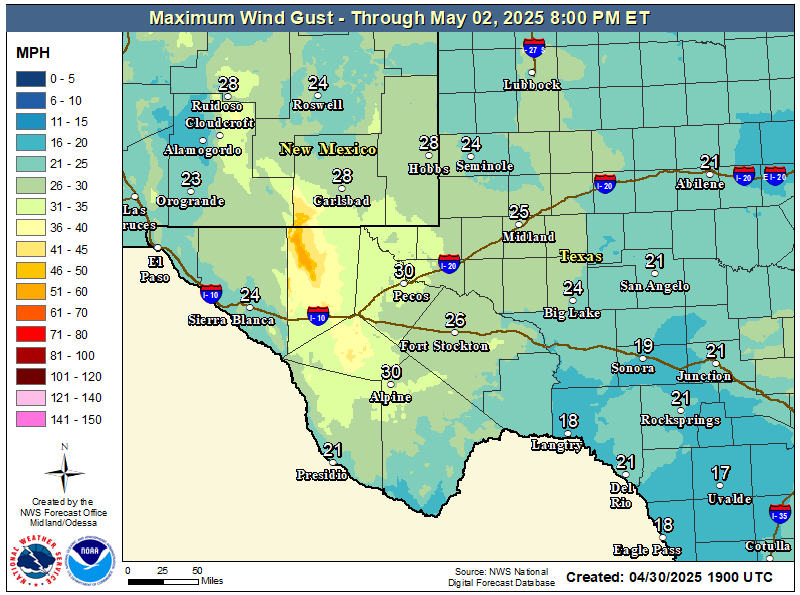
NWS Midland Peak Wind Gust Forecast

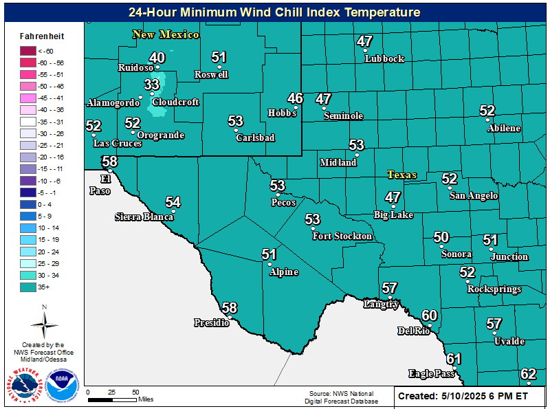
NWS Midland Wind Chill Forecast

New Mexico

Chaves County Plains & Mtn's

Lincoln County

NWS Albuquerque Web Page

NWS Albuquerque Web Page
Click On The Map To Open It Up

NWS Albuquerque New Mexico Precipitation Forecasts

NWS Albuquerque Hazardous Weather Outlook

NWS Albuquerque Hazardous Weather Outlook

NWS Albuquerque Forecast Graphics

NWS Albuquerque Forecast Grpahics

NWS Albuquerque Forecast Graphic

NWS Albuquerque Graphic Forecast

NWS Albuquerque Forecast High Temperatures Today

NWS Albuquerque Forecast Low Temperatures Tonight

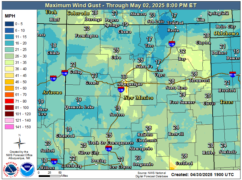
NWS Albuquerque Peak Wind Gust Forecast

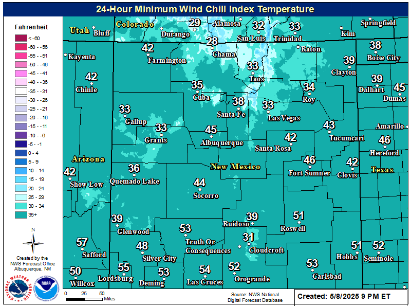
NWS Albuquerque Wind Chill Forecast

Texas

Otero County

NWS El Paso Web Page

Southern New Mexico & Far West Texas Precipitation Forecasts

NWS El Paso Hazardous Weather Outlook

NWS El Paso Hazardous Weather Outlook
Click On The Image To See The Rest Of The Outlooks

NWS El Paso Hazardous Weather Outlook

NWS El Paso Hazardous Weather Outlook
Click On The Image To See The Rest Of The Outlooks

NWS El Paso Graphic Forecast

NWS El Paso Graphic Forecast

NWS El Paso Graphic Forecast

NWS El Paso Graphic Forecast

NWS El Paso Forecast High Temperatures Today

NWS El Paso Forecast Low Temperatures Tonight

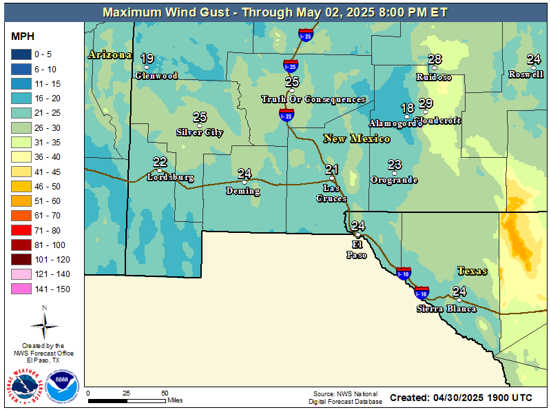
NWS El Paso Peak Wind Gust Forecast

NWS Lubbock Web Page

NWS Lubbock Web Page
Click On The Map To Open It Up

NWS Lubbock South Plains Precipitation Forecasts

NWS Lubbock Hazardous Weather Outlook

NWS Lubbock Hazardous Weather Outlook
Click On The Image To See The Rest Of The Outlooks

NWS Lubbock Hazardous Weather Outlook

NWS Lubbock Hazardous Weather Outlook
Click On The Image To See The Rest Of The Outlooks

NWS Lubbock Hazardous Weather Outlook

NWS Lubbock Hazardous Weather Outlook

NWS Lubbock Graphic Forecast

NWS Lubbock Graphic Forecast

NWS Lubbock Graphic Forecast

NWS Lubbock Graphic Forecast

NWS Lubbock Graphic Forecast

NWS Lubbock Hi Temperature Forecast Today

NWS Lubbock Low Temperature Forecast Tomight

My Rainfall Totals - 2.1 NNW Downtown Carlsbad

My Rainfall Totals - 2.1 NNW Downtown Carlsbad

My Seasonal Snowfall Totals - 2.1 NNW Downtown Carlsbad

My Seasonal Snowfall Totals - 2.1 NNW Downtown Carlsbad

Disclaimer

This blog and its contents are for informational purposes only! Always have multiple sources of information available to rely upon during severe weather. Do not rely solely on the Internet. Be weather-aware, plan ahead, have a backup plan, and be ready to act before severe weather strikes your location.