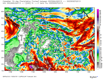
Latest 10-Day Rainfall Forecasts.
Overall the models are not very optimistic when it comes to rainfall for southeastern New Mexico over the next ten days. However, a tropical wave now located over Texas, will move northwestward into southern New Mexico by Wednesday, and this feature will increase our chances for scattered thunderstorms to break out on Tuesday.
With the eastern Pacific now becoming more active with tropical storms, the Atlantic Basin is forecast to do the same, it would not take much of a pattern shift to get the monsoon to swing back further to the east, and bring some more rainfall back into the area. So this will have to be watched in the coming weeks.
The Truth Is Stranger Than Fiction!
My Web Page Is Best Viewed With Google Chrome.


Comments
Post a Comment
Your comments, questions, and feedback on this post/web page are welcome.