

We Can't Catch A Break - Another Round Of High Winds & Blowing Dust!

Downtown Roswell, New Mexico.
We Can't Catch A Break - Another Round Of High Winds & Blowing Dust!
Like a broken record we can't turn off another significant high wind and widespread blowing dust event is shaping up for Thursday. Although this one currently does not look to be as severe and widespread as this past Sunday's blow down, it may be close in some areas. Strong winds will once again rake parts of the state today, with somewhat of a break on Wednesday, then another bad day Thursday. For the record (not that you want to hear this) in strong La Nina Springs, our windy season often starts in February and sometimes lasts into June or close to the 4th of July. We are on track for that pattern this year.
Our next potent winter storm will begin affecting the western half of New Mexico with snow over the mountains. A Winter Storm Watch is in effect for parts of the southwestern, western and northern mountains Wednesday afternoon through Thursday afternoon where 5" to 10" of new snow is forecast to fall. A Winter Storm Watch is in effect for parts of the northern mountains including the Chuska and Tusas mountains from late tonight through Thursday afternoon. New snowfall totals of 6" to 10" are expected with a foot of snow across the higher peaks and west facing slopes. Blowing snow may affect travel in these mountainous areas.
Albuquerque and Santa Fe could possibly see up to an inch of snow from this storm. Temperatures will fall behind the Pacific cold front Thursday into Thursday night and snow may fall over the valley floors over much of the state expect for the Southeastern Plains. At this time significant accumulations are not expected however.
Across the Sacramento and Capitan mountains snow is forecast Wednesday night into Thursday. New snowfall accumulations of 1" to 3" are possible in the Ruidoso area. In the Cloudcroft area 4" to 6" will be possible. Blowing snow and blowing dust may cause local travel issues in these areas Wednesday night into Thursday.
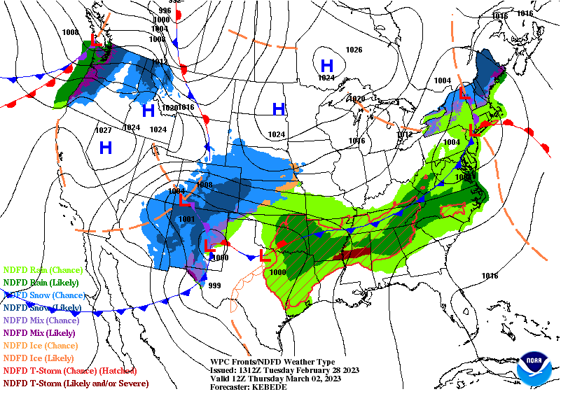
Early this morning another powerful Pacific Northwest mid/upper-level winter storm was organizing northwest of Seattle, Washington. This storm will continue to deepen and drop southward into southern California by sunset Wednesday. It then is forecast to swing east across New Mexico and by sunset Thursday should be centered near Hobbs (at the 500 millibar or 18,000' level).
A strong Pacific cold front is forecast to race east across the state and area Wednesday evening through Thursday morning. The strongest winds will occur ahead of and along this approaching cold front. Again, widespread blowing dust looks likely for much of the local area especially across southern, southeastern, and eastern sections of the state and eastward into West Texas on Thursday.
Today will be a windbag kind of day also. Wind Advisories are in effect today for Eddy, Lea, Chaves, eastern Lincoln, and Culberson Counties. Southwest winds will become sustained at 25-35 mph with gusts near 55 mph. Areas of blowing dust will be possible this afternoon and early evening.
A High Wind Warning remains in effect today through 11 PM MST Thursday night for the Guadalupe mountains of Eddy County, and Culberson County in West Texas including the Guadalupe Pass area. West winds sustained at 45 to 65 mph with gusts near 100 mph are forecast!
Once again the main weather event will be high winds and widespread blowing dust over much of the state and nearby areas.
Across the southern Sacramento Mountains: A High Wind Watch is in effect from Wednesday evening through Thursday evening. West winds will become sustained at 35 - 45 mph with gusts to 65 to 70 mph! Power outages are possible. Blowing dust may reduce the visibility and affect travel through the mountains.
Watches & Warnings For Thursday.
For the northern Sacramento Mountains: A High Wind Watch is in effect from Wednesday evening through Thursday evening. West winds will become sustained at 30-40 mph with gusts near 65 - 75 mph! Power outages are possible. Brief periods of blowing snow may create reduced visibility which may affect travel through the mountains. Blowing dust may also reduce the visibility and affect travel through the mountains.
Across the Chaves County Plains: A High Wind Watch n effect from Wednesday evening through Thursday evening. West winds will become sustained at 30-40 mph with gusts near 60 mph! Power outages are possible. Damage form the higher wind gusts may occur.
Across Eddy and Lea Counties: A High Wind Watch is in effect from Thursday morning through Thursday evening. West winds will become sustained at 30 - 50 mph with gusts to 75 mph! Damage form the higher wind gusts may occur.
Guadalupe Mountains of Eddy/Culberson Counties: A High Wind Warning remains in effect until 11 PM MST Thursday night. West winds sustained at 45 - 65 mph with gusts to near 95-100 mph are expected!. Damages from the winds may occur. Blowing dust may also reduce the visibility and affect travel through the mountains
High winds across parts of the state and locally may down trees, power lines, and power poles which may cause power outages in some locations. Other utility and cable lines may also be downed. Wind damage to homes, roofs, shingles, fences, sheds, barns, and other outbuildings are possible in many areas. Agricultural irrigation sprinkler systems may be blown away. Some west facing windows could blow out in gusts above 70 mph. Vehicles on north/south oriented highways may be blown over or blown off roads and highways. Especially high profile vehicles such as semi trucks, and camper trailers, school buses, and vans.
Widespread blowing dust is expected over much of the lower elevations of the southern and eastern half of of the state Thursday, as well as across the Guadalupe, Sacramento, and Capitan mountains.
Many areas could see the visibility drop down to 1/2 of a mile. Dust prone locations such as freshly plowed, cultivated, exposed or open farmlands and fields, lots, and highway construction sites (oil field areas) will experience sudden drops in the visibility down to zero with little to no advanced warning. Travel upon the states highways and roadways in these areas will be dangerous if not impossible in some locations at times.
Life threatening conditions may exist due to the brownout conditions. Remember that southeastern New Mexico has a long history of multivehicle accidents with fatalities and injuries during these blinding dust storms.
Red Flag Warnings and Fire Weather Watches have been issued for today and Thursday. Although not likely any wildfire (pray they don't) that could possibly develop (from downed power lines and other sources) could potentially add to the dangerous travel conditions especially if they break out near highways or roadways. Dense smoke could combine with the blowing dust to add to the hazardous conditions.

ECMWF 500 MB (18,000') Forecast.

Valid At 5 AM MST Wednesday.

Valid At 5 AM MST Thursday Morning.


Valid Wednesday Through 5 PM MST Thursday.


There Are None So Blind As Those Who "Will - Not" To See...107.


Comments
Post a Comment
Your comments, questions, and feedback on this post/web page are welcome.