

Severe T-Storms/Heavy Rain/Flash Flooding Today Into Tonight!

Clouds Obscuring The Capitan Mountains.
Blog updated at 9:52 AM MST Sunday morning.
Severe T-Storms Today!
I've been telling you since late summer that I suspected that this fall would be very active and even wild at times, and it certainly has. I have the same thoughts about our upcoming winter. Wild, very active, with lots of surprises. Some of the latest long-range forecast trends and discussions I have been looking at are leaning more and more towards a colder than normal winter for us. Combine that with our El Niño that is still strengthening like a runaway freight train, and you have the makings for a potential very wet/snowy winter.
As hard as it is to believe, the Storm Prediction Center (SPC) has issued a Slight Risk Outlook for parts of south-central, eastern, and southeastern New Mexico today and this evening. This area is surrounded by a Marginal Risk Outlook for most of the rest of the area.
Scattered thunderstorms are forecast to develop within the outlook areas this afternoon, continuing into tonight, especially across eastern New Mexico eastward into Texas. Some of these thunderstorms will become severe and produce large hail, damaging thunderstorm wind gusts, frequent cloud-to-ground lightning, heavy rains, and flash flooding.
A line of severe thunderstorms is forecast to develop this afternoon and evening along a Pacific cold front that will race eastward across the state. Severe thunderstorm wind gusts in excess of 70 mph will be possible with any supercell thunderstorm that develops out ahead of the line of thunderstorms, or those that become embedded within the line of storms.
Tornadoes will be possible with any supercell thunderstorms ahead of, or embedded within the line of severe thunderstorms. Qusay-Linear Convective System (QLC) tornadoes will be possible with bowing segments of the severe line of thunderstorms also.
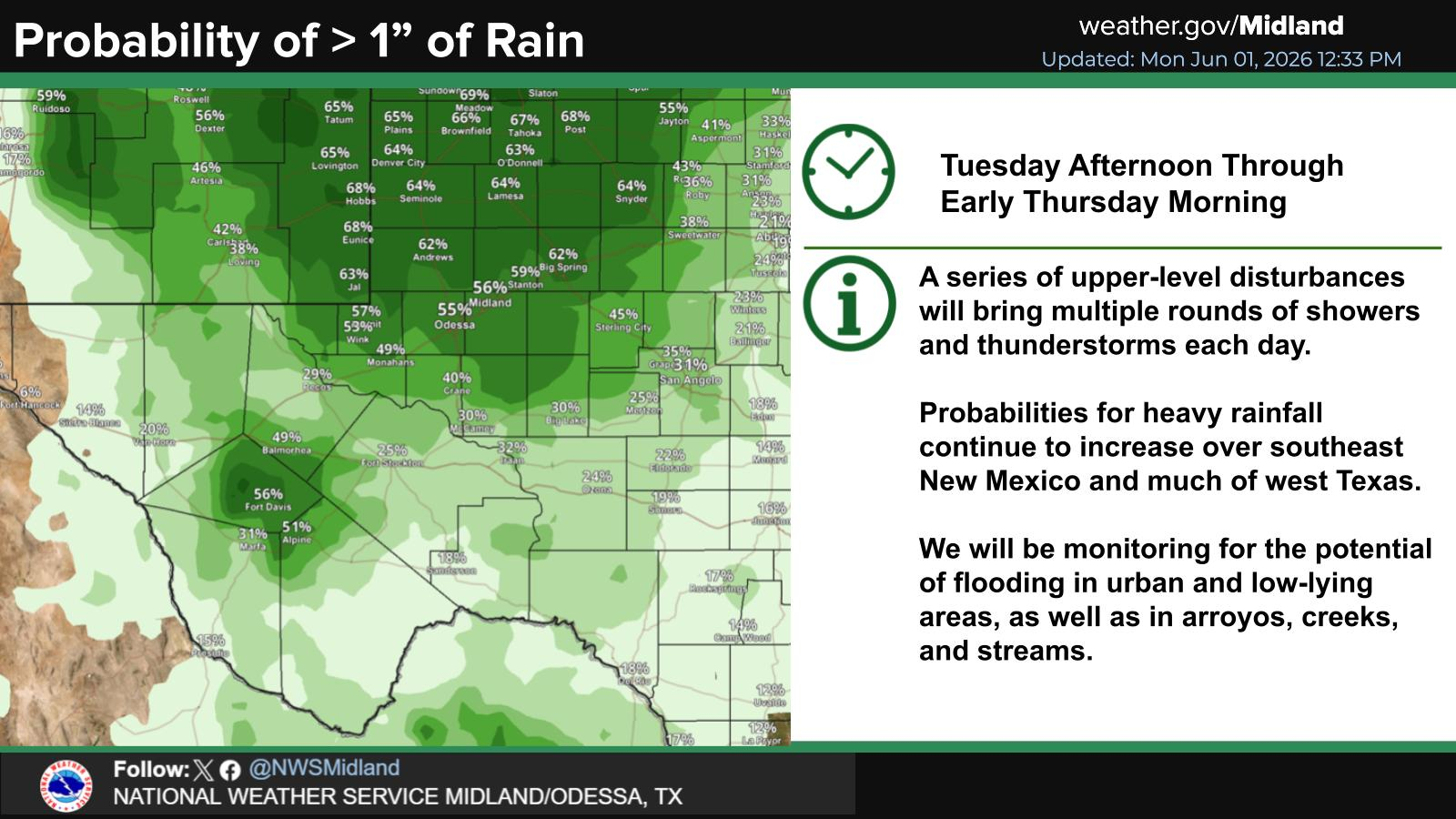
Excessive Rainfall Today Into Tonight!
"A Moderate risk of excessive rainfall exists across northwest NM today, with a slight risk of excessive rainfall across the remainder of western NM. A Flood Watch remains in effect through Monday morning for much of western NM as well as the Tusas and Jemez Mountains. Saturated soils from the previous flood event will allow for increased runoff. Even persistent light to moderate rainfall could cause flooding in arroyos, urban and poor drainage areas. River rises are expected. There is a moderate to high chance of river flooding on the Animas, La Plata, and San Juan rivers, though these rivers may not crest until Monday or Tuesday. Stay away from riverbanks!"
Flood Warnings and Flood Advisories remain in effect across parts of northwestern and northern New Mexico this morning.
High Wind Watch & Wind Advisories!
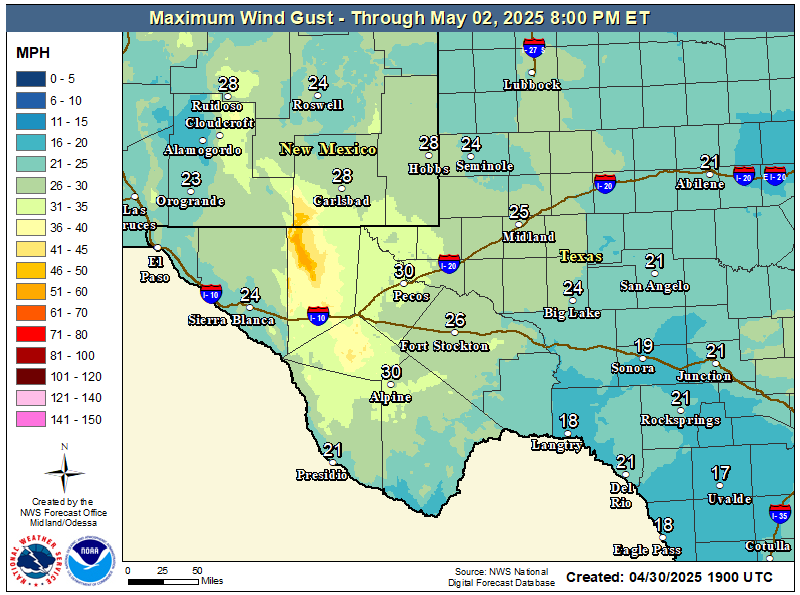
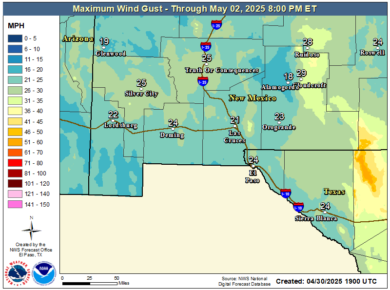
A High Wind Warning is now in effect for the southern Sacramento Mountains in Otero County from midnight tonight through 4 PM MST Monday. West winds sustained at 30 to 40 mph with gusts near 65 mph are forecast. Higher gusts will be possible with any severe thunderstorm this afternoon and evening.
A High Wind Watch remains in effect for the Guadalupe Mountains of Eddy and Culberson Counties on Monday. West winds sustained at 40 to 50 mph with gusts near 65 mph are forecast.
A Wind Advisory has been issued for the Johnson and Barlett Mesas, including Raton Pass, from 11 AM MST this morning through 5 AM MST Monday morning. Southwest winds sustained at 30 to 40 mph with gusts to 55 mph are forecast.
Strong westerly winds are forecast to kick up across the southeastern plains Monday afternoon. Sustained at around 25 to 30 mph with gusts near 40 mph. I wouldn't be surprised to see additional Wind Advisories issued for the area on Monday. Stronger gusts will occur with any severe thunderstorm.
Strong southwesterly winds are forecast to increase this afternoon across the Sacramento Mountains with gusts in the 25 to 40 mph range. These winds will become westerly on Monday and gust up into the 35 to 45 mph range. Ski Apache will see gusts close to 50 mph tonight into Monday. Stronger gusts will occur with any severe thunderstorm.
Scattered showers and thunderstorms will be possible across the southeastern plains this evening ahead of the approaching Pacific cold front. Some of these will become severe, including over the Sacramento and Capitan Mountains.
A rain and snow mix is forecast for Ski Apache that will change over to all snow by Monday morning before ending later in the day. At this time, little accumulation is expected, and no snow is forecast for the Cloudcroft area.
Once again, areas of fog and dense fog blanket the southeastern plains and nearby areas. These will burn off later this morning and early afternoon.
As the storm departs Monday morning and colder air settles in behind it, a couple inches of snow will be possible over the northern mountains above 9,000'. Higher totals may be possible across the higher peaks.
Area Forecast Discussion
National Weather Service Midland/Odessa TX
534 AM CST Sun Nov 1 2026

...New AVIATION...

.KEY MESSAGES...
Updated at 529 AM CST Sun Nov 1 2026

- Patchy fog will develop over portions of southeast New Mexico
  and West Texas early this morning.

- Isolated to scattered showers and thunderstorms may clip
  portions of southeast New Mexico late Sunday night. A storm or
  two may be strong to marginally severe, capable of producing
  strong and gusty winds.

- Increasing southerly winds shifting to westerly Monday, with
  strong westerly winds (40-50 mph, gusts 65 mph) over the
  Guadalupes/Delawares. A High Wind Watch is in effect.

&&
Area Forecast Discussion...UPDATED
National Weather Service Albuquerque NM
450 AM MST Sun Nov 1 2026

...New AVIATION...

.KEY MESSAGES...
Issued at 440 AM MST Sun Nov 1 2026

- Heavier rainfall will return today through Monday morning
  across western New Mexico. Given saturated soils, there is a
  chance for localized flooding from persistent rainfall. River
  rises are expected across northern and western NM and there is a
  moderate to high chance for river flooding.

- Severe thunderstorms will develop across central and eastern New
  Mexico this afternoon and tonight, bringing a threat for hail,
  damaging winds and tornadoes.

- A few inches of snow will fall over the northern mountains above
  9000 feet Monday morning.

&&
Area Forecast Discussion
National Weather Service El Paso TX/Santa Teresa NM
415 AM MST Sun Nov 1 2026

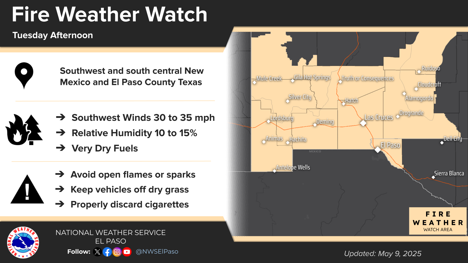
...New AVIATION, FIRE WEATHER...

.KEY MESSAGES...
Updated at 340 AM MST Sun Nov 1 2026

 - Pacific cold front will bring scattered showers and
   thunderstorms this afternoon and evening. Cooler temperatures
   Monday and Tuesday.

 - Storms will be capable of heavy rain and flooding across
   Southwest New Mexico, in particular the Gila Wilderness. A
   Flood Watch is in effect for portions of Grant and Hidalgo
   Counties.

 - Quieter and drier weather will prevail after Monday with
   temperatures remaining seasonable.

&&


Today.

Monday.

Tuesday.

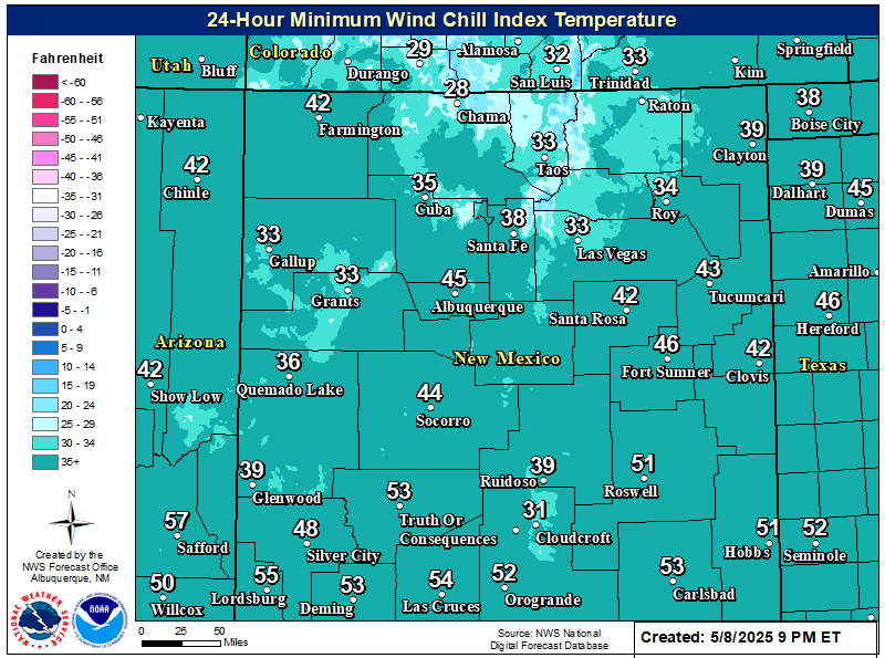
NWS NDFD Forecast Low Temperatures.
Monday Morning.

Tuesday Morning.

Wednesday Morning.

You Want The Truth; You Can’t Handle The Truth!

































Comments
Post a Comment
Your comments, questions, and feedback on this post/web page are welcome.