

Windy Tonight Into Wednesday. Historic Look At El Nino Winter 1987-88 In S/SE NM.
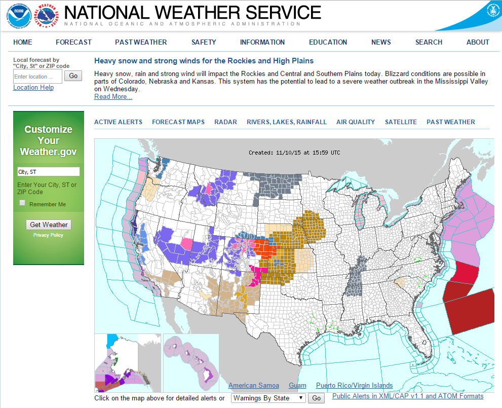
A potent early winter storm will roar out of the Rockies tonight and out onto the central plains states tonight into Wednesday. Ahead of it strong to high winds will impact areas from southeastern Arizona northeastward into New Mexico this afternoon into Wednesday. Winter Storm Warnings, Winter Storm Watches, Blizzard Warnings, and Winter Weather Advisories are in effect for parts of Colorado, southeastern Wyoming, southwestern Nebraska, and northwestern Kansas.

"An Enhanced Risk of Severe Thunderstorms for Wed (11/11)
Severe thunderstorms capable of large hail and wind damage are expected to develop in the central Plains and lower to mid Missouri Valley late Wednesday morning into early afternoon. The potential for wind damage and tornadoes should increase during the afternoon across the mid Mississippi Valley reaching the Ohio Valley during the early evening. A more isolated threat for large hail, wind damage and tornadoes will also be possible during the afternoon across the Arklatex, Ozarks and lower Mississippi Valley."

Valid From 10 AM MST Today - 5 PM MST Thursday.
Warm One On Monday.

Strong To High Winds In NM Tonight Into Wednesday.

Valid @ 11 PM Tonight.

Valid @ 11 AM Wednesday.

Valid @ 5 PM MST This Afternoon.

Valid @ 11 AM MST Wednesday.
Typically warmer than normal temperatures occur ahead of an approaching storm and cold front. With the cold frontal passage below normal temperatures occur. This is easily seen on the two temperature anomaly forecast maps above.

Valid @ 11 AM MST Wednesday.


To Convert Knots To MPH Multiply By 1.15. 20 Knots = 23 MPH.
Blog updated @ 1:56 PM MST.
Again this next potent winter storm will track north of southeastern New Mexico tonight into Wednesday across northern New Mexico and southern Colorado. Whenever this happens we get swiped with the tail end of the mid-upper level trough of low pressure. This of course means lots of wind for us. Such will be the case this afternoon into Wednesday.
The strongest/highest winds will occur over and near the mountains late this afternoon, overnight and into around noontime on Wednesday. In the Guadalupe's westerly winds sustained at around 35-45 mph will gust up to around 60 mph.
Across the northern Sacramento mountains southwesterly winds will increase to sustained speeds this afternoon to 25-35 mph with gusts near 50 mph. These strong winds will shift around to the west and increase to sustained speeds of near 35-45 mph with gusts to around 60 mph tonight. Becoming northwesterly and remaining strong until around noontime Wednesday before dying off Wednesday night.
Roswell is currently a Wind Advisory for northwesterly winds at around 25-30 mph with gusts near 40 mph Wednesday morning.
For the rest of the southeastern plains southwesterly winds will increase up to around 15-20 mph this afternoon. Increasing to 15-25 mph with gusts near 35 mph tonight. Westerly winds will be sustained around 25-30 mph with gusts near 40 mph until around noontime Wednesday then decreasing throughout the afternoon.

A strong but dry Pacific cold front will sweep from west to east across New Mexico this afternoon into tonight. Colder air gusty behind the front will make for a blustery day across the area on Wednesday. Across the southeastern plains highs today will range from the low-upper 70's today. Lows tonight will be mostly in the 40's.
Behind the cold front tomorrow our highs will range from the low-upper 60's. Highs in the mountains will range from around 42°F in Cloudcroft to 52°F in Ruidoso and 56°F in Mayhill.
Some of the coldest lows of the season will occur area wide Thursday morning. Low temperatures will range from around 19°F in Cloudcroft to the low-mid 20's at the lower elevations of the mountains, and the mid 20's to near 31°F across the southeastern plains. Some locations will have a killing freeze and those of us who haven't had a freeze yet should see one.
Friday into the weekend looks to be seasonably cool with highs across the southeastern plains mostly in the upper 50's to near 60°F on Friday and the mid-upper 50's Saturday.

Without a doubt the El Nino winter of 1987-1988 was one for the record books and one to remember in New Mexico. Since our current El Nino best fits the analog pattern of the 1987-1988 El Nino then lets see what happened in that winter. Southeastern New Mexico saw one of the coldest and snowiest events in our local history during the December 13th-15th winter storm. Listed below are so of the temps, snowfall totals, and seasonal snowfall totals from that season.
Roswell, NM.
Low Temp December 1987 -3°F.
December 1987 Snowfall Total 15.3".
Max Snow Depth On Ground Dec 13th-5th 10".
Storm Snowfall Total Dec 13th-15th, 1987 10.3".
1987-1988 Seasonal Snowfall Total (Oct - Apr) 32.6".
Artesia, NM.
Low Temp December 1987 -13°F.
December 1987 Snowfall Total 11.8".
Max Snow Depth On Ground Dec 13th-5th 9".
Storm Snowfall Total Dec 13th-15th, 1987 9.0".
1987-1988 Seasonal Snowfall Total (Oct - Apr) 18.8".
Lakewood, NM.
Low Temp December 1987 -13°F.
December 1987 Snowfall Total 17.8".
Max Snow Depth On Ground Dec 13th-5th 15".
Storm Snowfall Total Dec 13th-15th, 1987 14.8".
1987-1988 Seasonal Snowfall Total (Oct - Apr) Missing.
Carlsbad, NM.
Low Temp December 1987 -4°F.
December 1987 Snowfall Total 15.3".
Max Snow Depth On Ground Dec 13th-5th 13".
Storm Snowfall Total Dec 13th-15th, 1987 13.0".
1987-1988 Seasonal Snowfall Total (Oct - Apr) 25.5".
Tatum, NM.
Low Temp December 1987 -2°F.
December 1987 Snowfall Total Missing.
Max Snow Depth On Ground Dec 13th-5th 10".
Storm Snowfall Total Dec 13th-15th, 1987 11.2".
1987-1988 Seasonal Snowfall Total (Oct - Apr) Missing".
Hobbs, NM.
Low Temp December 1987 7°F.
December 1987 Snowfall Total 5.6".
Max Snow Depth On Ground Dec 13th-5th 5".
Storm Snowfall Total Dec 13th-15th, 1987 4.5".
1987-1988 Seasonal Snowfall Total (Oct - Apr) 8.7".
El Paso, TX.
Low Temp December 1987 6°F.
December 1987 Snowfall Total 25.9".
Max Snow Depth On Ground Dec 13th-5th 14".
Storm Snowfall Total Dec 13th-15th, 1987 22.4".
1987-1988 Seasonal Snowfall Total (Oct - Apr) 32.5".
Capitan, NM.
Low Temp December 1987 -6°F.
December 1987 Snowfall Total 20.6".
Max Snow Depth On Ground Dec 13th-5th 12".
Storm Snowfall Total Dec 13th-15th, 1987 13.5".
1987-1988 Seasonal Snowfall Total (Oct - Apr) 80.8".
Ruidoso, NM.
Low Temp December 1987 -8°F.
December 1987 Snowfall Total 35.4".
Max Snow Depth On Ground Dec 13th-5th 24".
Storm Snowfall Total Dec 13th-15th, 1987 29.3".
1987-1988 Seasonal Snowfall Total (Oct - Apr) 81.9".
Cloudcroft, NM.
Low Temp December 1987 -6°F.
December 1987 Snowfall Total 22.0".
Max Snow Depth On Ground Dec 13th-5th 15".
Storm Snowfall Total Dec 13th-15th, 1987 15.0".
1987-1988 Seasonal Snowfall Total (Oct - Apr) 76.5".
Elk, NM.
Low Temp December 1987 -12°F.
December 1987 Snowfall Total 31.5".
Max Snow Depth On Ground Dec 13th-5th 24".
Storm Snowfall Total Dec 13th-15th, 1987 24.0".
1987-1988 Seasonal Snowfall Total (Oct - Apr) 53.0".
Interesting Summary From The Ruidoso Co-Op Climate Observer.

Climate Data/Records Are Courtesy Of:
The Truth Is Stranger Than Fiction!


Comments
Post a Comment
Your comments, questions, and feedback on this post/web page are welcome.