

Pk Wind Gusts/Storm Reports From Monday - Oct & Year-To-Date Rainfall Totals - Quiet Wx This Week.

South Of Cloudcroft, NM.
For now, the nonstop parade of El Niño-driven Pacific storms has come to an end. Giving northwestern and northern New Mexico, as well as southern and southwestern Colorado, a much-needed break from the recent excessive rainfall and widespread flooding and flash flooding.
The Chama CoCoRaHS Station located 1.0 miles north of town recorded a whopping 8.50" during October.
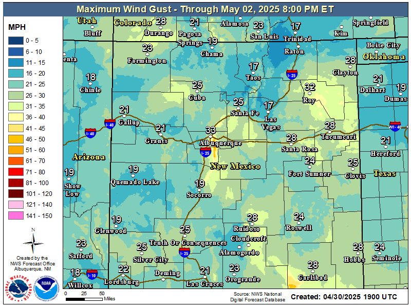
High winds raked the area yesterday, and wind damage was reported in the Ruidoso area and west of Mayhill. Two semi's were blown over just south of Guadalupe Pass. A peak wind gust of 80 mph was clocked in Pine Springs, Guadalupe Mountains National Park, at 12:56 PM CST.
The Bowl Raws located 1/2 mile north of Guadalupe Peak (7,755') reported a peak wind gust of 111 mph.
The San Augustine Pass Raws located just east of Las Cruces along US Hwy 70 clocked a peak gust of 75 mph.
The Vaughn UPR (Union Pacific Railroad) automated station recorded a peak gust of 66 mph.
A gust of 63 mph was recorded at the Smokey Bear Raws in Ruidoso. Power outages occurred in the Ruidoso area when high winds downed pine trees, power lines, and power poles. A gust of 56 mph was recorded by a PWS just west of Mayhill.
The Hobbs Lea County Regional Airport AWOS recorded a peak gust of 51 mph, the Caprock Raws 50 mph, the Queen Raws 49 mph, a PWS east of Carrizozo 49 mph, the Artesia Municipal Airport AWOS 45 mph, and the Carlsbad Cavern City Air Terminal Airport ASOS 44 mph.
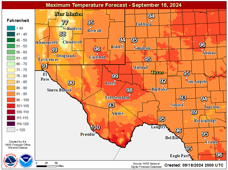
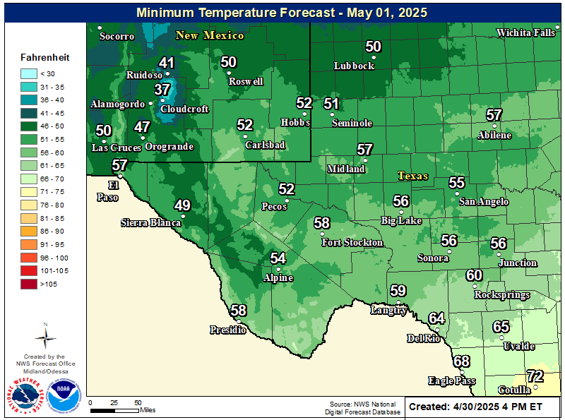
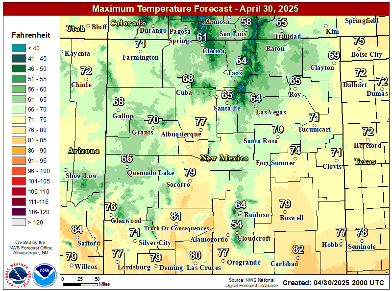
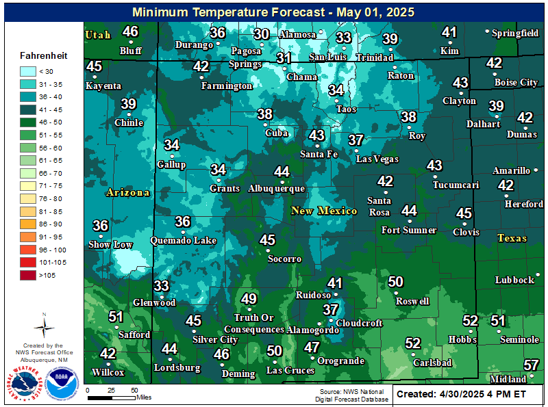
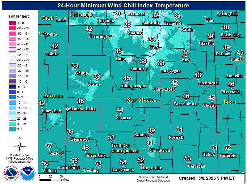
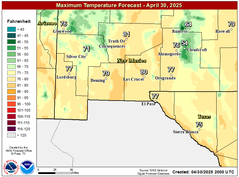
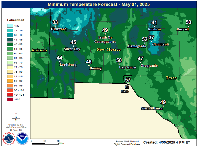
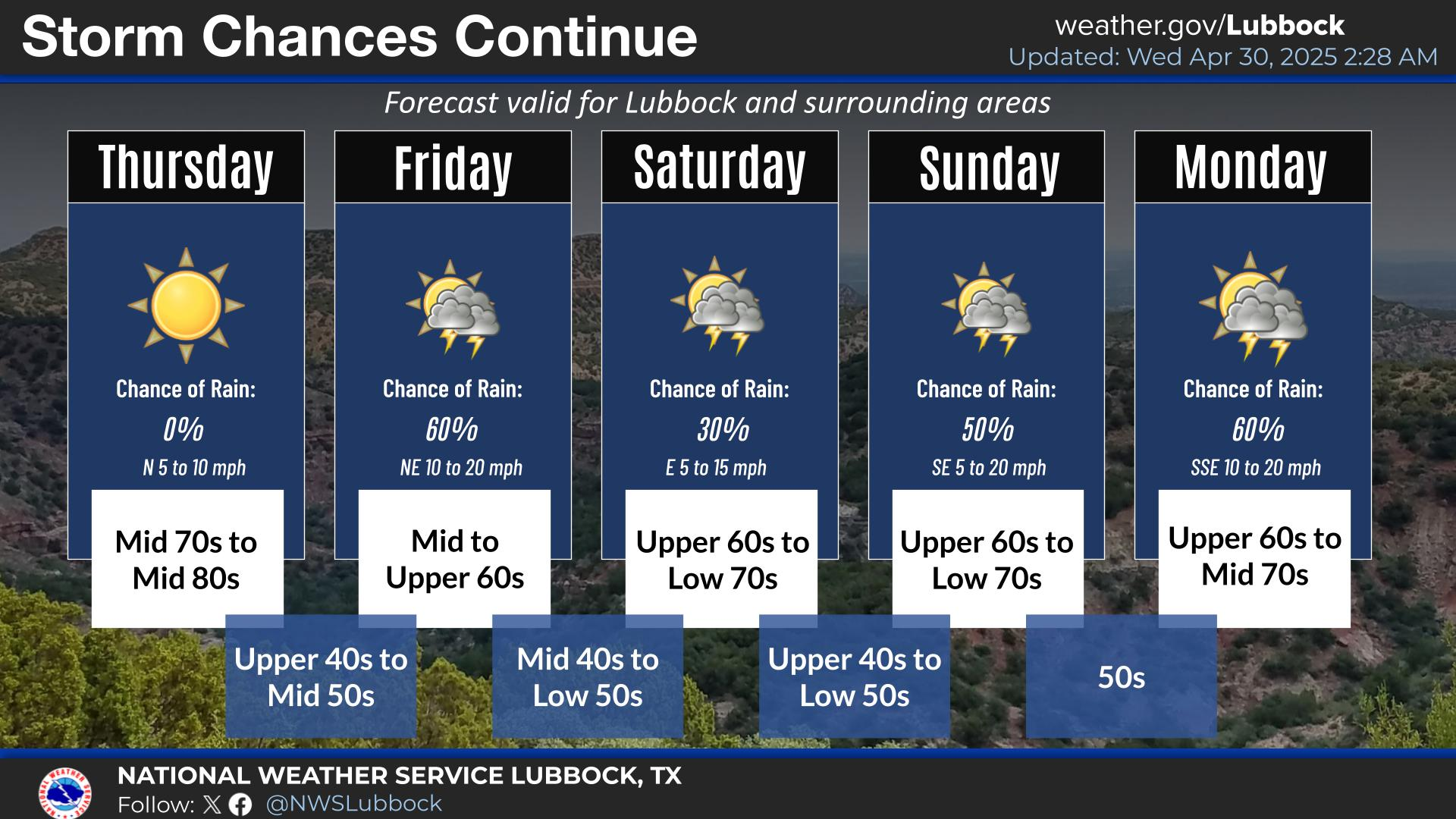
A cold front will slide southeast across the area Wednesday night into Thursday, bringing a slightly cooler airmass with it. Dropping our daytime highs down into the 60s Thursday into next Monday, and our overnight lows into the 40s.
Selected October Rainfall Totals.
Roswell CoCoRaHS 8.1 N 5.41"
Queen Raws 4.71"
Ruidoso CoCoRaHS 3.2 SW 4.70"
Weed PWS 4.50"
Mayhill CoCoRaHS 4.0 SSE 4.29"
8-Mile Draw Raws 4.12"
Roswell XL AWS 6.25 NW 4.07"
Cloudcroft CoCoRaHS 0.4 ESE 4.00"
Sierra Blanca Snotel 4.00"
Dog Canyon Raws - Guadalupe Mtns Natl Park 3.98"
Cloudcroft CoCoRaHS 1.8 SW 3.93"
Cloudcroft NWS Climate Coop Station 3.92"
South of Cloudcroft PWS 3.91"
Whites City XL AWS 9 SW 3.85"
Ski Apache CoCoRaHS 3.76"
Carlsbad XL AWS 7.5 NW 3.67"
Mayhill Raws 3.60"
Artesia CoCoRaHS 3.5 NNE 3.52"
Cosmic Raws 3.23"
Lake Arthur CoCoRaHS 2.5 ESE 3.16"
Bat Draw Raws - Carlsbad Caverns Visitor Center 3.13"
Timberon PWS 3.11"
Artesia Airport AWOS 3.11"
Alto CoCoRaHS 2.8 E 2.95"
Jal NMCC 2.90"
Caprock Raws 2.65"
Carlsbad CoCoRaHS 2.1 NNW Downtown 2.62"
Capitan CoCoRaHS 1.3 WSW 2.58"
Monument CoCoRaHS 1.2 W 2.56"
Artesia NWS Climate Coop Station 2.40"
Paduca Raws - Near WIPP 2.39"
Hope CoCoRaHS 25.9 SSW 2.24"
Ruidoso NWS Climate Coop Station 2.20"
Carlsbad Cavern City Air Terminal Airport ASOS 1.74"
Hondo NMCC 1.71"
Hobbs Lea County Regional Airport AWOS 1.20"
Tatum CoCoRaHS 0.9 E .76"
Selected Year-To-Date Rainfall Totals.
Sierra Blanca Snotel 39.20"
Ski Apache CoCoRaHS 35.56"
Cloudcroft CoCoRaHS 1.8 SW 34.56"
Cloudcroft NWS Climate Coop Station 32.76"
Cloudcroft CoCoRaHS 0.4 ESE 30.89"
Alto CoCoRaHS 2.8 E 25.07"
Ruidoso CoCoRaHS 3.2 SW 23.76"
Ruidoso NWS Climate Coop Station 23.27"
Queen Raws 23.14"
Mayhill CoCoRaHS 4.0 SSE 22.33"
Capitan CoCoRaHS 1.3 WSW 20.61"
Jal NMCC 20.59"
Caprock Raws 19.99"
Dog Canyon Raws - Guadalupe Mtns Natl Park 19.94"
Roswell CoCoRaHS 8.1 N 19.04"
Artesia NWS Climate Coop Station 17.78"
8-Mile Draw Raws 17.40"
Hope CoCoRaHS 25.9 SSW 16.92"
Lake Arthur CoCoRaHS 2.5 ESE 16.66"
Lovington CoCoRaHS 3.0 NNE 16.31"
Carlsbad CoCoRaHS 2.1 NNW Downtown 16.24"
Timberon PWS 16.23"
Tatum CoCoRaHS 0.9 E 15.99"
Monument CoCoRaHS 1.2 W 14.99"
Artesia CoCoRaHS 3.5 NNE 14.56"
Hondo NMCC 14.07"
Hobbs Lea County Regional Airport AWOS 12.76"
Artesia Airport AWOS 11.36"
Carlsbad Cavern City Air Terminal Airport ASOS 10.87"
Paduca Raws - Near WIPP 10.86"
Area Forecast Discussion
National Weather Service Midland/Odessa TX
1255 PM CST Tue Nov 3 2026

...New SHORT TERM, LONG TERM...

.KEY MESSAGES...
Updated at 1255 PM CST Tue Nov 3 2026

- Mild daytime temperatures (60s to 70s F highs) and chilly
  nighttime temperatures (40s to 50s F lows) this week.

&&
Area Forecast Discussion
National Weather Service Albuquerque NM
100 PM MST Tue Nov 3 2026

...New SHORT TERM, LONG TERM, FIRE WEATHER...

.KEY MESSAGES...
Issued at 1250 PM MST Tue Nov 3 2026

- Many rivers across northwestern and north central New Mexico
  have peaked and will continue to fall below bankfull stages
  through Wednesday and Thursday.

- A mix of light rain showers and high terrain snow will move east
  across the far northern mountains Wednesday night then into far
  northeast New Mexico Thursday morning. A brief period with minor
  travel impacts may occur along Interstate 25 at Raton Pass from
  snow and low visibility.

- Drier conditions will persist for the remainder of the region
  through the rest of this week.

&&
Area Forecast Discussion
National Weather Service El Paso TX/Santa Teresa NM
1047 AM MST Tue Nov 3 2026

...New DISCUSSION, AVIATION, FIRE WEATHER...

.KEY MESSAGES...
Updated at 948 AM MST Tue Nov 3 2026

 - Mainly dry through the weekend with temperatures near or
   slightly below normal.

 - Breezy Wednesday afternoon, otherwise winds on the light side.

&&

793
NWUS54 KMAF 022202
LSRMAF
Preliminary Local Storm Report
National Weather Service Midland/Odessa TX
402 PM CST Mon Nov 2 2026

..TIME...   ...EVENT...      ...CITY LOCATION...     ...LAT.LON...
..DATE...   ....MAG....      ..COUNTY LOCATION..ST.. ...SOURCE....
            ..REMARKS..

1256 PM     Non-Tstm Wnd Gst Pine Springs            31.89N 104.81W
11/02/2026  M80 MPH          Culberson          TX   Mesonet

&& $$ KL
776
NWUS54 KMAF 030247
LSRMAF

Preliminary Local Storm Report
National Weather Service Midland/Odessa TX
847 PM CST Mon Nov 2 2026

..TIME...   ...EVENT...      ...CITY LOCATION...     ...LAT.LON...
..DATE...   ....MAG....      ..COUNTY LOCATION..ST.. ...SOURCE....
            ..REMARKS..

1256 PM     Non-Tstm Wnd Gst 6 W Whites City         32.17N 104.48W
11/02/2026  M58 MPH          Eddy               NM   Mesonet


0150 PM     Non-Tstm Wnd Gst 5 SW Hobbs              32.68N 103.22W
11/02/2026  M51 MPH          Lea                NM   ASOS/AWOS


1250 PM     Non-Tstm Wnd Gst 18 NW Jal               32.23N 103.46W
11/02/2026  M54 MPH          Lea                NM   Mesonet


0358 PM     Non-Tstm Wnd Dmg 5 S Pine Springs        31.81N 104.83W
11/02/2026                   Culberson          TX   Department of Hig

            TXDOT reported two semi rollovers south of
            Guadalupe Pass on US Hwy 180 due to high
            winds.

1252 PM     Non-Tstm Wnd Gst 1 NE Pine Springs       31.89N 104.80W
11/02/2026  M70 MPH          Culberson          TX   Mesonet

&& $$ KL(Click on the link above to view them all).
722
NWUS55 KABQ 032129
LSRABQ

Preliminary Local Storm Report
National Weather Service Albuquerque NM
229 PM MST Tue Nov 3 2026

..TIME...   ...EVENT...      ...CITY LOCATION...     ...LAT.LON...
..DATE...   ....MAG....      ..COUNTY LOCATION..ST.. ...SOURCE....
            ..REMARKS..

1000 AM     Flood            1 N Chama               36.91N 106.58W
11/02/2026                   Rio Arriba         NM   Public

            Images on social media show massive amounts
            of earth washed out at the Cumbres & Toltec
            Railroad bridge where train tracks across
            the Rio Chama. The damage to the railroad
            bridge has rendered it unusable.

&& $$ TS
NOUS45 KABQ 031814 PNSABQ NMZ201>241-040615- Public Information Statement National Weather Service Albuquerque, NM 1114 AM MST Tue Nov 3 2026 ...NWS Damage Survey for 10/22/26 Tornado Event... .Mt Taylor Cibola National Forrest in McKinley County... Rating: EFU Estimated Peak Wind: - mph Path Length /statute/: 1.20 miles Path Width /maximum/: 150 yards Fatalities: 0 Injuries: 0 Start Date: 10/22/2026 Start Time: 02:52 PM MST Start Location: 7 E San Mateo / McKinley County / NM Start Lat/Lon: 35.3386 / -107.5114 End Date: 10/22/2026 End Time: 02:55 PM MST End Location: 7 E San Mateo / McKinley County / NM End Lat/Lon: 35.3559 / -107.5106 Survey Summary: Defined swath of numerous trees damaged/displaced on high resolution satellite imagery. Damage track based on high resolution satellite data before/after the tornado. Time of tornado estimated from radar tornado debris signature. Track not accessible by ground. && EF Scale: The Enhanced Fujita Scale classifies tornadoes into the following categories: EF0.....65 to 85 mph EF1.....86 to 110 mph EF2.....111 to 135 mph EF3.....136 to 165 mph EF4.....166 to 200 mph EF5.....>200 mph NOTE: The information in this statement is preliminary and subject to change pending final review of the event and publication in NWS Storm Data.
$$

767
NWUS54 KEPZ 012340
LSREPZ

Preliminary Local Storm Report
National Weather Service El Paso Tx/Santa Teresa NM
440 PM MST Sun Nov 1 2026

..TIME...   ...EVENT...      ...CITY LOCATION...     ...LAT.LON...
..DATE...   ....MAG....      ..COUNTY LOCATION..ST.. ...SOURCE....
            ..REMARKS..

0440 PM     Tstm Wnd Dmg     2 N Rodeo               31.87N 109.03W
10/19/2026                   Hidalgo            NM   County Official

            Delayed report. Employee from Chiricahua
            Desert Museum reports 82 mph wind gust.
            Major damage to building with the front
            doors blown open, shingles taken off the
            roof, and water damage due to flooding to
            the visitor center and library. Roof metal
            flew off the nearby self storage building.
            18 power poles were down along NM-80. The
            storm damage resulted in a 24-hour power
            loss.

&& $$ CD
672
NWUS54 KEPZ 030019
LSREPZ

Preliminary Local Storm Report
National Weather Service El Paso Tx/Santa Teresa NM
519 PM MST Mon Nov 2 2026

..TIME...   ...EVENT...      ...CITY LOCATION...     ...LAT.LON...
..DATE...   ....MAG....      ..COUNTY LOCATION..ST.. ...SOURCE....
            ..REMARKS..

1000 AM     Non-Tstm Wnd Dmg 5 W Mayhill             32.91N 105.56W
11/02/2026                   Otero              NM   Trained Spotter

            Time and location approximate. Spotter
            shared a photo of a large tree branch down
            on a home within James Canyon, caused by
            high winds.

&& $$ CD


Note: Some of these automated standalone reporting stations may not reflect their monthly and yearly rainfall totals accurately. They may be reporting lower rainfall totals than have actually fallen. This is due to several reasons. One, some of these stations were installed and came online during the spring and early summer; thus, their totals do not reflect what fell from January until then. Two, I noticed that some of these stations went offline this summer and fall during thunderstorms, so their rainfall totals may not be reflected here.

New Mexico CoCoRaHS October 2026 Rainfall.


You Want The Truth; You Can’t Handle The Truth!










Comments
Post a Comment
Your comments, questions, and feedback on this post/web page are welcome.