Isolated T-Storms But Still Very Hot This Week.
June 26th, 2018.
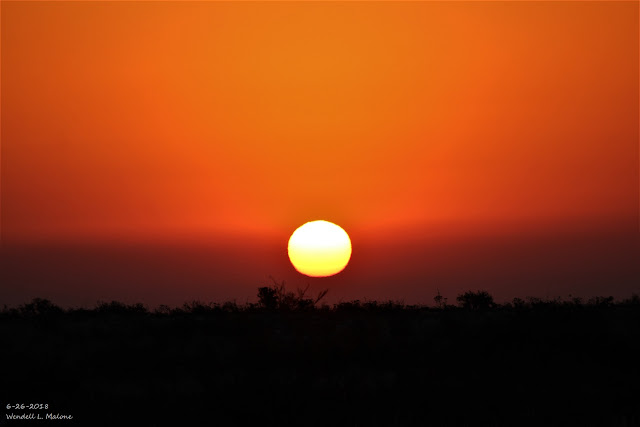
This hazy, somewhat smokey, dusty sunrise I captured from just south of Whites City this morning pretty much sums up our weather of late. A cold front blew through the Southeastern Plains early Monday morning producing northerly wind gusts to 65 mph at the Bat Draw Raws located at the Carlsbad Caverns Visitor Center and 52 mph at an automated weather station in southwestern Carlsbad.
The weak cold front brought brief relief from the excessive heat yesterday. My high temp recorded here at our home in Carlsbad was only 95.2º, down from 108.5º on Sunday and 105.1º on Saturday. I said brief because as of 3:50 PM MDT this Tuesday afternoon I've already managed to climb back up to 102.6º this afternoon. Triple digit highs are forecast for the rest of this work week.
The weak cold front brought brief relief from the excessive heat yesterday. My high temp recorded here at our home in Carlsbad was only 95.2º, down from 108.5º on Sunday and 105.1º on Saturday. I said brief because as of 3:50 PM MDT this Tuesday afternoon I've already managed to climb back up to 102.6º this afternoon. Triple digit highs are forecast for the rest of this work week.
Meanwhile the Crooked Creek Fire currently burning along the east slopes of the northern Guadalupe Mountains some 20 miles southwest of Hope, and 30 miles west of Lakewood is now 40% contained. It has scorched some 6,800 acres so far and was started by dry lightning on June 15th. This isn't the only Forest Fire currently burning in New Mexico. Visit this site "New Mexico Fire Information" for a list of current fires and those of this spring and early summer thus far.
The Heat Is Back.
Finally Some Rumbles Of Thunder.
June 26th, 2018.
Coming home from work this afternoon I captured this thunderstorm over the Guadalupe Mountains. Notice the Cumulonimbus Mammatus Clouds. This storm was dumping moderate to heavy rains in the Queen area. As of 4 PM the Queen Raws was reporting .21" of rainfall, the Dog Canyon Raws southwest of Queen .05", and both the Bowl Raws and Pine Springs .01". That's not much rain but its a start and sure beats nothing at all. Notice the Cumulonimbus Mammatus Clouds.
Valid At 4 PM MDT.
(As Of 4 PM MDT
This storm was dumping moderate to heavy rains in the Queen area. As of 4 PM the Queen Raws was reporting .21" of rainfall, a Personal Weather Station (PWS) in Weed reported .08", the Dog Canyon Raws southwest of Queen .05", and both the Bowl Raws and Pine Springs .01". That's not much rain but its a start and sure beats nothing at all.
(Valid As Of 8 AM MDT Tuesday, June 26, 2018).
(Valid As Of 8 AM MDT Tuesday, June 26, 2018).
December 28th, 2017 - June 25th, 2018).
This mornings run of the European (ECMWF) forecast model keeps us in the oven through the rest of this week into the first of next week with near to above triple digit high temps across the Southeastern Plains. Its not very hopeful at all for wetting rains either. The GFS model seems too wet so the truth may lie in between the two models. Isolated to scattered thunderstorms will be possible especially this weekend with the best chance for getting wet being over and near the mountains.
(June 24th -3th, 2018).
The Truth Is Stranger Than Fiction!


Comments
Post a Comment
Your comments, questions, and feedback on this post/web page are welcome.