Drought Busting Rains Coming Along With Major Heat Relief!
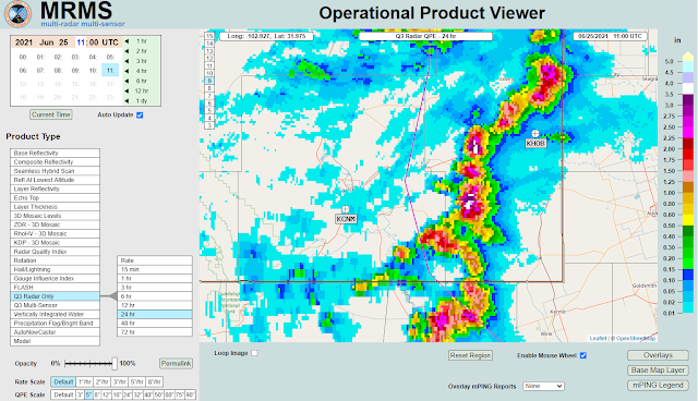
(Storm Total Rainfall Estimates).
Cannon AFB GRLevel3_2.0.
(Storm Total Rainfall Estimates).
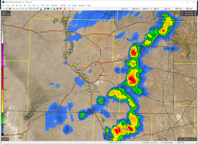
Locally Heavy Rain Has Already Fallen.
Thunderstorm activity picked up Wednesday afternoon and increased somewhat yesterday afternoon. A couple of severe thunderstorm warnings were issued for a broken line of thunderstorms that formed west of the Hobbs and Eunice areas Thursday afternoon. Local radar estimates indicate that maybe 3.50" of rain fell in a few spots west and southwest of Hobbs. This may be a little high due to hail contamination in the radar returns.
Major Changes Coming In Our Weather.
Valid At 6 AM MDT Monday, June 28, 2021.
Valid At 6 PM MDT Saturday, June 26, 2021.
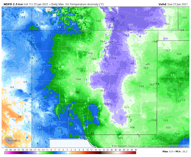
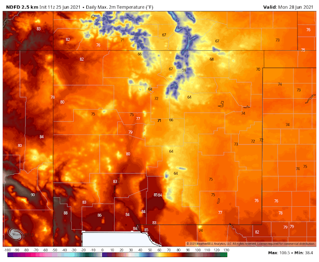
A significant pattern change will usher in much cooler weather along with widespread heavy to very heavy rains this weekend into next week. A mid-upper level trough of low pressure is forecast to dig southwestward into the area this weekend. Meanwhile, a strong cold front will backdoor southwestward into the state tonight into Saturday night. While all of this is going on the annual monsoon will try and get an early start next week.
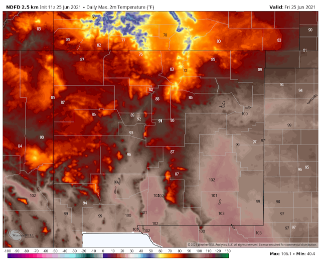
Friday.
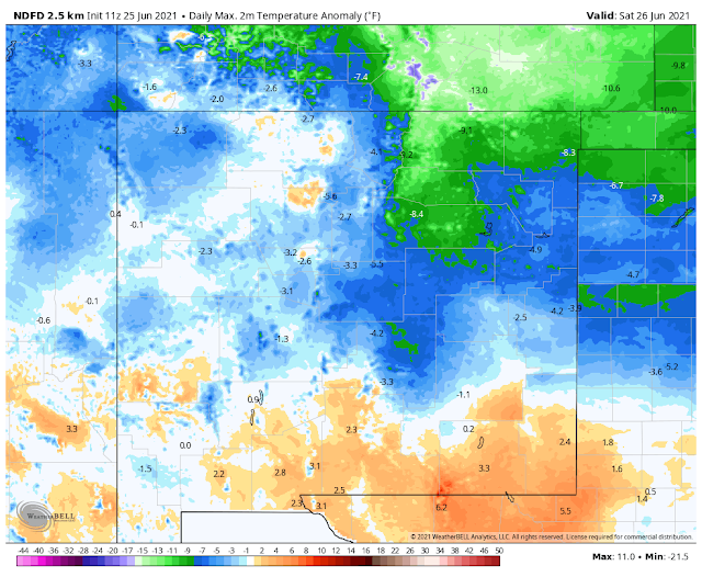
Saturday.
Sunday.
Monday.
Today (Friday) will be another scorcher with afternoon highs ranging from the 80's in the Sacramento mountains to 100 to 105 across Southeastern New Mexico and West Texas. As the strong cold front to our north pushes southward and westward on Saturday we should see our highs drop down into the mid 90's locally.
Sunday into Monday will see a 20 to 30-degree drop in our high temperatures with most lower elevation locations only getting up into the 70's. The mountains will see the 60's. These readings will be some 20-degrees below normal.
Threat For Severe Thunderstorms & Flash Flooding.
Valid Today Through 6 PM MDT Tuesday,
GFS Storm Total Rainfall Forecast.
Valid Today Through 6 PM MDT Tuesday,
WPC Storm Total Rainfall Forecast.
NWS Storm Total Rainfall Forecast.
Valid Today Through 6 AM MDT Monday.
Flash Flood Threat This Weekend Into Tuesday.
Good agreement among the computer forecast models with last night's runs. Generally, widespread rainfall across the local area between this afternoon and next Tuesday will be in the 1.50" to 4.00" range. Pockets of heavier rainfall will occur and storm totals potentially could end up in the 6" to 8" range in some locations.
A few severe thunderstorms will be possible this afternoon and evening and again on Saturday. More so on Saturday. From Saturday night into the first of next week, we will transition into more of a heavy rain and flash flood event. Significant flash flooding will be possible in some areas. This will be especially true where training thunderstorms (one thunderstorm after another) occurs.
The good news is that the potential to further take a bite out of our exceptional to extreme drought will exist into next week.
The Truth Is Stranger Than Fiction!








Comments
Post a Comment
Your comments, questions, and feedback on this post/web page are welcome.