Posts

Showing posts from March, 2024

My Blog Archive List (July 2010 - August 2025).

Show more

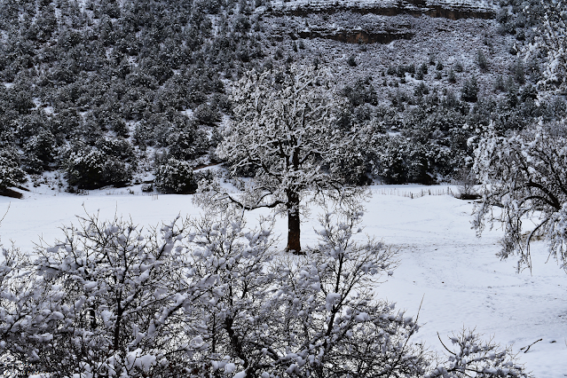
Looking Back At Our 14-Day Winter Storm Impacts - March 27, 2024.

Image
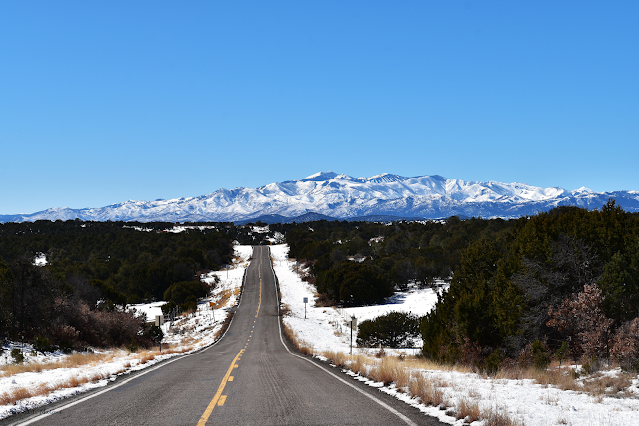
February 13, 2024. Looking South At Sierra Blanca Peak. From North Of Capitan On St Hwy 246. Looking Back At Our 14-Day Winter Storm Impacts. Sunday's Peak Wind Gusts. New Mexico MesoWest Reported Peak Wind Gusts. NWS Midland Reported Peak Wind Gusts. West Texas MesoNet Reported Peak Wind Gusts. HRAP 14-Day Precipitation Totals. NOHRSC 14-Day Snowfall Total Map. New Mexico CoCoRaHS 14-Day Precipitation Totals. New Mexico CoCoRaHS 14-Day Snowfall Totals. There Are None So Blind As Those Who "Will - Not" To See...107.

Widespread Significant Damaging High Wind/Blowing Dust Event Sunday.

Image
March 9, 2024. East Of Cloudcroft, NM. Surface Map Forecast. Valid At 6 AM MDT Sunday, March 24, 2024. GFS Surface MSL Forecast. Valid At 6 PM MDT Sunday. GFS 500 MB (18,000' MSL) Analysis. Valid At Midnight MDT Last Night. GFS 500 MB (18,000' MSL) Forecast. Valid At 6 AM MDT Sunday. GFS 500 MB (18,000' MSL) Forecast. Valid At 6 AM MDT Monday. Very Strong Jet Stream Aloft On Sunday. GFS 250 MB (34,000' MSL) Jet Stream Wind Forecast. Valid At 9 AM MDT Sunday Morning. GFS 500 MB (18,000' MSL) Jet Stream Winds Forecast. Valid At 9 AM MDT Sunday Morning. GFS 700 MB (10,000' MSL) jet Stream Wind Forecast. Valid At 9 AM MDT Sunday Morning. NWS NDFD Peak Wind Gust Swatch Forecast. Valid At 6 PM MDT Sunday. NWS NDFD Storm Total Precipitation Forecast Valid At 6 AM MDT Monday. NWS NDFD Storm Total Snowfall Forecast Valid At 6 AM MDT Monday. NWS Midland Forecasts. NWS Albuquerque Forecasts. NWS El Paso Forecasts. Widespread Significant Damaging High Wind/Blowing Dust Even...

72-Hour Storm Summary - Sunday March 17, 2024.

Image
March 9, 2024. East Of Mayhill, New Mexico. 72-Hour Storm Summary - Sunday March 17, 2024.  Surface Map Analysis. At 6 AM MDT Sunday, March 17, 2024. Rapid Refresh Model (RAP) Analysis.  At 8 AM MDT Sunday, March 17, 2024. Water Vapor Satellite Image. At 12:31 PM MDT Saturday, March 16, 2024. NWS NDFD Storm Total Precipitation Forecast. Valid Today Through 6 AM MDT Wednesday Morning. NWS NDFD Storm Total Snowfall Forecast. Valid Today Through 6 AM MDT Wednesday Morning. MRMS 72-Hour Precipitation Totals. As Of  8 AM MDT Sunday, March 17, 2024. NWS 72-Hour Snowfall Analysis Maps. (As Of 7 AM MDT Sunday, March 17, 2024). NWS 72-Hour Snowfall Reports Map. (As Of 7 AM MDT Sunday, March 17, 2024). New Mexico MesoWest 72-Hour Precipitation Totals. New Mexico 72-Hour CoCoRaHS Precipitation Reports. (As Of 8 AM MDT Sunday, March 17, 2024). New Mexico 72-Hour CoCoRaHS Snowfall Reports. (As Of 8 AM MDT Sunday, March 17, 2024). New Mexico CoCoRaHS 72-Hour Precipitation Summary. (As ...
If you are viewing my web page on your cell phone, then be sure and click on the three white bars located in the top left-hand corner of the page (only visible on your phone). This is the menu bar, and it opens up additional links and graphics. Such as forecast maps, severe weather outlooks, current conditions, radar and satellite links, and more.

Current US Hazardous Weather Watch/Warning Map

New Mexico

Chaves County Plains & Mtn's

Eddy County

Culberson County

Lea County

Lincoln County

Otero County

Ruidoso Live Webcam

Cloudcroft Live Webcam

Roswell Live EarthCam

Average Daily High/Low Temperatures & Rainfall/Snowfall