Current Date & Time

These Daily Record Highs May Be Broken.

Record High Temps For Sun Dec 19th-
Location
Record
Date
Normal High/Low
Roswell Climate
73
1994
55/24
Artesia Climate
82
1980
56/21
Carlsbad Climate
79
1980
58/28
Carlsbad Airport
75
1978
57/28
Hobbs Climate
76
1921
57/29
Tatum Climate
71
1997+
54/24
Pine Springs Climate
66
1997
53/30
Capitan Climate
61
2003
49/22
Ruidoso Climate
64
1950
50/19
Elk Climate
75
1955
53/21
Cloudcroft Climate
49
1994
42/17


Record High Temps For Mon Dec 20th-
Location
Record
Date
Normal High/Low
Roswell Climate
75
1981+
55/24
Artesia Climate
80
1921
56/21
Carlsbad Climate
80
1933
58/28
Carlsbad Airport
84
1933
57/28
Hobbs Climate
74
1981
57/29
Tatum Climate
77
1921
54/24
Pine Springs Climate
61
1994
53/30
Capitan Climate
64
2001
49/22
Ruidoso Climate
65
1955
50/19
Elk Climate
78
1955
53/21
Cloudcroft Climate
53
2001
42/17


Record High Temps For Tue Dec 21st-
Location
Record
Date
Normal High/Low
Roswell Climate
81
1981
55/24
Artesia Climate
80
1981+
56/21
Carlsbad Climate
82
1933
58/28
Carlsbad Airport
86
1933
57/28
Hobbs Climate
78
1981
57/29
Tatum Climate
76
1981
54/24
Pine Springs Climate
66
1994
53/30
Capitan Climate
65
1981+
49/21
Ruidoso Climate
67
1973
50/19
Elk Climate
76
1955
53/21
Cloudcroft Climate
55
2005
42/17


Daily Record High Temp Data Is Courtesy Of-


The Truth Is Stranger Than Fiction!

Comments

My Blog Archive List (July 2010 - August 2025).

Show more

My Current Weather Conditions

MY CoCoRaHS Precipitation Data

NWS Albuquerque 2026 Winter Outlook (Updated Nov 3rd).

NWS Midland Web Page

NWS Midland Web Page
Click On The Map To Open It Up

SE New Mexico & West Texas Precipitation Forecasts

Eddy County

Guadalupe Mtns Eddy & Culberson County

Lea County

NWS Midland Hazardous Weather Outlook

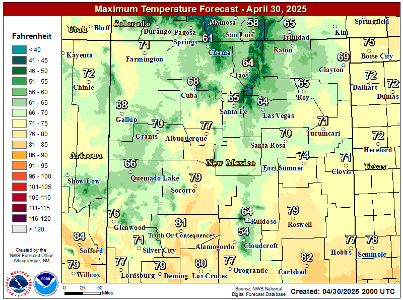
NWS Midland Forecast High Temperatures Today

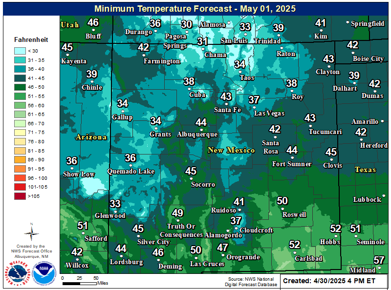
NWS Midland Forecast Low Temperatures Tonight

NWS Midland Peak Wind Gust Forecast

NWS Midland Forecast Graphic

NWS Midland Forecast Graphic
Patchy areas of dense fog is expected across southeast New Mexico, northern Permian Basin, and Guadalupe Mountains tonight through Thursday morning. Drive with caution when encountering fog!

NWS Midland Graphic Forecast

NWS Midland Graphic Forecast
Low clouds and fog over portions of the area will lift by late this morning. Warmer temperatures return today through Saturday. The next cold front arrives Sunday with much cooler temperatures to follow into early next week. Dry weather through the weekend before another system brings a chance of rain by early next week.

NWS Midland Forecast Graphic

NWS Midland Forecast Graphic
A damage survey concluded a thunderstorm produced two tornadoes in Gaines and Dawson counties, respectively, on the evening of November 14th. Here are the findings and details of the survey.

NWS Albuquerque Web Page

NWS Albuquerque Web Page
Click On The Map To Open It Up

NWS Albuquerque New Mexico Precipitation Forecasts

New Mexico

Chaves County Plains & Mtn's

Lincoln County

NWS Albuquerque Hazardous Weather Outlook

NWS Albuquerque Hazardous Weather Outlook

NWS Albuquerque Forecast High Temperatures Today

NWS Albuquerque Forecast Low Temperatures Tonight

NWS Albuquerque Wind Chill Forecast

NWS Albuquerque Peak Wind Gust Forecast

NWS Albuquerque Graphic Forecast

NWS Albuquerque Graphic Forecast
Dense Fog is likely to return to areas of east-central and southeastern New Mexico tonight into Thursday morning. Low visibility as low as a quarter mile will impact the morning commute in these areas.

NWS Albuquerque Graphic Forecast

NWS Albuquerque Graphic Forecast
Gusty winds return on Friday across the forecast area. The strongest winds are forecast to be in northeast New Mexico.

NWS Albuquerque Graphic Forecast

NWS Albuquerque Graphic Forecast
Daytime temperatures will be within several degrees of average through Friday, then trend below average going into next week. Chances for rain and snow showers will come back late Friday and Saturday, then increase further on Monday.

NWS El Paso Web Page

Southern New Mexico & Far West Texas Precipitation Forecasts

Texas

Otero County

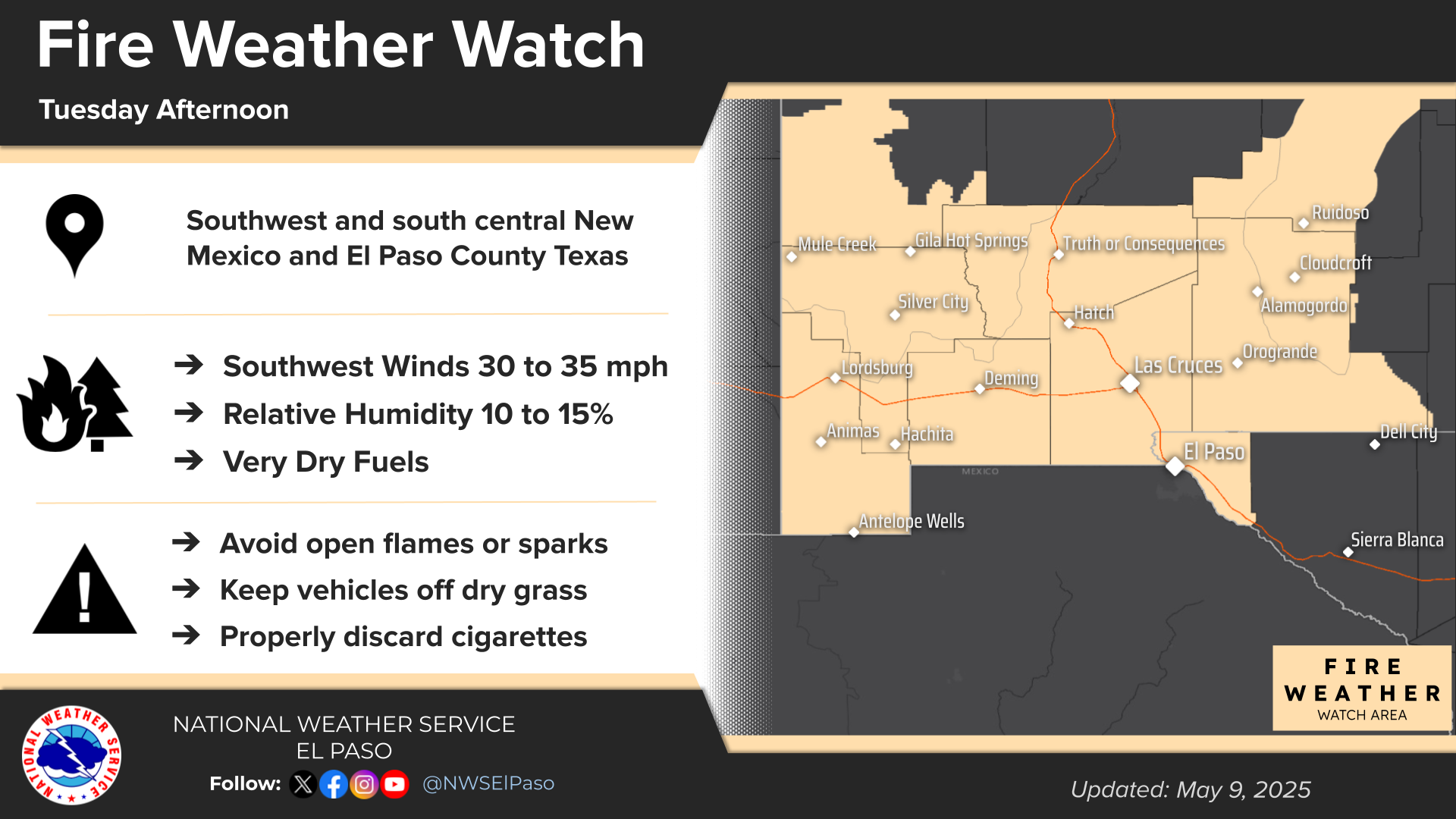
NWS El Paso Hazardous Weather Outlook

NWS El Paso Hazardous Weather Outlook
Click On The Image To See The Rest Of The Outlooks

NWS El Paso Hazardous Weather Outlook

NWS El Paso Hazardous Weather Outlook
Click On The Image To See The Rest Of The Outlooks

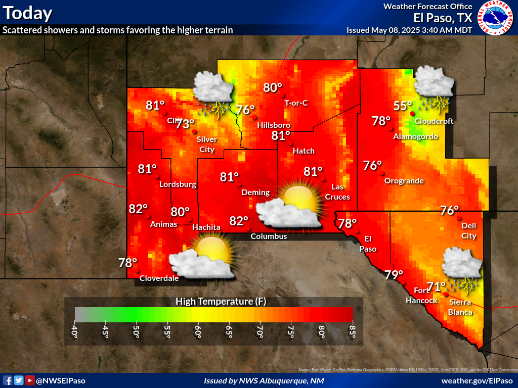
NWS El Paso Forecast High Temperatures Today

NWS El Paso Forecast Low Temperatures Tonight

NWS El Paso Wind Chill Forecast

NWS El Paso Peak Wind Gust Forecast

NWS El Paso Graphic Forecast

NWS El Paso Graphic Forecast

NWS Lubbock Web Page

NWS Lubbock Web Page
Click On The Map To Open It Up

NWS Lubbock South Plains Precipitation Forecasts

NWS Lubbock Hazardous Weather Outlook

NWS Lubbock Hi Temperature Forecast Today

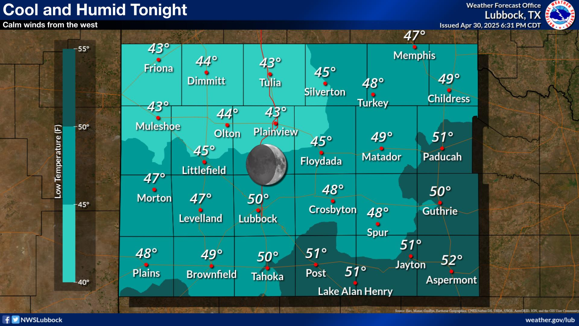
NWS Lubbock Low Temperature Forecast Tomight

NWS Lubbock Graphic Forecast

NWS Lubbock Graphic Forecast
A Dense Fog Advisory is in effect until 10 am Thursday for locations on the Caprock along and west of the I-27/U.S. 87 Corridor.

NWS Lubbock Graphic Forecast

NWS Lubbock Graphic Forecast
Low clouds and fog will redevelop tonight. The fog will likely become dense across much of the Caprock early Thursday morning. Skies will gradually clear out during the day Thursday with highs in the upper 50s to upper 60s.

NWS Lubbock Graphic Forecast

NWS Lubbock Graphic Forecast
Warming temperatures are expected during the second half of the week. However, a return to cooler temperatures is expected late this weekend.

My Rainfall Totals - 2.1 NNW Downtown Carlsbad

My Rainfall Totals - 2.1 NNW Downtown Carlsbad

My Seasonal Snowfall Totals - 2.1 NNW Downtown Carlsbad

My Seasonal Snowfall Totals - 2.1 NNW Downtown Carlsbad

Disclaimer

This blog and its contents are for informational purposes only! Always have multiple sources of information available to rely upon during severe weather. Do not rely solely on the Internet. Be weather-aware, plan ahead, have a backup plan, and be ready to act before severe weather strikes your location.