

Who Got Wet & Who Will Get Wet This 4th Of July Weekend.
(As Of 7:15 AM MDT This Morning).


(As Of 7:30 AM MDT This Morning).


Mother nature has been rather busy over the past 24-hours in The Land Of Enchantment. Its pretty easy to see where all of the thunderstorm activity has been after taking at look at the lightning strike density maps above. Additional rainfall totals are available here. And via CoCoRaHS.
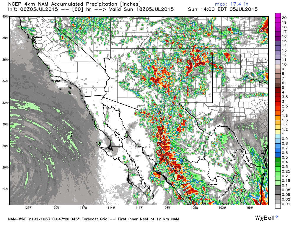
NAM-WRF Total Rainfall Forecast.
Valid @ Noon MDT Sunday.

GFS Total Rainfall Forecast.
Valid @ 6 PM MDT Sunday.


Pretty much everyone in New Mexico has a chance of getting wet sometime today into Monday. As is normal this time of the year the mountains and nearby locations will have the best chances of seeing scattered t-storms. Some of these storms will last well into the night as well.
The Truth Is Stranger Than Fiction!


Comments
Post a Comment
Your comments, questions, and feedback on this post/web page are welcome.