

Hot This Weekend - Next Storm Mid-Week.
Valid At Noon MDT Wednesday, March 30, 2022.

Hot This Weekend - Next Storm Mid-Week.
Spring is notorious for being turbulent weather-wise and this spring has certainly started on that turbulent note. It's the time of the year when cold air masses and warm air masses collided from time to time. When this happens a variety of weather occurs. Such will be the case from the first to the middle of next week.
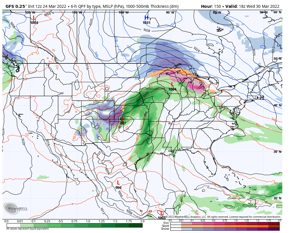
A warmup is now occurring behind our latest storm that has departed. Seasonally hot temperatures will occur across the local area Sunday and Monday ahead of yet another winter-like storm. That strong spring storm will affect the area Tuesday into Thursday of next week with a variety of weather including strong winds, blowing dust, high fire danger, areas of rain and snow along with colder temps.
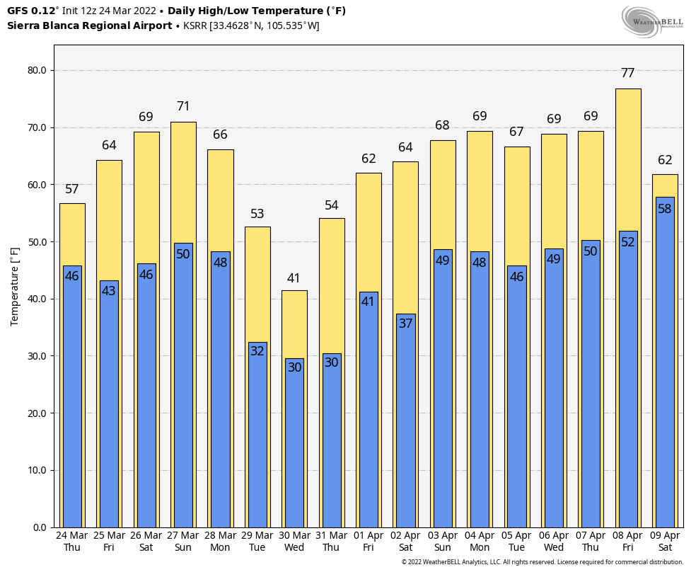
Forecast high temps for Southeastern New Mexico and nearby areas will climb up to near 90 to the low 90's Sunday and Monday. A few local record high temps may be threatened.
Like our last storm, this next strong spring storm will likely drop its highest amounts of rain and snow over and near the mountains.
Today.

Friday.

Saturday.

Sunday.

Monday.


Valid At 6 PM MDT Wednesday, March 30, 2022.
GFS Snowfall Forecast.

First and foremost it's really too early to get to specific with impacts from next week's storm. It does have a similar look to our storm from a couple of days ago at least in the GFS models forecasts. So take all of this with a grain of salt and know that although the exact details can't be resolved yet, there will be another strong spring storm next week impacting the region.
Given the time of the year, the mountains of New Mexico will likely see the highest snowfall. But that does not mean that some lower elevations won't get snow. Severe thunderstorms may once again plaque Texas, Oklahoma, Louisiana, and the rest of the central and southern parts of the nation next week. More on all of this later.
The Truth Is Stranger Than Fiction!


Comments
Post a Comment
Your comments, questions, and feedback on this post/web page are welcome.