

Hot Today Into The Weekend - Cooler & Wetter Starting Memorial Day.

May 13, 2025.
Looking West From The Carlsbad Beach.
Altocumulus Standing Lenticular Clouds (ACSL).
Thunderstorms & Cooler Next Week.
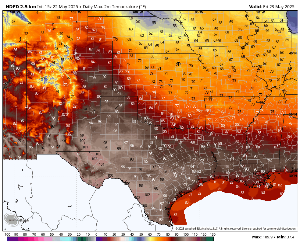
High temperatures today, Friday, and Saturday across southeastern New Mexico are forecast to hit the century mark for the first time this year. Locally, our high temperatures will be 6 to 13 degrees above normal today into Sunday. Behind the cold front, our temps will average 4 to 12 degrees below normal Memorial Day into next Wednesday.
A series of upper-level short-wave troughs of low pressure will traverse the region Sunday into the middle of next week. Meanwhile, a cold front will sag southward through New Mexico Sunday night into Memorial Day. The dryline will establish itself east of the mountains Sunday into Memorial Day as well. In fact, by next Tuesday and Wednesday, it will back west of the El Paso area. We normally don't see it this far west this early in the season.
Increasing low-level southeasterly upslope flow from the Gulf of America will advect rich Gulf moisture into the area to help fuel scattered showers and thunderstorms next week, starting on Memorial Day. Moist low-level easterly upslope flow will also increase along and behind the southward advancing cold front across the state.
Next week will be active as far as scattered rain showers and thunderstorms are concerned. Long-range models hint at above-normal chances for precipitation and cooler-than-normal temperatures.
As is usually the case this time of the year, the most widespread and strongest thunderstorms will form along and east of the state's mountains, where the heaviest rains should fall. Some of these thunderstorms may be of the severe variety early next week also. Early forecast storm total rainfall amounts next week look to be in the .50" to 2.00" range for these areas. However, you know the drill, there will likely be a few areas that may get more than this, especially where the stronger storms form.
All in all, a very welcome and much-needed pattern change for most of the state. Hopefully, the rains will be enough to dampen the fire danger and bring some relief to the drought-stricken sections of the area.
Today.

Friday.
Saturday.

Sunday.

Memorial Day.

Tuesday.

Wednesday.


There Are None So Blind As Those Who "Will - Not" To See...107.


Comments
Post a Comment
Your comments, questions, and feedback on this post/web page are welcome.