Posts

Current Date & Time

Eagle Nest, New Mexico Tornado - August 9th, 2018.

Image
Blog Updated At 4:21 PM MDT Friday, August 10th, 2018. Blog Updated At 4:54 PM MDT Monday, August 13th, 2018. August 9th, 2018. Courtesy Of Pete Pedro. Incredible video and photos of a tornado this afternoon in Eagle Nest, New Mexico. Eagle Nest is located in northern New Mexico in the Moreno Valley at an elevation of 8,238' . So once again and for the second time this year a tornado has touched down in or near a mountain community. The first sighting occurred near Picacho in Lincoln County ,  31 miles east of Ruidoso at an elevation of around 5,000' to 6,000' on May 25th of this year. Golf ball size hail is also reported to have fallen in Eagle Nest this afternoon. @weatherchannel Eagle Nest, New Mexico. pic.twitter.com/QBAHyrYqOY — Kayla Johnson (@RockChalkKJo) August 9, 2018 Some of the best video yet of the #Tornado in Eagle Nest #NM from BJ Lindsey. #nmwx pic.twitter.com/z7pkp1keB1 — Mark Ronchetti (@KRQEMark) August 9, 2018 ...

My Blog Archive List (July 2010 - August 2025).
Show more

My Current Weather Conditions

MY CoCoRaHS Precipitation Data

NWS Albuquerque 2026 Winter Outlook (Updated Nov 3rd).

NWS Midland Web Page

NWS Midland Web Page
Click On The Map To Open It Up

SE New Mexico & West Texas Precipitation Forecasts

Eddy County

Guadalupe Mtns Eddy & Culberson County

Lea County

NWS Midland Forecast High Temperatures Today

NWS Midland Forecast Low Temperatures Tonight

NWS Midland Peak Wind Gust Forecast

NWS Midland Graphic Forecast

NWS Midland Graphic Forecast
Another round of dense fog may develop tonight lasting through the morning commute across the light gray highlighted areas. When visibilities get low, take it slow!

NWS Midland Graphic Forecast

NWS Midland Graphic Forecast
After a foggy and misty Friday morning for some, a slightly warmer and breezy afternoon is in store.

NWS Midland Forecast Graphic

NWS Midland Forecast Graphic
A damage survey concluded a thunderstorm produced two tornadoes in Gaines and Dawson counties, respectively, on the evening of November 14th. Here are the findings and details of the survey.

NWS Albuquerque Web Page

NWS Albuquerque Web Page
Click On The Map To Open It Up

NWS Albuquerque New Mexico Precipitation Forecasts

New Mexico

Chaves County Plains & Mtn's

Lincoln County

NWS Albuquerque Hazardous Weather Outlook

NWS Albuquerque Hazardous Weather Outlook

NWS Albuquerque Forecast High Temperatures Today

Today's High Temperature Difference From Climatology

NWS Albuquerque Forecast Low Temperatures Tonight

Tonight's Low Temperature Difference From Climatology

NWS Albuquerque Wind Chill Forecast

NWS Albuquerque Peak Wind Gust Forecast

NWS Albuquerque Graphic Forecast

NWS Albuquerque Graphic Forecast
Dense Fog is likely to return to areas of east-central and southeastern New Mexico tonight into Friday morning. Low visibility as low as a quarter mile will impact the morning commute in these areas.

NWS Albuquerque Graphic Forecast

NWS Albuquerque Graphic Forecast
Gusty southerly to southwesterly winds are forecast across much of western, south-central, and northeastern NM Friday afternoon. Crosswinds will yield difficult travel conditions on area highways for high profile vehicles.

NWS Albuquerque Graphic Forecast

NWS Albuquerque Graphic Forecast
Light rain and mountain snow is forecast to clip western, central, and northern NM Friday night through Saturday morning. There is a minor risk for slick road conditions through high mountain passes during this time.

NWS Albuquerque Forecast Grpahics

NWS Albuquerque Forecast Grpahics
Temperatures cool after a weak system clips northern and central NM Friday night into Saturday morning. Temperatures stay cold into next week with another system forecast to arrive near Tuesday. Morning lows will be notably chilly with many areas starting off near or below freezing.

NWS El Paso Web Page

Southern New Mexico & Far West Texas Precipitation Forecasts

Texas

Otero County

NWS El Paso Hazardous Weather Outlook

NWS El Paso Hazardous Weather Outlook
Click On The Image To See The Rest Of The Outlooks

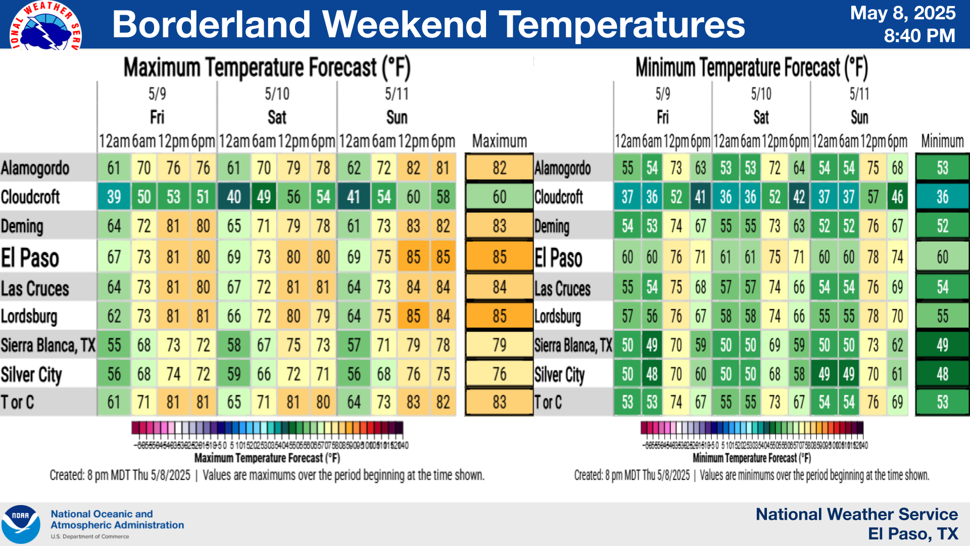
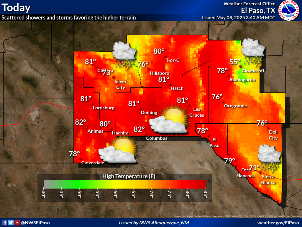
NWS El Paso Forecast High Temperatures Today

NWS El Paso Forecast Low Temperatures Tonight

NWS El Paso Wind Chill Forecast

NWS El Paso Peak Wind Gust Forecast

NWS El Paso Graphic Forecast

NWS El Paso Graphic Forecast

NWS El Paso Graphic Forecast
Wind Gusts for November 20-21

NWS El Paso Graphic Forecast

NWS Lubbock Web Page

NWS Lubbock Web Page
Click On The Map To Open It Up

NWS Lubbock South Plains Precipitation Forecasts

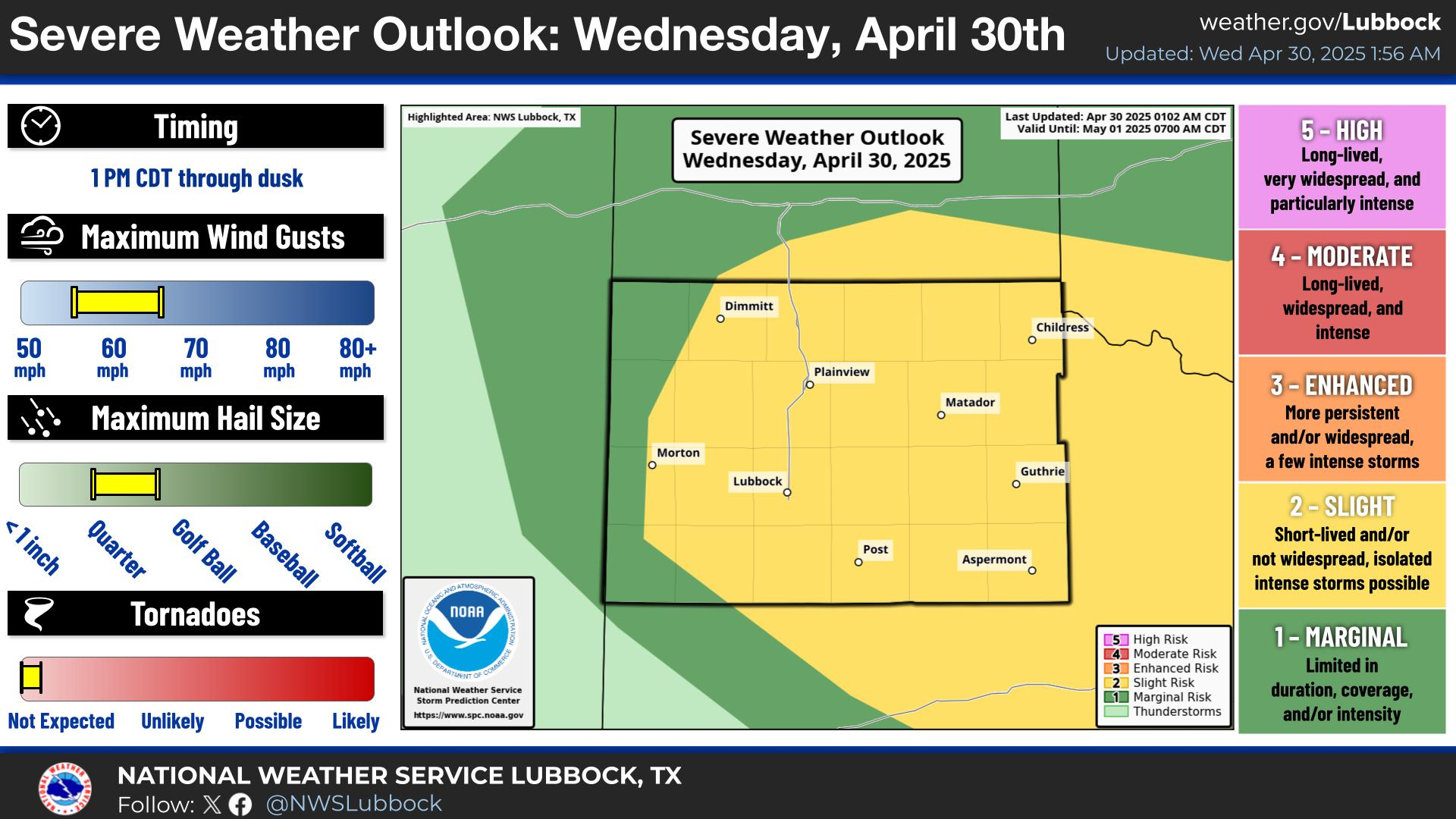
NWS Lubbock Hazardous Weather Outlook

NWS Lubbock Hazardous Weather Outlook

NWS Lubbock Hazardous Weather Outlook
Click On The Image To See The Rest Of The Outlooks

NWS Lubbock Hazardous Weather Outlook

NWS Lubbock Hazardous Weather Outlook
Click On The Image To See The Rest Of The Outlooks

NWS Lubbock Hazardous Weather Outlook

NWS Lubbock Hi Temperature Forecast Today

NWS Lubbock Low Temperature Forecast Tomight

NWS Lubbock Graphic Forecast

NWS Lubbock Graphic Forecast
Once again, some low clouds and patchy fog will return tonight ahead of sunnier skies for Friday through the weekend. Mild highs in the 60s will be replaced by 40s and 50s by Sunday.

NWS Lubbock Graphic Forecast

NWS Lubbock Graphic Forecast
After a mild start to the weekend with a few showers off the Caprock, much cooler weather arrives Sunday and carries into early week.

My Rainfall Totals - 2.1 NNW Downtown Carlsbad

My Rainfall Totals - 2.1 NNW Downtown Carlsbad

My Seasonal Snowfall Totals - 2.1 NNW Downtown Carlsbad

My Seasonal Snowfall Totals - 2.1 NNW Downtown Carlsbad

Disclaimer

This blog and its contents are for informational purposes only! Always have multiple sources of information available to rely upon during severe weather. Do not rely solely on the Internet. Be weather-aware, plan ahead, have a backup plan, and be ready to act before severe weather strikes your location.