


Continued Very Hot Into Next Week!
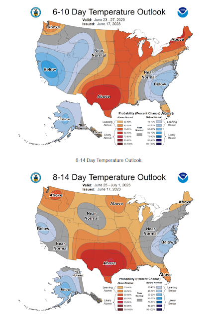
WPC Long Range Temperature Outlook. (6-10 & 8-14 Day Forecasts). Blog updated at 1:51 PM MDT - With Today's Outlooks. WPC Long Range Rainfall Outlook. (6-10 & 8-14 Day Forecasts). New Mexico MesoWest Reported High Temperatures Friday. NWS NDFD Forecast High Temperatures. Today. Sunday. Monday. Carlsbad 17-Day Forecast High/Low Temperatures. GFS Model. ECMWF Model. Continued Very Hot Into Next Week! Hot, dry, and breez to windy weather today...or better put blast furnace weather. Southwest to west winds will gust up to around 40 mph this afternoon and evening across the southeastern plains. Gusts between 40 - 50 mph are forecast for the Sacramento, Capitan, and Guadalupe mountains. Single digit relative humidity values with high temps ranging from 100º to 105º across the southeastern plains today. The low to mid 80's are forecast for the Ruidoso area and the low to mid 70's for the Cloudcroft area. Our forecast high temps ramp up this coming work week with no immed...


