


Yet Another Potentially Strong Winter Storm For NM Next Weekend.
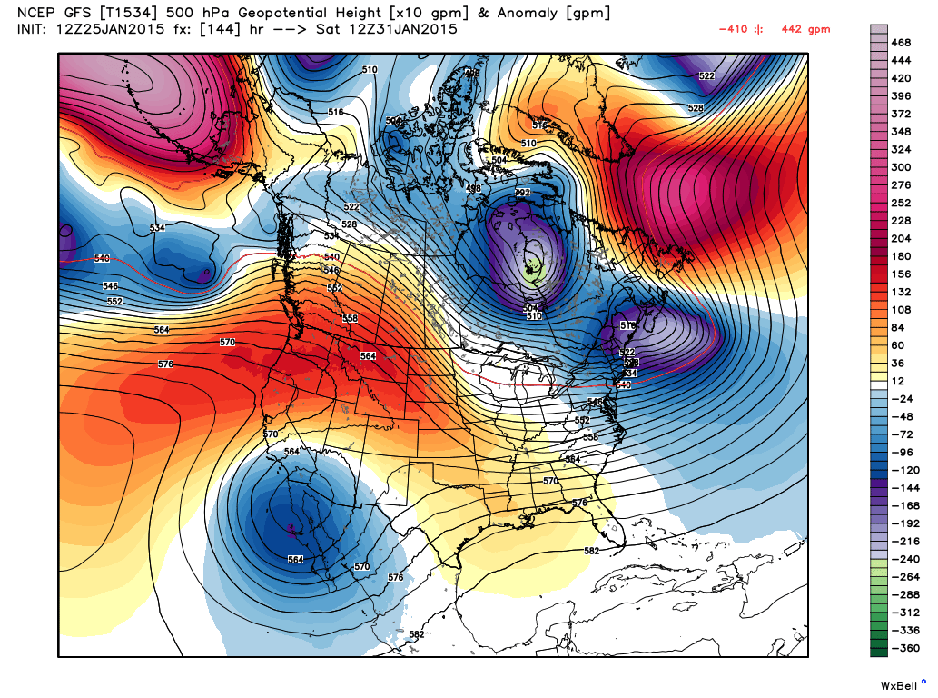
This Mornings 12Z/5 AM MST
GFS (T1534) 500 MB Forecast.
Valid @ 5 AM MST Saturday, January 31, 2015.

This Mornings 12Z/5 AM MST
Canadian (GEM) 500 MB Forecast.
Valid @ 11 AM MST Saturday, January 31, 2015.

This Mornings 12Z/5 AM MST GFS (T1534)
Total Precipitation (Rainfall) Forecast.
Valid @ 5 PM MST Saturday, January 31, 2015.

This Mornings 12Z/5 AM MST GFS (T1534)
Accumulated Snowfall Forecast.
Valid @ 5 PM MST Saturday, January 31, 2015.

This Mornings 12Z/5 AM MST Canadian (GEM)
Accumulated Snowfall Forecast.
Valid @ 5 PM MST Saturday, January 31, 2015.

Carlsbad, NM.

Hobbs, NM.

Sierra Blanca Regional Airport - Ruidoso, NM.
First Look At Our Next Winter Storm.
By this time next weekend New Mexico may once again be dealing with a strong winter storm. Interestingly enough it appears (for now anyway) that our temperatures here in southeastern New Mexico may be on the border (just above freezing), so this could be all heavy rain for us. Or if the Canadian model is forecasting, this may be another heavy snow event for parts of the area.
The trend this winter has been for these storms to dig further to the south than the models initially forecast. Time will tell if this one follows that trend. Either way it looks like a very wet storm. One way or the other it appears that the Guadalupe, Sacramento, Capitan and other mountains ranges in teh state are in for more heavy snows.
The Truth Is Stranger Than Fiction!


Comments
Post a Comment
Your comments, questions, and feedback on this post/web page are welcome.