Next Winter-Like Storm On The Way.
Carlsbad, New Mexico.
Red Sky In The Morning - Sailors Take Warning.
Blog Updated At 11:49 AM NDT Saturday.
Next Winter-Like Storm On The Way.
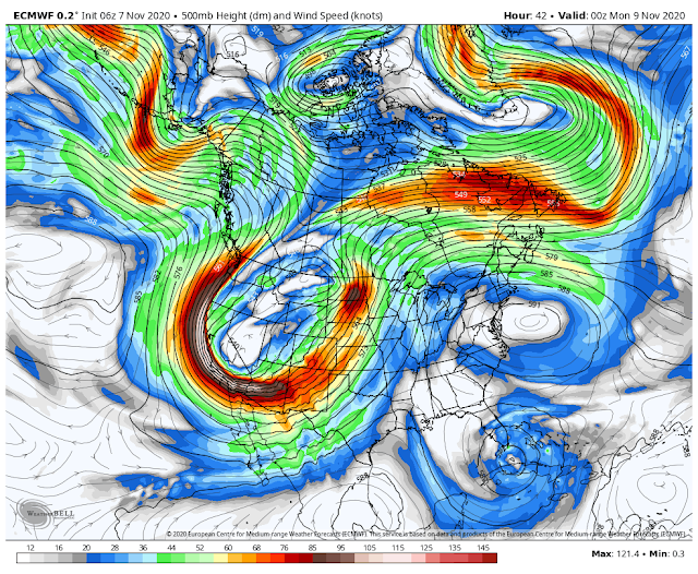
At Midnight Saturday Night.
Valid At 5 PM MDT Sunday.
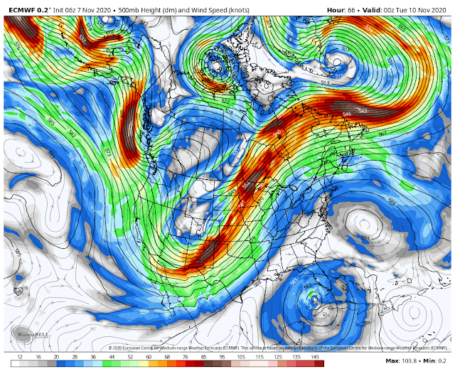
Early this Saturday morning our next winter-like storm (closed low at the 18,000' level) was centered over northern California. It will continue to dig/move slowly southeastward today into Sunday. By Monday afternoon the mid-level storm will have pulled off to the east and northeast into Wyoming.
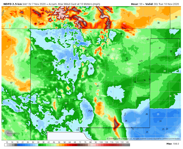
Strong southwesterly winds ahead of the approaching Pacific cold front and the mid-upper level closed low will increase across Southeastern New Mexico and nearby areas this afternoon into Monday. Southwesterly gusts up to 30-40 mph will occur at times especially on Sunday at the lower elevations.
A Wind Advisory has been issued for the Cloudcroft area in the Sacramento Mountains for late tonight into Sunday night. Southwesterly winds are forecast to increase around midnight tonight and become sustained at around 25-35 mph with gusts near 55 mph through Sunday night. Southwesterly winds may gust close to 75 mph in the Guadalupe Mountains on Monday.
NWS NDFD High-Temperature Forecasts.
Today.
Sunday.
Monday.
Forecast high temperatures today and Sunday across the lower elevations of Southeastern New Mexico and nearby areas are expected to range from the upper 70's to near 80. Monday should see highs in the upper 60's to 70 ahead of an approaching Pacific cold front. Behind the front, on Tuesday our high temps will drop down into the 60's. Nighttime lows will drop into the 30's once again starting Monday night.
Highs in the mountains today and Sunday will be in the 50's to near 70. Highs Monday and Tuesday drop down into the 40's. Lows will be in the 20's.
A Marginal Risk for a few isolated severe thunderstorms will be in place across extreme southwestern and western New Mexico today into tonight. Isolated thunderstorms may produce damaging wind gusts of around 60 mph.
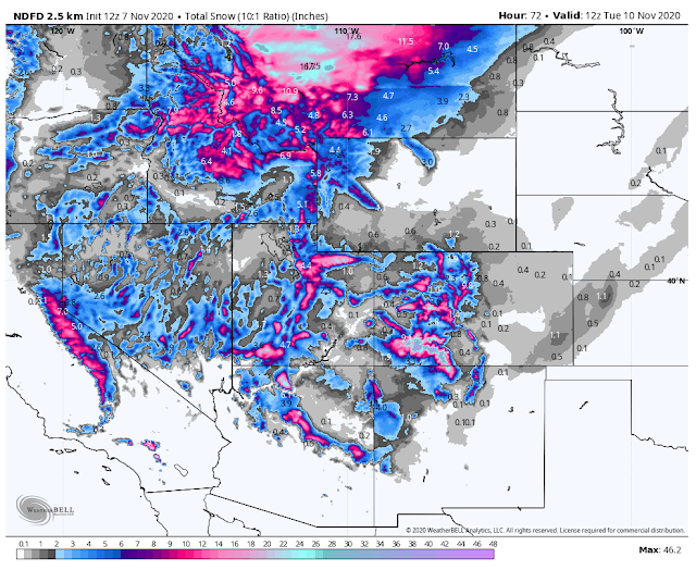
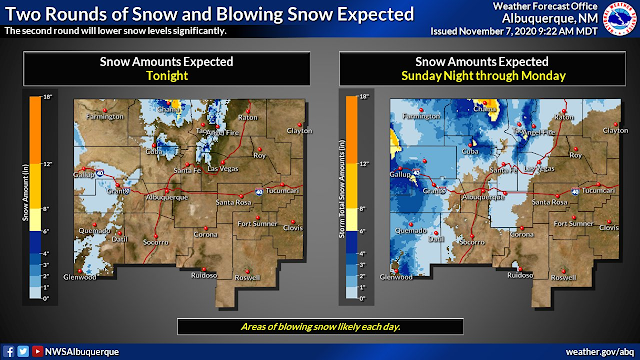
With a northern track of the storm unfortunately we get left out moisture-wise this time. The Sacramento Mountains will see a light mix of rain and snow showers.
Valid Today Through 5 AM MDT Tuesday.
Perhaps an inch or so of snow will fall across the higher elevations of the Sacramento Mountains generally above 8,000'.
The Truth Is Stranger Than Fiction!









Good afternoon. I concur with your idea in a storm pattern regarding the early September and late October storms where we received record cold and snow here in El Paso. In between was more record heat.
ReplyDeleteThey were around 45 days apart so I’m guessing the next big storm may be 30 days out from late October with the amplitude being a little less as the frequency tightens. But since it’s much colder now, snow will be easier to come by if we can get the H2O.
Thanks again. Your blog is really amazing.
Thank you...glad you like it!
Delete