
Warming Up This Week - Windy Across N/NE NM Friday - Sunday

September 25, 2025.
Meredith, New Hampshire.
Warming Up This Week - Changes Again Next Weekend.
My wife and I recently spent time in New England, visiting family and friends. I didn't think that the timing of our visit would coincide with their annual fall leaf color changes. I was wrong. We got to see the beginning of this change, and it was beautiful, as you can tell by my cover photo.
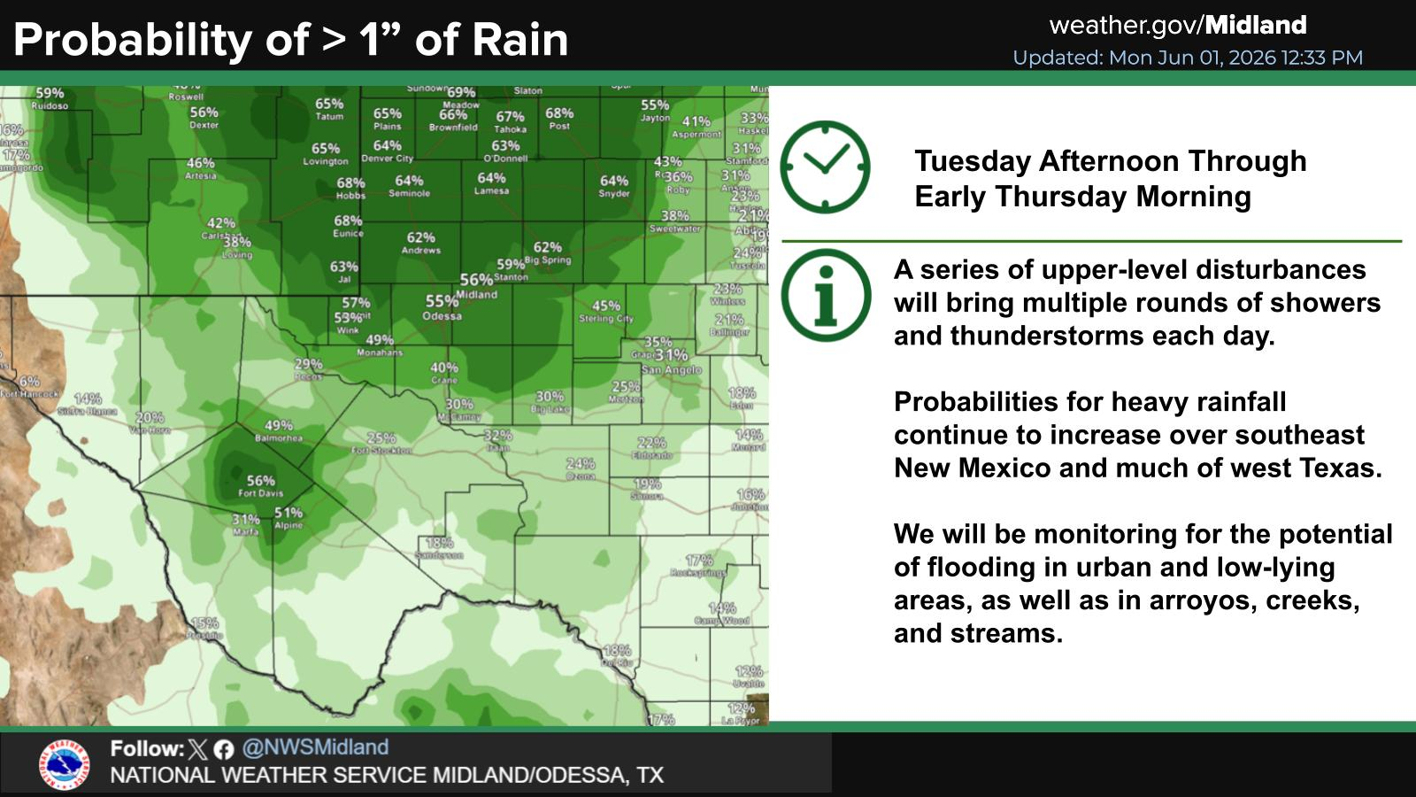
Our annual summer monsoon has come to an end...right on time, today, the last day of September. Over the past five days, most locations in the state measured rainfall. Thankfully, excessive rainfall and catastrophic flash flooding failed to materialize in the Ruidoso area.
A few areas ended up with some rather impressive totals. Some of the heavier totals are listed below:
Hondo NMCC 3.75"
Sandia Park CoCoRaHS 3.6 ESE 3.69"
Tijeras CoCoRaHS 4.2 NE 3.51"
Sandia Park CoCoRaHS 0.5 S 3.15"
Sandia Park CoCoRaHS 2.4 ENE 3.08"
Edgewood CoCoRaHS 1.8 SSE 2.90"
PWS FW2471 Bell Canyon Bell Canyon NW Of Mayhill 2.76"
PWS FW7228 Sandia Park 2.52"
PWS GW0586 Albuquerque 2.36"
Laguna Raws 2.09"
PWS Valencia SWCD 1.74"
PWS Gallup FW8699 Gallup 1.68"
Sunspot CoCoRaHS 0.2 SSW 1.31"
Nogal CoCoRAHS 4.6 SSE 1.29"
Fort Sumner CoCoRAHS 8.9 NNW 1.26"
Dexter NMCC 1.25"
Mesquite CoCoRAHS 3.1 NW 1.01"
Roswell CoCoRaHS 2.0 NNE .96"
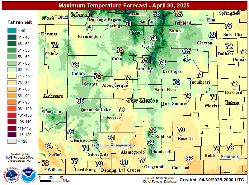
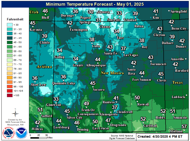
This week's weather will be warm and tranquil. Changes start Friday into Sunday when strong gusty southerly and southwesterly winds will begin to kick up over northern and northeastern New Mexico. Other areas of the state will be breezy at times as well.
A mid-upper level low will swing across the Four Corners Region Friday into the weekend. Scattered rain showers and thunderstorms are expected to ramp up across central and northern New Mexico next week as a stronger storm develops over California. Depending upon how far south the strong mid-upper level drops, precipitation may overspread much of the state except for the far western areas late next week.
Cooler temps may also move into much of the state the first of next week behind a cold front. Snow will be possible across the higher peaks (above 10,000') of far northern New Mexico and southern Colorado early next week.
Area Forecast Discussion
National Weather Service Midland/Odessa TX
641 AM CDT Tue Sep 30 2025

...New AVIATION...

.KEY MESSAGES...
Updated at 639 AM CDT Tue Sep 30 2025

- Warmer temperatures with dry weather conditions can be expected
  today through the upcoming weekend.

&&
Area Forecast Discussion...UPDATED
National Weather Service Albuquerque NM
530 AM MDT Tue Sep 30 2025

...New AVIATION...

.KEY MESSAGES...
Updated at 522 AM MDT Tue Sep 30 2025

- Patchy fog may reduce visibility on roadways early this morning
  in portions of central and eastern New Mexico.

- After a drier and warmer period Tuesday through Friday, rain
  chances will increase this weekend into early next week. Gusty
  south to southwest winds are likely Friday through Sunday as
  well, creating hazardous crosswinds for high-profile vehicles.

- Wetter than normal weather is favored for central and northern
  New Mexico next week.

&&
Area Forecast Discussion...UPDATED
National Weather Service El Paso TX/Santa Teresa NM
547 AM MDT Tue Sep 30 2025

...New AVIATION, FIRE WEATHER...

.KEY MESSAGES...
Updated at 516 AM MDT Tue Sep 30 2025

 - Dry conditions persist through the week ahead.

 - Temperatures will climb to around 5 to 8 degrees above normal by
   Thursday as a drier air mass takes over. Southerly winds may also
   become a little breezy Saturday and Sunday.

&&


(Valid Monday, Oct 6, 2025).


(AS Of 5 AM MDT Tuesday, Sept 30, 2025).

(As Of 6 AM MDT Monday, Sept 29, 2025).

(Thursday, Sept 25 - Tuesday, Sept 30, 2025).


(Thursday, Sept 25 - Tuesday, Sept 30, 2025).


There Are None So Blind As Those Who "Will - Not" To See...107.


























Comments
Post a Comment
Your comments, questions, and feedback on this post/web page are welcome.