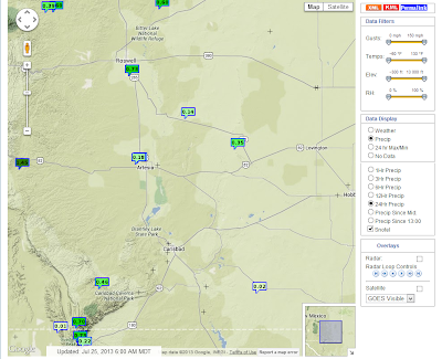
Rains Return To SE NM.
Click On The Maps To Enlarge Them.
24-Hour Rainfall Totals As Of 6 AM MDT.
GRLevel3_2.00 Dual Pol Radar.
Estimated Storm Total Rainfall Amounts.
Thunderstorms returned to southeastern New Mexico yesterday afternoon and evening. Some of these have persisted until sunrise this morning. I only managed to pick up .01" here at my home in Carlsbad.
The Truth Is Stranger Than Fiction!
My Web Page Is Best Viewed With Google Chrome.


Comments
Post a Comment
Your comments, questions, and feedback on this post/web page are welcome.