Overnight Reported Rainfall Totals As Of 5 AM MDT.


(As Of 5 AM MDT This Morning).

 NWS Midland Dual Pol Doppler Radar. 

NWS Midland Dual Pol Doppler Radar.  

NWS Midland Dual Pol Doppler Radar. 

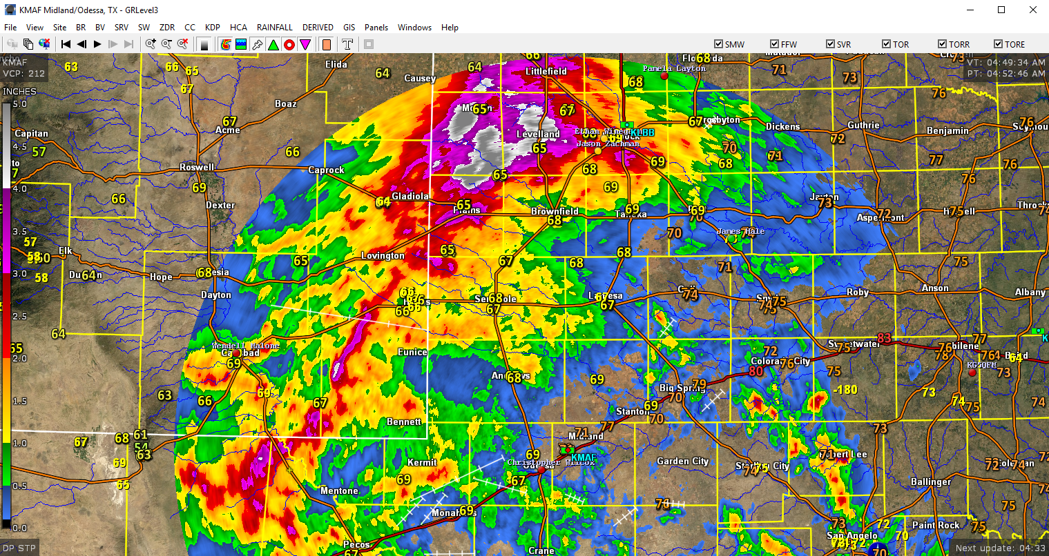
NWS Lubbock Dual Pol Doppler Radar.

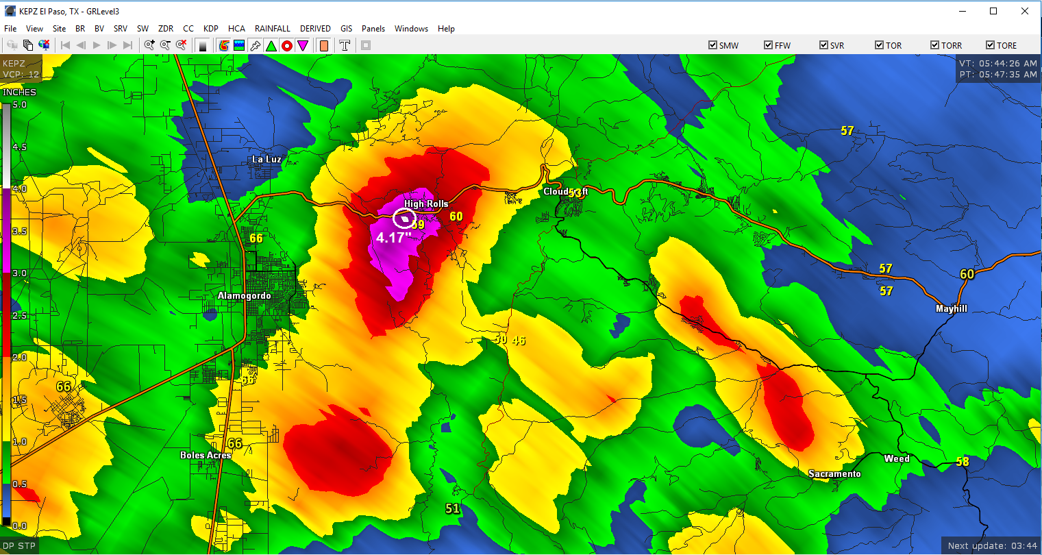
NWS El Paso/Santa Teresa Dual Pol Doppler Radar.

(As Of 5 AM MDT This Morning).


As of 5 AM MDT this Tuesday, August 1st, 2017 I had measured .36" here at our home in NW Carlsbad overnight. Compare this to the Carlsbad Airport ASOS total of 1.80" located 6 miles to my SSW. The Bowl Raws just north of Guadalupe Peak had picked up 2.05"

Radar estimated that 3.00" to 3.30" of rain may have fallen between Loving and Malaga. The El Paso radar estimated that 4.00" of rain fell near the High Rolls area.

(As Of 5 AM MDT This Morning).


The Truth Is Stranger Than Fiction!

Comments

NWS Midland Regional Forecast

NWS Midland Regional Forecast

NWS Albuquerque Regional Forecast

NWS Albuquerque Regional Forecast

NWS Albuquerque Regional Forecast

NWS Albuquerque Regional Forecast

NWS Albuquerque Regional Forecast

NWS El Paso Regional Forecast

NWS El Paso Regional Forecast

NWS Lubbock Regional Forecast

NWS Lubbock Regional Forecast

Current US Temps

Current US Wind Chill/Heat Index Temperatures

Current Watches In Effect

SPC Mesoscale Discussions

Storm Prediction Center (SPC) Day 1 Severe Weather Outlook

Current NWS National Watches/Warnings In Effect

Current NWS National Watches/Warnings In Effect
Click On The Map For The Latest Updates

New Mexico

Eddy County Plains & Guadalupe Mtn's

Guadalupe Mtn's In Culberson County

Chaves County Plains & Mtn's

Lea County

Lincoln County

Otero County

NWS Forecast High Temps Today

NWS Forecast Low Temps Tonight

NWS Albuquerque Storm Total Rainfall Forecast

NWS Midland Storm Total Rainfall Forecast

NWS El Paso Storm Total Rainfall Forecast

Average Daily High/Low Temperatures

Average Daily High/Low Temperatures