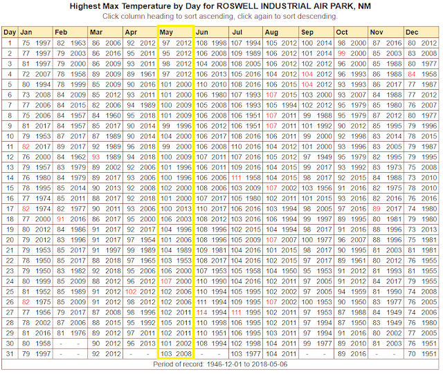
3-Days Of 100ºF Temps Coming Up.
4-25-2018.
Stratocumulus Clouds Partially Obscuring El Capitan and Guadalupe Peaks.
Tuesday.
Wednesday.
Thursday.
Friday.
(May Highlighted In Yellow).
Roswell Climate.
Roswell Airport.
Artesia Climate.
Carlsbad Climate.
Carlsbad Airport.
Hobbs Climate.
Ruidoso Climate.
Hot weather has returned to the area...I know, most of you were hoping for a cool wet spring. Not going to happen this year. Sorry. Near to a few record daily high temps may be established or at least come close over the next three days or so as a ridge of high pressure at the mid and upper levels of the atmosphere dominates our weather.
At the surface a dryline is forecast to set up and will act as a convergence zone for a few high based widely scattered thunderstorms to pop up tomorrow afternoon. Don't get your hopes up though because those of us who manage to get wet won't get very wet. And if you do then count your blessings.
The main story will be the heat from tomorrow into Friday with our afternoon high temps hovering around the century mark for the first time this year. Oh joy right?
Valid Today Through 6 PM MDT Thursday.
WPC 7-Day Total Rainfall Forecast.
Valid Today Through 6 PM MDT Monday, May 14, 2018.
The Truth Is Stranger Than Fiction!


Comments
Post a Comment
Your comments, questions, and feedback on this post/web page are welcome.