Current Date & Time

Fall Freeze Data For New Mexico

Storm Total Rainfall Reports.


Blog Updated At 7:30 PM MDT Sunday.


From Saturday, Sept 1st - Saturday, Sept 8th, 2018.

Radar estimated 3".00 to over 7.00" about 40 miles north or Roswell in northern Chaves County and southern De Baca County.


Chaves County.

Roswell Portable Raws NE Of Town 2.29"

Eddy County.

Queen Raws 1.35"

Lea County.

Paduca Raws 1.13"

Lincoln County.

Sierra Blanca Regional Airport NE Of Ruidoso 1.15"

Otero County.

Mescal Raws 1.24"

Guadalupe Mtn's Natl Park.

The Bowl Raws 1.41"

Public Reports - 7-Day Rainfall Totals.

Becca Baker In Loving Almost 4.00"
Runyan Ranches 50 Miles W Of Artesia 3.98"
Tim Thomas In Tatum 3.20"
Craig Schinnerer In Halfway 3.00"
Johnny Waldrip On Rocky Arroyo 3.00"
Lance Crenshway In Downtown Hobbs 2.90"
Judy Van Tol Dycus In South Carlsbad 2.50"
Kathy Klein Wells In West Roswell 2.24"
Romine Ranch Near The Flying H Ranch 2.20"
Norma Rogers In Carlsbad 1.50"
Mark Malone Ranch N Of Lakewood 1.50"
Gail Carter In Carlsbad 1.26"
Mark Malone In Atoka 1.10"
Our Home In NW Carlsbad 1.07"
Sharon Demerritt In Atoka 1.03"
Todd Jones In Carlsbad .70"
Barry Price In Cottonwood North Of Artesia .60"
Aaron Ballew In Carlsbad .30"

The Truth Is Stranger Than Fiction!

Comments

My Blog Archive List (July 2010 - August 2025).

Show more

My Current Weather Conditions

MY CoCoRaHS Precipitation Data

NWS Albuquerque 2026 Winter Outlook (Updated Nov 3rd).

NWS Midland Web Page

NWS Midland Web Page
Click On The Map To Open It Up

SE New Mexico & West Texas Precipitation Forecasts

Eddy County

Guadalupe Mtns Eddy & Culberson County

Lea County

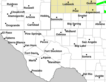
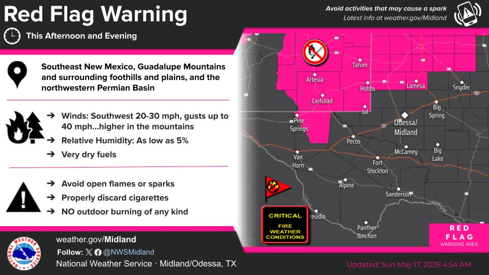
NWS Midland Hazardous Weather Outlook

NWS Midland Hazardous Weather Outlook
Click On The Image To See The Rest Of The Outlooks

NWS Midland Hazardous Weather Outlook

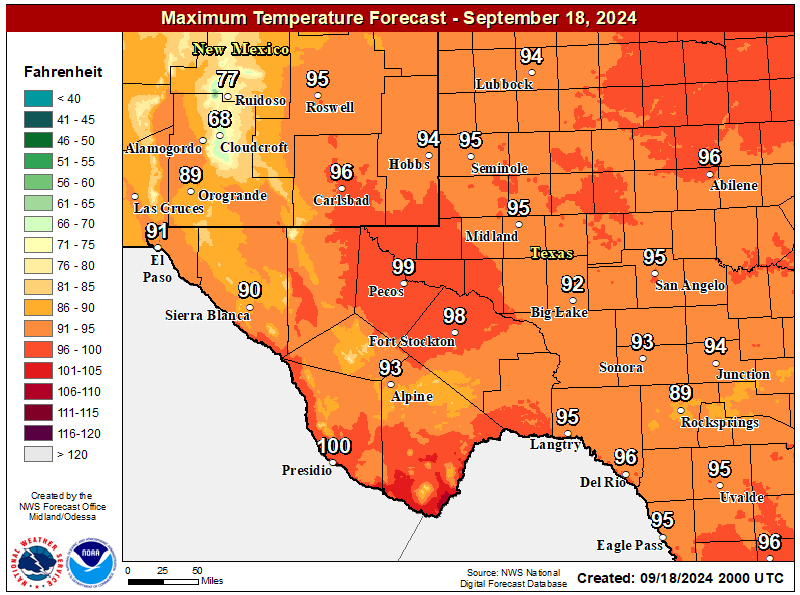
NWS Midland Forecast High Temperatures Today

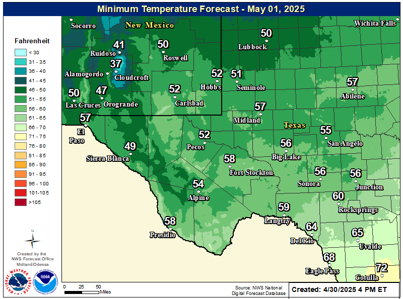
NWS Midland Forecast Low Temperatures Tonight

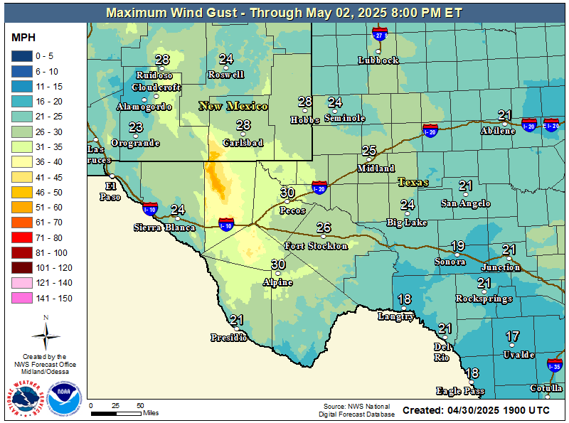
NWS Midland Peak Wind Gust Forecast

NWS Midland Graphic Forecast

NWS Midland Graphic Forecast
A storm system brings scattered showers/storms to the area tonight. Widespread flooding is not expected, but heavier storms may cause ponding of water on roads. Showers will linger over the northeast Permian Basin through Saturday morning.

NWS Albuquerque Web Page

NWS Albuquerque Web Page
Click On The Map To Open It Up

NWS Albuquerque New Mexico Precipitation Forecasts

New Mexico

Chaves County Plains & Mtn's

Lincoln County

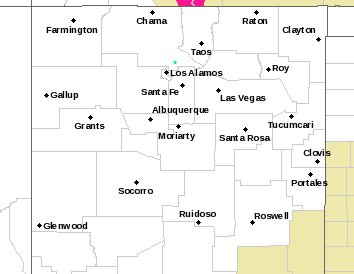
NWS Albuquerque Hazardous Weather Outlook

NWS Albuquerque Hazardous Weather Outlook

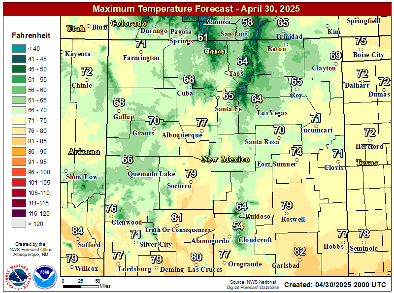
NWS Albuquerque Forecast High Temperatures Today

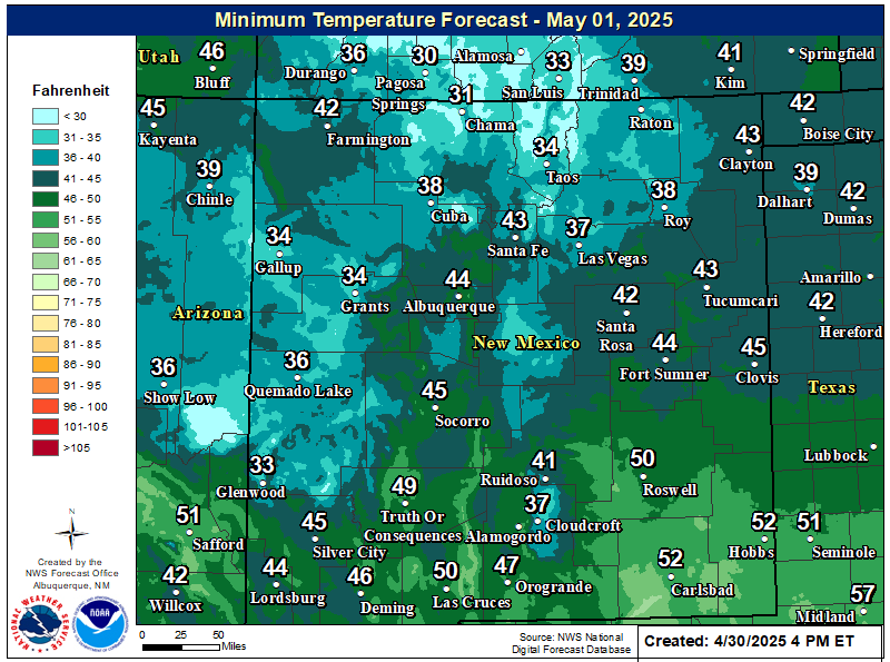
NWS Albuquerque Forecast Low Temperatures Tonight

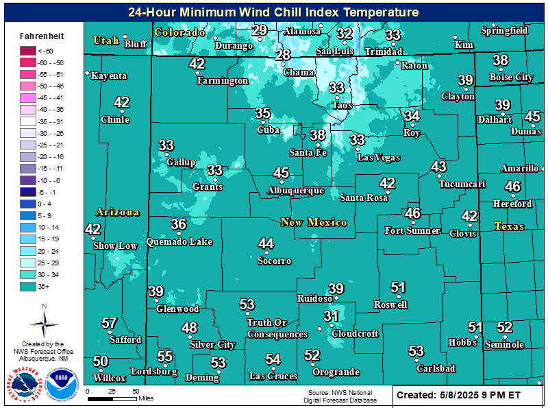
NWS Albuquerque Wind Chill Forecast

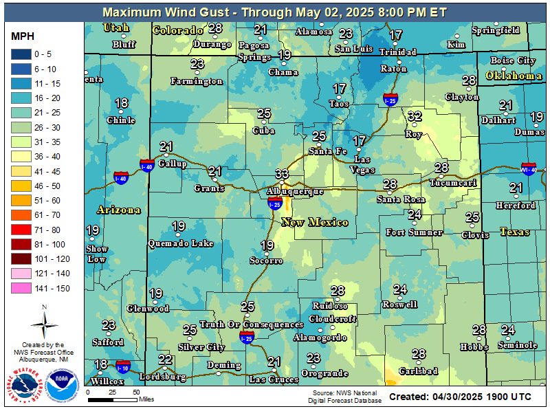
NWS Albuquerque Peak Wind Gust Forecast

NWS Albuquerque Graphic Forecast

NWS Albuquerque Graphic Forecast
A Winter Weather Advisory is in effect across the Tusas Mountains from midnight tonight to 9 PM MST Saturday. Snow is expected above 8,500 feet, with accumulations generally between 4 to 8 inches. Travel could be very difficult on U.S. Highway 64 between Tres Piedras and Tierra Amarilla. Tire traction will be reduced. Extend the distance between your vehicle and the vehicle in front of you.

NWS Albuquerque Graphic Forecast

NWS Albuquerque Graphic Forecast
Snow above 8,500' will generally range 4-8 inches. Slick winter travel will favor the U.S. 64 corridor through the Tusas Mountains.

NWS Albuquerque Forecast Grpahics

NWS Albuquerque Forecast Grpahics
Cooler and wetter weather today. Calmer weather returns late Sunday through Monday before the next storm system looks to clip northwestern NM Tuesday.

NWS El Paso Web Page

Southern New Mexico & Far West Texas Precipitation Forecasts

Texas

Otero County

NWS El Paso Hazardous Weather Outlook

NWS El Paso Hazardous Weather Outlook
Click On The Image To See The Rest Of The Outlooks

NWS El Paso Hazardous Weather Outlook

NWS El Paso Hazardous Weather Outlook
Click On The Image To See The Rest Of The Outlooks

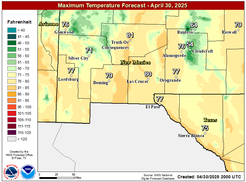
NWS El Paso Forecast High Temperatures Today

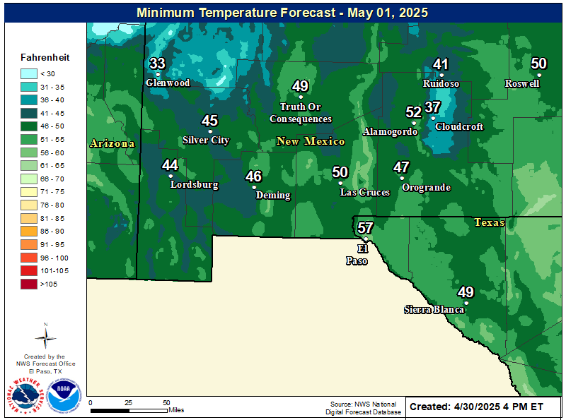
NWS El Paso Forecast Low Temperatures Tonight

NWS El Paso Wind Chill Forecast

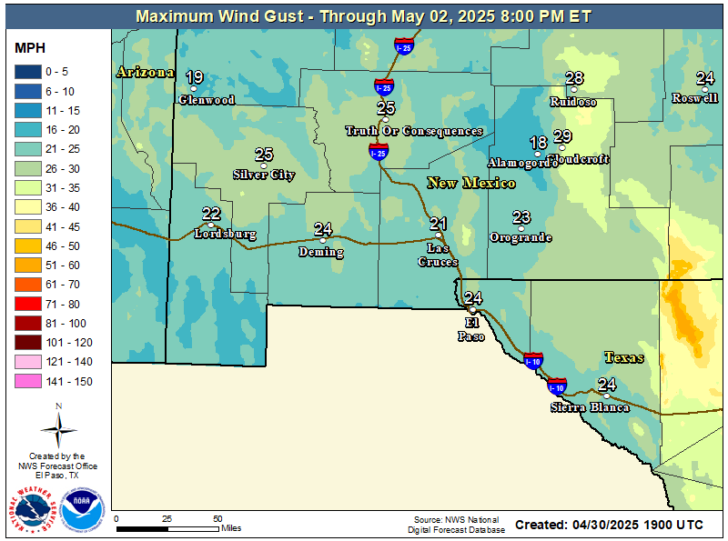
NWS El Paso Peak Wind Gust Forecast

NWS El Paso Graphic Forecast

NWS El Paso Graphic Forecast
Saturday will be another near normal day with highs climbing to the upper 60s, approaching 70 F across the area. Skies will be mostly cloudy to start the day then becoming partly cloudy by late morning. Isolated rain showers will be around in the morning and taper off by mid afternoon. West winds will begin to pick up in the afternoon, with sustained winds at 15-20 mph with gusts up to 30 mph.

NWS Lubbock Web Page

NWS Lubbock Web Page
Click On The Map To Open It Up

NWS Lubbock Hazardous Weather Outlook

NWS Lubbock Hazardous Weather Outlook
Click On The Image To See The Rest Of The Outlooks

NWS Lubbock Hazardous Weather Outlook

NWS Lubbock Hazardous Weather Outlook
Click On The Image To See The Rest Of The Outlooks

NWS Lubbock South Plains Precipitation Forecasts

NWS Lubbock Hi Temperature Forecast Today

NWS Lubbock Low Temperature Forecast Tomight

NWS Lubbock Graphic Forecast

NWS Lubbock Graphic Forecast
Cloudy skies and scattered rain showers will continue through the day. Highs will only be in the 50s for most locations. Rain will continue into the evening hours, but gradually come to an end from west to east tonight.

NWS Lubbock Graphic Forecast

NWS Lubbock Graphic Forecast
Cloudy and breezy Sunday with highs in the 50s, then cold Monday morning, with lows dropping to near freezing on the Caprock. Remaining chilly on Tuesday despite more sunshine, with some warming on Wednesday.

My Rainfall Totals - 2.1 NNW Downtown Carlsbad

My Rainfall Totals - 2.1 NNW Downtown Carlsbad

My Seasonal Snowfall Totals - 2.1 NNW Downtown Carlsbad

My Seasonal Snowfall Totals - 2.1 NNW Downtown Carlsbad

Disclaimer

This blog and its contents are for informational purposes only! Always have multiple sources of information available to rely upon during severe weather. Do not rely solely on the Internet. Be weather-aware, plan ahead, have a backup plan, and be ready to act before severe weather strikes your location.