Major Winter Storm For Much Of NM & W TX!
Cloudcroft, New Mexico.
Saturday Morning At 5 AM MST.
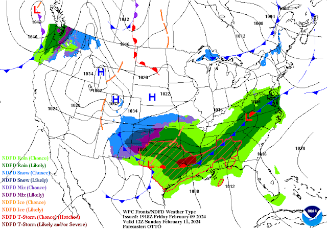
At 5 AM MST This Morning.
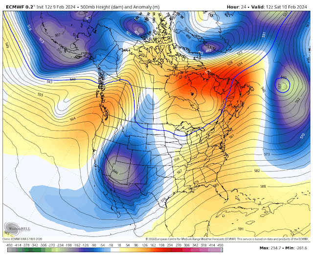
ECMWF 500 MB (18,000') Forecast.
Valid At 5 AM MST Sunday Morning.
Major Winter Storm For Much Of NM & West Texas!
A deep mid-upper long-wave trough of low pressure was stretched from the Yukon in Canada southwestward to off of the coast of San Diego this morning. Several embedded short waves were rotating through this large trough.
By sunrise Saturday morning a mid-upper level closed low is forecast by the ECMWF model to be centered near northwestern Arizona. This low will deepen as it slides southeastward into New Mexico Saturday into Sunday. By sunrise Sunday morning it is forecast to be centred near Jal in southern Lea County, New Mexico. That is if it does not deepen further, dig further south, and slow down in its trek to the southeast. The model trends over the past 24-hours has been to do just this.
At the surface a Pacific cold front will slide eastward across most of New Mexico on Saturday. With a backdoor cold front moving southward down the eastern plains into Sunday morning. Low level upslope flow will develop and increase across the area as the mid-upper level storm slides southeast across the state Saturday into Sunday.
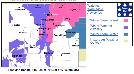
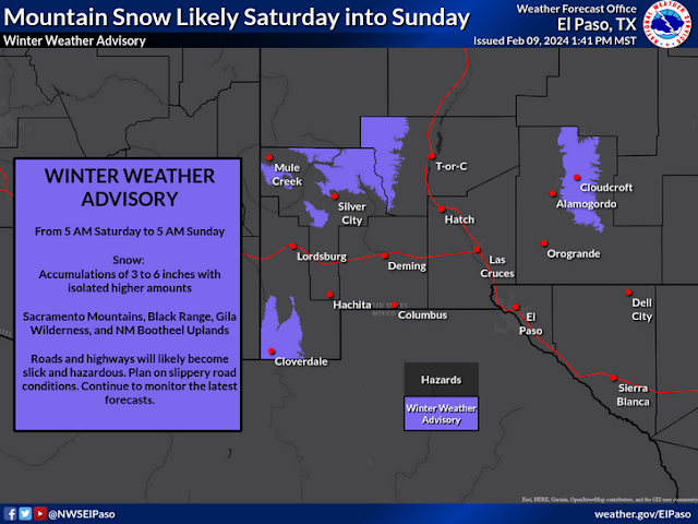
Winter Watches, Winter Storm Warnings, and Winter Weather Advisories are in effect for western, northern, northeastern, central and parts of southeastern New Mexico. As well as eastward into the Texas Panhandle and South Plains.
A Winter Storm Watch is now in effect for the Guadalupe Mountains of Eddy and Culberson Counties. From Saturday evening through Sunday afternoon. Snowfall totals of 5" are possible.
A Winter Weather Advisory is now in effect for the northern Sacramento Mountains including the Ruidoso area from 5 AM MST Saturday through 5 AM MST Sunday. Snowfall totals of 2" to 4" below 7,500' with 4" to 6" above 7,500' are expected. Ski Apache may see storm totals of 6" to 12".
A Winter Weather Advisory is in effect for the southern Sacramento Mountains including the Cloudcroft, Sunspot, Mountain Park/High Rolls, Mescalero, Apache Summit areas above 7,500', and below 7,500' on the west slopes. Storm totals are currently forecast to be in the 3" to 7" range.
Heavy snow along with blowing and drifting snow will make travel dangerous and difficult in the warning and advisory areas. Some roads may be closed. If the snow is heavy and wet some power lines may come down creating local power outages.
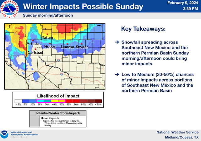
As for the southeastern plains rain will change over to snow Saturday night and continue into Sunday. Our inbound winter storm needs to drop a little further to the south to give us accumulating snowfall on the ground. There is a real chance that this may happen. So be prepared for changes in our local forecasts, along with additional updates, and additions to the current watches,warnings, and advisories in effect. Finally winter right!!
There is simply way too much for me to cover in this blog post so please check my main weather web page often this weekend for all of your local weather forecasts, watches, warnings, advisories and much more. Stay warm and safe all.
There Are None So Blind As Those Who "Will - Not" To See...107.









Comments
Post a Comment
Your comments, questions, and feedback on this post/web page are welcome.