Click On The Image To See The Rest Of The Outlooks
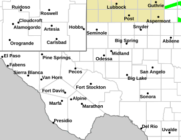
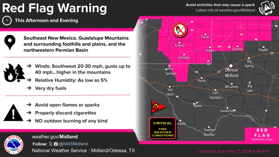
NWS Midland Hazardous Weather Outlook
NWS Midland Hazardous Weather Outlook
NWS Midland Hazardous Weather Outlook
Click On The Image To See The Rest Of The Outlooks
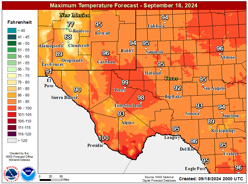
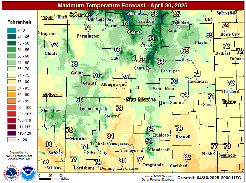
NWS Midland Forecast High Temperatures Today
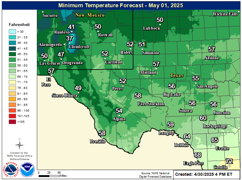
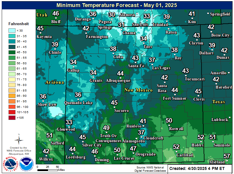
NWS Midland Forecast Low Temperatures Tonight
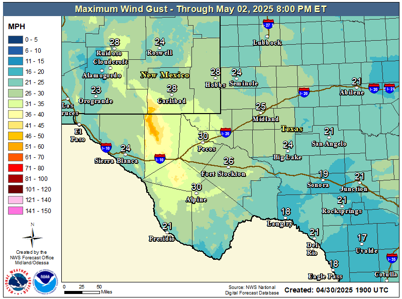
NWS Midland Peak Wind Gust Forecast
NWS Midland Forecast Graphic
Rain chances will increase from west to east over our area Friday evening through early Saturday morning ahead of an approaching upper level system. Rain showers may linger over eastern portions of our region into the day Saturday. Locally heavy rainfall may result in minor flooding or ponding of water in urban and low lying areas, but the overall risk of flash flooding remains very limited.
NWS Albuquerque Web Page
Click On The Map To Open It Up
NWS Albuquerque New Mexico Precipitation Forecasts
Showers with embedded thunderstorms enter southwestern NM this afternoon, spreading to more of eastern and northern NM tonight into Saturday morning. Some storms will produce gusty winds and brief moderate rainfall.
NWS Albuquerque Graphic Forecast
Valley rain and mountain snow spread over the northern mountains with rain and storms favoring the eastern plains through much of the day Saturday.
NWS Albuquerque Graphic Forecast
Snow above 9,000' will generally range 2-6 inches with locally higher amounts up to 8 inches atop the peaks. Slick winter travel will favor the U.S. 64 corridor through the Tusas Mts.
NWS Albuquerque Forecast Grpahics
Cooler and wetter weather late today through the weekend. Calmer weather returns late Sunday through Monday before the next storm system looks to clip northwestern NM Tuesday.
NWS El Paso Web Page
Southern New Mexico & Far West Texas Precipitation Forecasts
Click On The Image To See The Rest Of The Outlooks
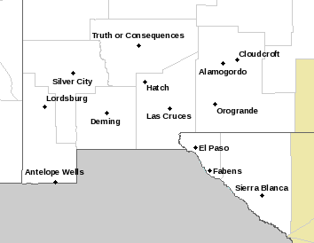
NWS El Paso Hazardous Weather Outlook
Click On The Image To See The Rest Of The Outlooks
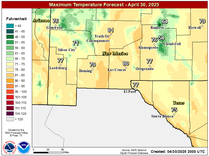
NWS El Paso Forecast High Temperatures Today
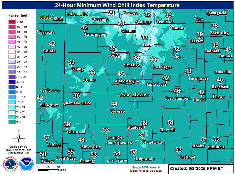
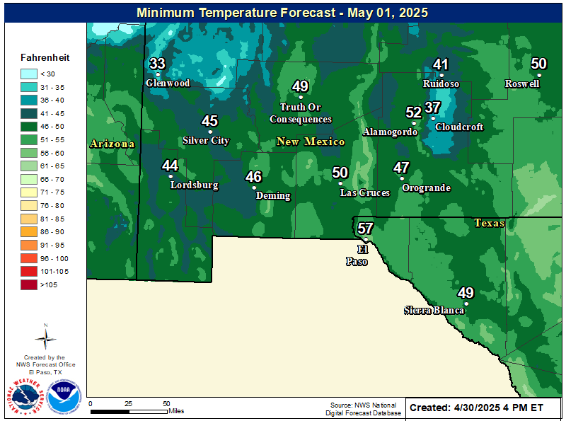
NWS El Paso Forecast Low Temperatures Tonight
NWS El Paso Wind Chill Forecast
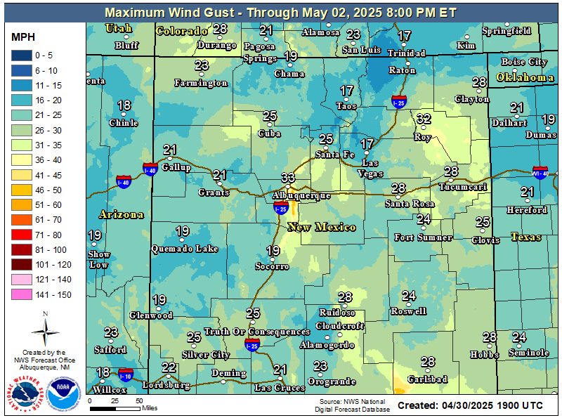
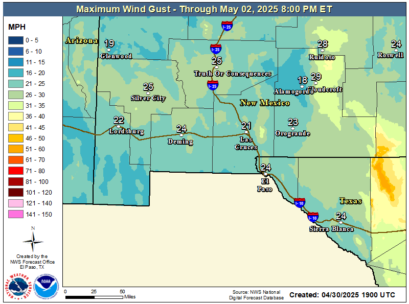
NWS El Paso Peak Wind Gust Forecast
NWS El Paso Graphic Forecast
A Pacific storm system rapidly moves across Arizona and southern New Mexico in the afternoon and night of Friday. Highest rainfall is expected east of the Rio Grande Valley.
NWS El Paso Graphic Forecast
Showers will begin in the west Friday afternoon and spread east through the evening. Highest rainfall amounts likely from the Rio Grande Valley east. A few thunderstorms also possible.
NWS El Paso Graphic Forecast
NWS Lubbock Web Page
Click On The Map To Open It Up
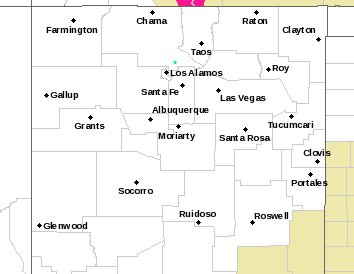
NWS Lubbock Hazardous Weather Outlook
Click On The Image To See The Rest Of The Outlooks
NWS Lubbock Hazardous Weather Outlook
Click On The Image To See The Rest Of The Outlooks
Mild and sunny conditions are expected across the region today. Winds will generally be out of the west at 5-10 mph.
NWS Lubbock Graphic Forecast
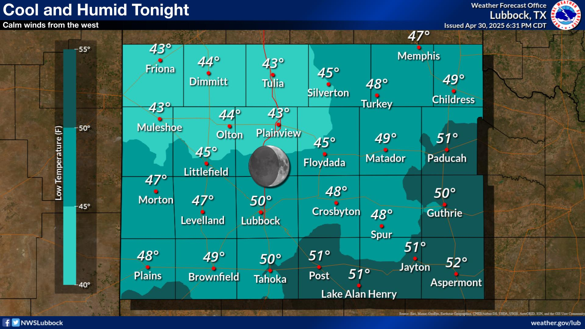
Cool with lows in the upper 30s to mid 40s under clear skies and light southerly winds.
NWS Lubbock Graphic Forecast
Cloudy, cool, and rainy conditions are expected across the region Saturday through Saturday night. The highest rain chances will generally be off the Caprock after 6 PM on Saturday evening. Some locally heavy rain is possible, but widespread flooding is not expected.
NWS Lubbock Graphic Forecast
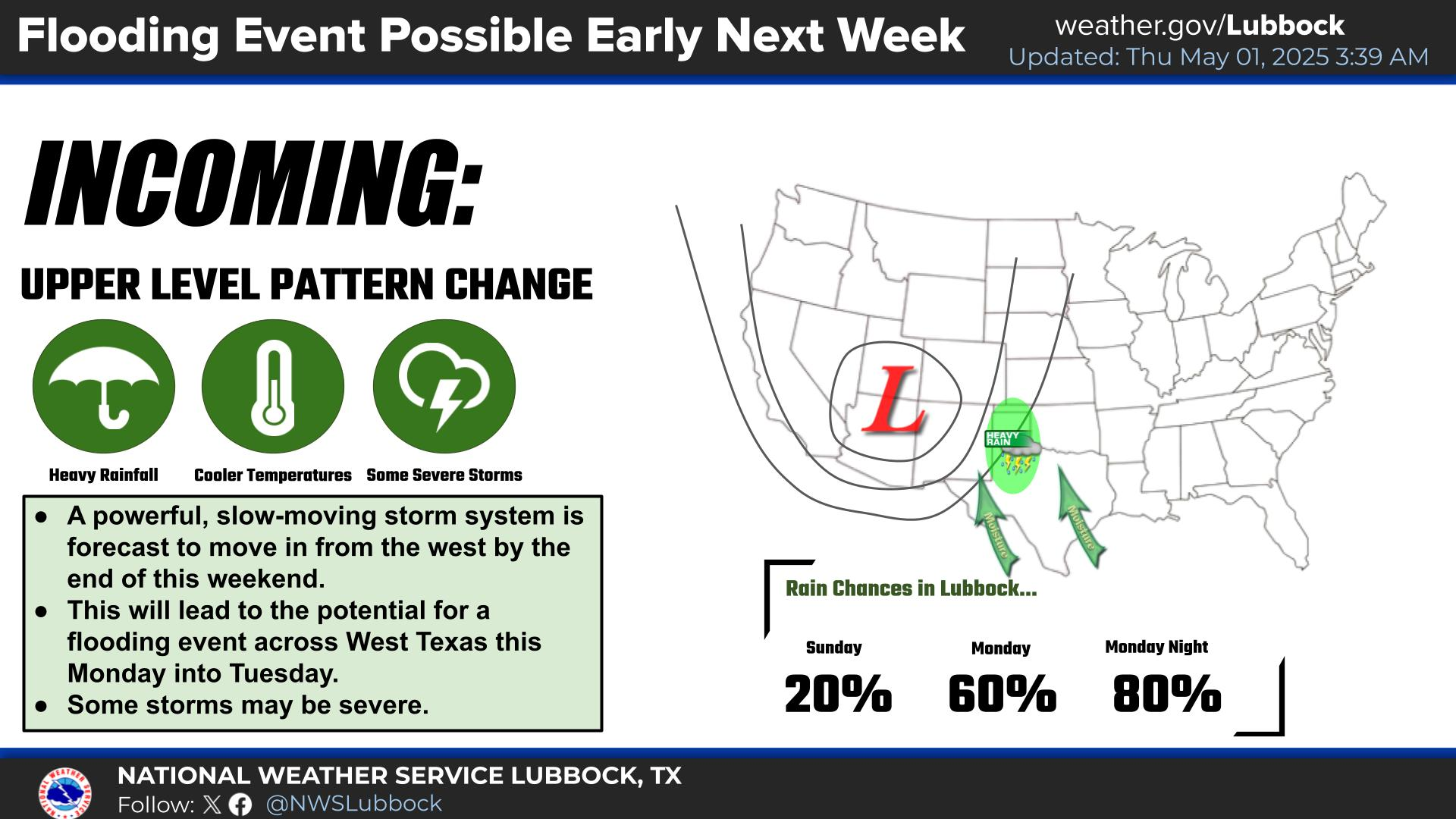
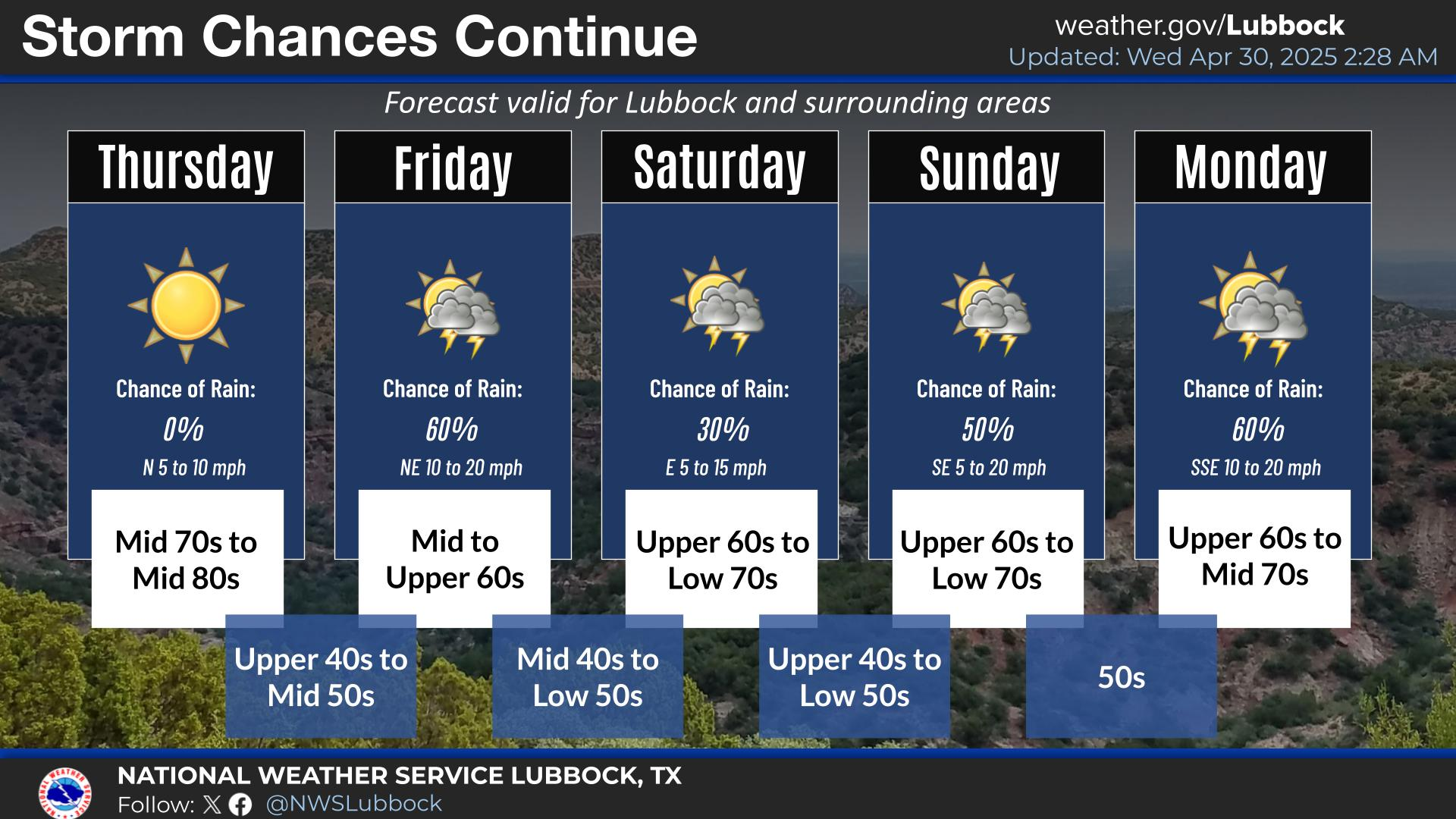
Precipitation chances return Friday night through Sunday, with the best chances being Saturday night. Severe storms are not expected, but rainfall amounts over an inch are possible (20-40% chance) off the Caprock. Cooler conditions are expected at the start of next week, when highs may only be in the low 50s.
My Seasonal Snowfall Totals - 2.1 NNW Downtown Carlsbad
Disclaimer
This blog and its contents are for informational purposes only!
Always have multiple sources of information available to rely upon during severe weather. Do not rely solely on the Internet.
Be weather-aware, plan ahead, have a backup plan, and be ready to act before severe weather strikes your location.
















Comments
Post a Comment
Your comments, questions, and feedback on this post/web page are welcome.